TORS OF DARTMOOR

a database of both lesser- & well-known rocks and outcrops

Home Search Map The East Access About Team Social Blog

Pound Rock

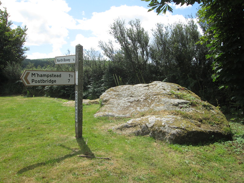
At the entrance to North Bovey from the north on a green triangle is this very large rock with its own finger post. Simply marked as 'Pound' on the OS map of 1886, Pound Rock albeit quite long and broad, reaches little more than a metre in height on its west side.

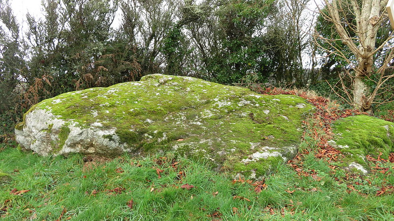
Several hundred years ago, this area was used for impounding stray animals; hence its name.
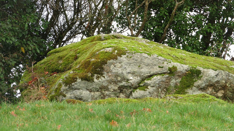
icon
icon
Pound Rock
The map above is not a navigation tool and we recommend that the grid reference shown below is used in conjunction with an Ordnance Survey map and that training in its use with a compass is advised.
Grid Ref:
SX 739 842
Height:
240m
Parish:
North Bovey
Tor Classification:
Boulder
Access:
Public
Rock Type:
Granite
Credit:
Mike Brown
Reference / Further Reading:
Tim Jenkinson: East Dartmoor The Hidden Landscape: Rocks and Tors (published privately)
Mike Brown: The Gazetteer of Dartmoor Names
Debbie Jenkin: Walks from Ring of Bells North Bovey (2014)

Please Support Us

We are proud to see the names of lesser-known tors are now being used more commonly on other websites and whilst this is to be encouraged we do request that, should you wish to use the information on this page, you provide a backlink to the website as reference, by copying the relevant address:

https://www.torsofdartmoor.co.uk/tor-page.php?tor=pound-rock

Please also consider a small donation to the upkeep of the site; any contribution goes toward the fees to keep the database online and any costs incurred when undertaking research such as subscriptions to online archives.