TORS OF DARTMOOR
a database of both lesser- & well-known rocks and outcrops
PuggiestoneThe Puggie Stone, The Puckie Stone, The Puckle Stone, The Pixy Stone
 Higher up the road from Leigh Bridge on the left is Puggiestone. A compact outcrop set in a garden that both Crossing and Dave Brewer refer to, the former explaining that the names are probably a corruption of 'pixy', and the latter indicating that the stone formed part of the Chagford beating the bounds procession of 1986 and 2000. (Thanks go to Mike Kitchener for providing us with the above image.) 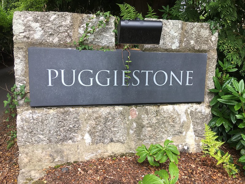 Earliest mention we can find is 1858, in 'The Quarterly Journal of the Geological Society of London' by GW Ormerod; "A short distance below the junction of the North and South Teign Rivers, at Legh Bridge, on a spur projecting on the right hand of the valley, a rock-basin is found on the top of a large transported block of granite known as the Puckie stone. This basin is irregular in shape, and measures 40 inches from N. to S. and 43 inches from E. to W. The longest diameter is nearly N.W. to S.E., 58 inches; the sides are nearly upright, and from 2 to 5 inches high; the bottom is nearly flat, but rough from the projecting felspar; it was covered with fine sand composed of disintegrated granite." 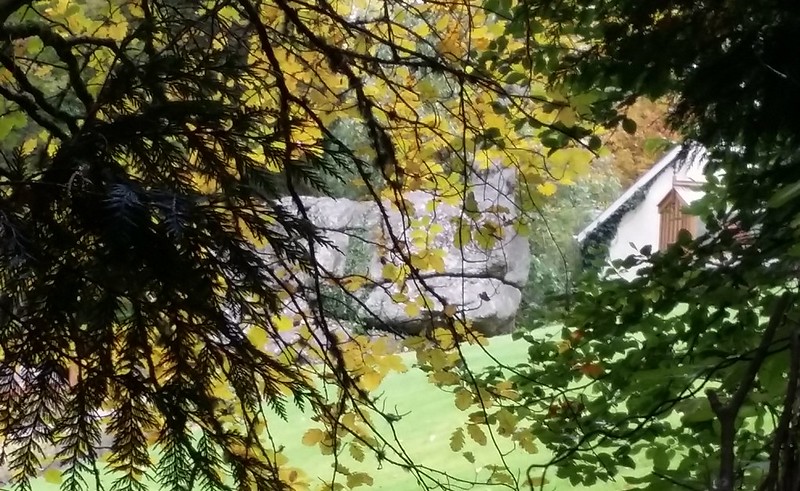 But later, in his book 'A Perambulation of Dartmoor', Samuel Rowe doubts the authenticity of the rock basin; "Scarcely half a mile above Holy Street, a tor rises near the river's brink on the south side, called by the country people the Puckie, Puckle, or Puggie Stone, and celebrated for the large rock-basin, or pan (as it's popularly called) on its summit. The antiquary, trusting to local report, will be disappointed when, after having succeeded in scaling the rock, he finds that the characteristics of the genuine rock-basin, as herein-before described, are not sufficiently clear to enable him to pronounce that this is not one of the examples attributable exclusively to the operation of natural agencies. Although of large size, it is not of the usual circular form, nor do its sides display any decisive indications of artificial adaption." A hand made rock basin or not, the modern day antiquary will unlikely ever view it unless they are wealthy, being within the private grounds of a very expensive luxury holiday home, their website here. If someone can afford to hire it, please let us know and we'll be happy to pop round to view this forbidden outcrop rather than peer through the increasingly thickening hedge beside the road. 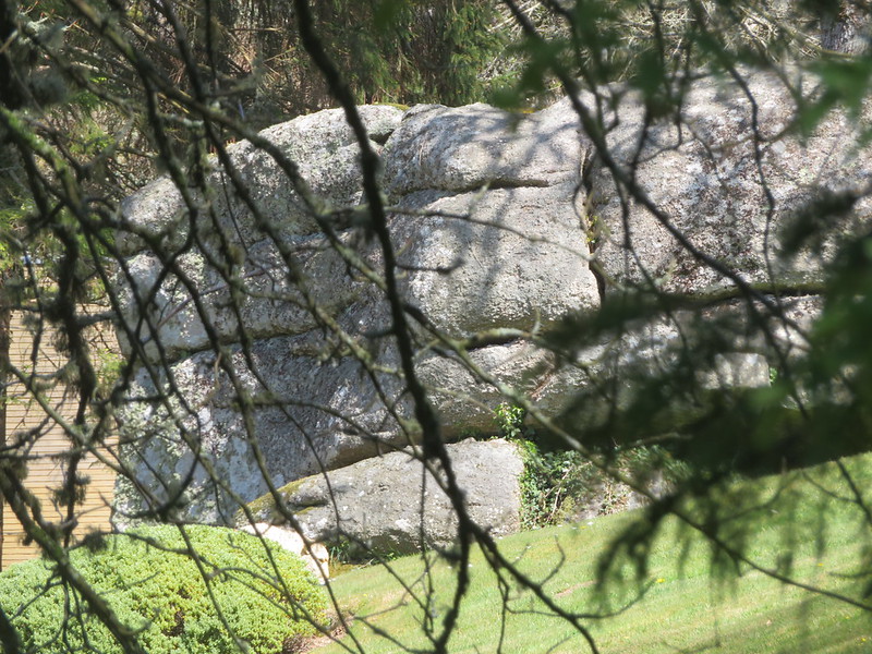
| ||||||||||||||||||||||||||||