TORS OF DARTMOOR
a database of both lesser- & well-known rocks and outcrops
Raven Rock (Ausewell)
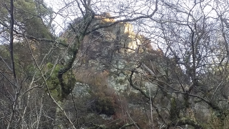 Raven Rock is not the easiest of rocks to photograph at close-quarters and indeed there are better views to be had of it from across the River Dart, particularly in the winter months. The summit lies immediately beside one of the main tracks that run through Ausewell Wood. 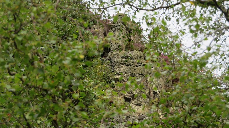 It's an untidy mess of a tor whose extensive clitter spills down the hill to the bottom track beside the Double Dart; surely evidence that this hidden giant was once far grander than it is today. Its beetling tower is visible, in small sections, from the track directly below the summit, but trees and heather still sadly conceal much of its majesty. The Rock's position hanging on the side of the hill must have once been a spectacle, dominating the Double Dart and the opposing Holne Chase. 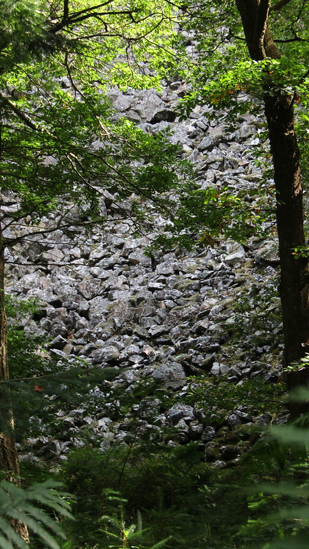 At the top of the Rock, on a small ledge that protrudes from the hillside, wonderful views are afforded westward to Chase Wood and higher tors to the west, including Sharp Tor, Bel Tor and Corndon Tor. It is a view worth taking the time to enjoy. 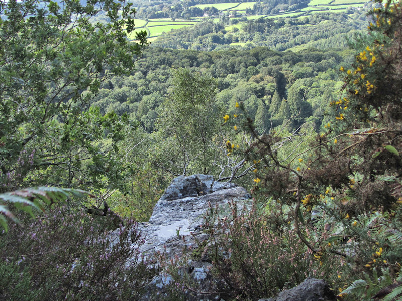 For so long off limits to the public without permission, Ausewell Wood is now accessible thanks to a collaboration between The National Trust and The Woodland Trust. However, Raven Rock resides in a sensitive area for ground nesting birds and under the Wildlife and Countryside Act 1981, between the beginning of March and the end of July, it is, along with the surrounding woodland, out of bounds to the public. During this time, these sites are being monitored with trail cameras and/or CCTV and you are advised to respect any closures in place. Outside of these months, the summit of Raven Rock is accessible from the higher track, and its bulk partially visible from the lower, but visitors are urged to respect the fragile environment here by not deviating from these tracks as a notice near the top of the Rock requests.
| ||||||||||||||||||||||||||||||