TORS OF DARTMOOR
a database of both lesser- & well-known rocks and outcrops
Ravens' Tor (Lydford)Raven's Tor 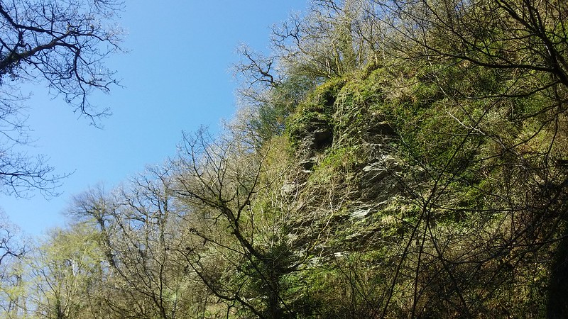 As marked on Ordnance Survey Maps, this tor towers above the River Lyd. Its name is quite fitting; it would seem it is only accessible by ravens and other bird species due to the severity of the slope! The tor is characterised by one huge crag composed of Lydford Formation - Mudstone; sedimentary bedrock that formed between 358.9 and 329 million years ago during the Carboniferous Period (British Geological Survey). 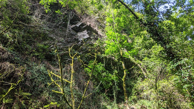 Lydford Gorge is a local beauty spot, and one of the most popular attractions within Dartmoor National Park. The Lyd has excavated a deep ravine that is adorned by dense temperate rainforest. The narrowness of the cleft means that sunlight rarely reaches the valley-floor; moreover, it is always damp and home to special lichens and mosses. We learn from the National Trust (NT) that: "The River Lyd probably got its name from the Anglo-Saxon word 'hlyda,' meaning 'loud' - which it certainly is as it rages through the gorge." 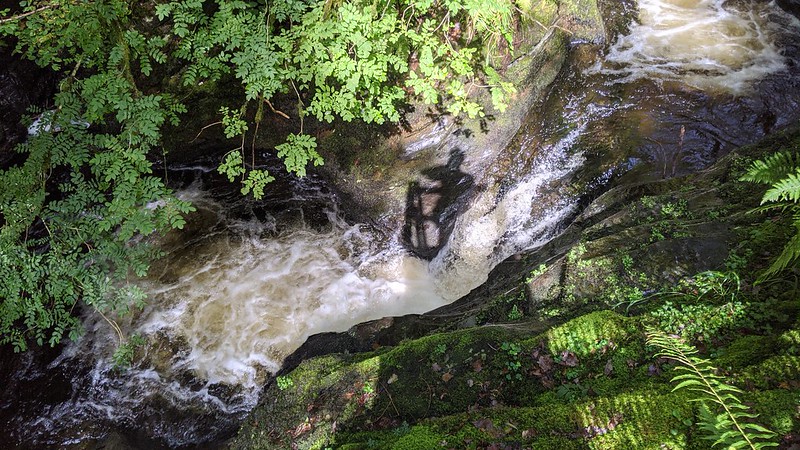 Owned and managed by the NT, Ravens' Tor could be seen during the summer season when the full river trail was open. The tor could be bagged at its base by taking this trail (one-way) from Whitelady Waterfall to Tunnel Falls (so named because the path passed through a tunnel by the falls). Glancing up from the footbridge above Tunnel Falls, the rambler was greeted by a spectacular scene of rock festooned in foliage; a sentinel guarding the Gorge. 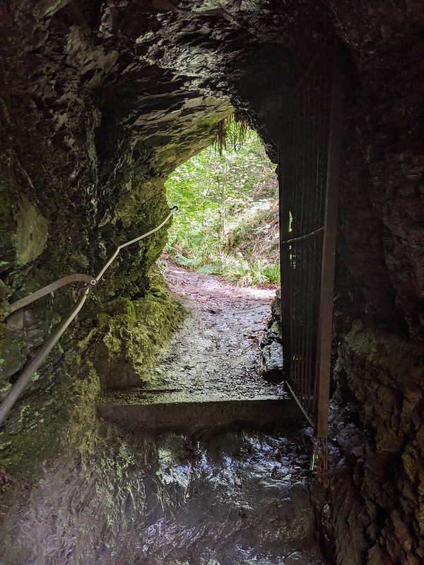 However, as of 2024, The NT decided that the river trail would no longer reopen to the public and had to be closed indefinitely. They cited a number of reasons for this, the main one being the constant annual work required to keep the route safe. Indeed, in the winter months the River Lyd would crash through the Gorge with such immense force, leading to all sorts of problems along the trail, and this would be accompanied by landslides. With the rocks being fragile and the soils thin, these were always a threat and the NT had to frequently monitor the hillsides. It was an unfortunate decision that was not taken lightly, but the importance of public safety and wellbeing had to prevail. It now means, though, that Ravens' Tor can no longer be viewed from any point. However, the long-standing entrance fee (free for NT members) remains in place for those wishing to walk in Lydford Gorge; please check their website for opening times to visit the Whitelady Waterfall and Devil's Cauldron trails.
| ||||||||||||||||||||||||||||||