TORS OF DARTMOOR
a database of both lesser- & well-known rocks and outcrops
Riddy Rock
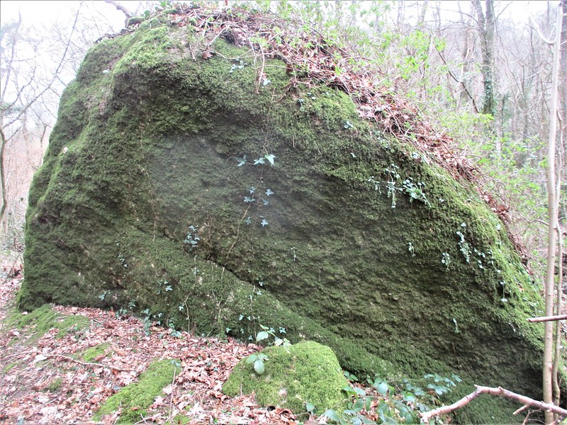 In his fictitious novel 'To Call Her Mine', we learn from Walter Besant that: "It lay quite across the ridge, here broad, on which the house was built, and sloped over into the valley below, where the Becky ran down its narrow gorge, hastening to keep its appointment with the Bovey beyond Riddy Rock." Later, we notice a second mention of the Rock: "Standing on Hayne Down, one can see how the ground breaks down, with hill after hill, each lower than the other, until the Ridge itself abruptly falls into the lower Combe at Riddy Rock, where the waters meet. First, there is Ease Down; then, Manaton Tor; next, Latchell; and, lastly, Nympenhole or Oddy Tor, with Gratnor Farm beyond these Tors, its fields and meadows showing among the trees like a clearance in some great primeval forest." 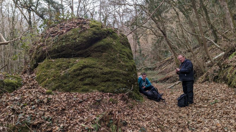 The first person to attempt to decipher these late 19th Century descriptions was Tim Jenkinson, who in 1999 successfully located Latchell Tor above Freeland, Water; but the whereabouts of Riddy Rock, on the other hand, proved elusive. It was not until May 2022, when Beating the Bounds of Lustleigh Parish, that Max Piper noticed a very large rock beside the River Bovey just upstream from its confluence with the Becka (Becky) Brook. A site visit with the Tors of Dartmoor Team in March 2023 revealed a good chunk of granite at SX 77914 80171 which fits Besant's assertion of the confluence being 'beyond' (i.e. below; further downstream of) Riddy Rock. In the absence of any sizeable outcrop in the vicinity of Besant's description this is believed to be the Rock in question. 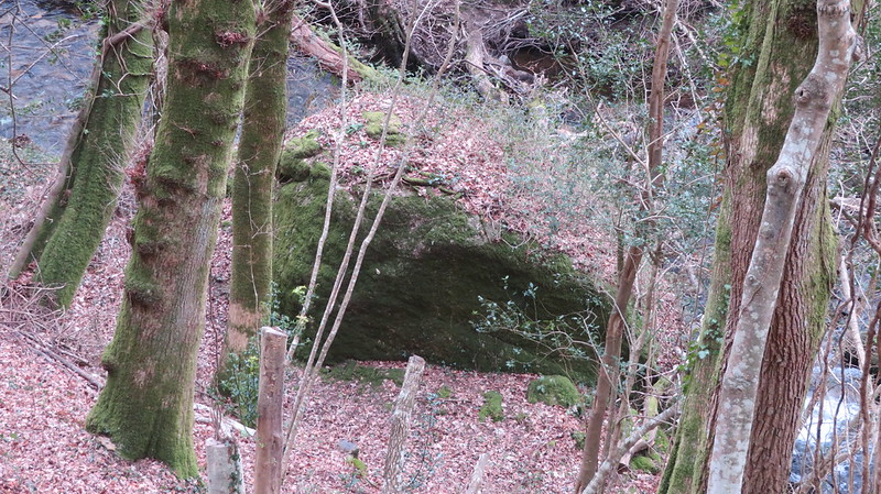 The feature is most impressive in winter and early spring when the lack of leaves accentuates its mossy rounded projection into the Bovey. It is also rather striking when seen from the public bridleway ascending to Boveycombe Farmstead a short distance above. The Rock is thought to have once been an important historic waymarker as it lies between the river and an old, disused track which appears to have once served Boveycombe, a 14th Century farmstead. The farm ruins are mostly concentrated around the aforementioned bridleway, but their extent possibly extended below closer to where Riddy Rock resides. 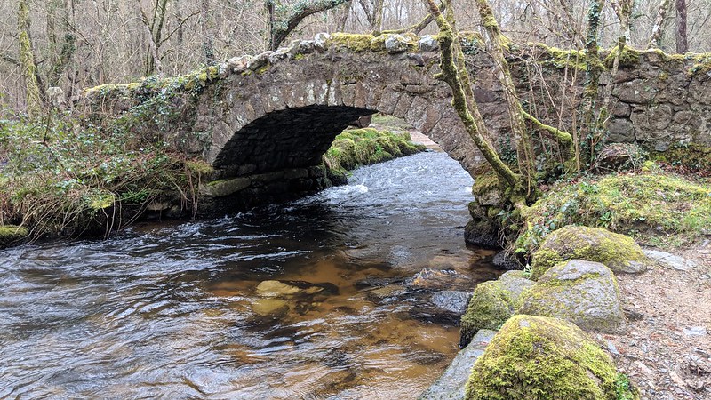 A proverbial stone's throw downstream lies Hisley Bridge, once used by packhorses and their drivers. Nowadays it is a well-known and celebrated beauty spot. The bridge itself is not large but is noted for its cobbled surface as one walks across it. At the south-western end of the southern parapet stands a very fine slotted granite gatepost, which would have once supported timber beams within the slots to form a gateway.
| ||||||||||||||||||||||||||||||