TORS OF DARTMOOR
a database of both lesser- & well-known rocks and outcrops
Roborough RockRoborough Rocks, Ullestor Rock, Udal Tor, Yelverton Rock, The Rock, Hurlstone Rock, Ulster 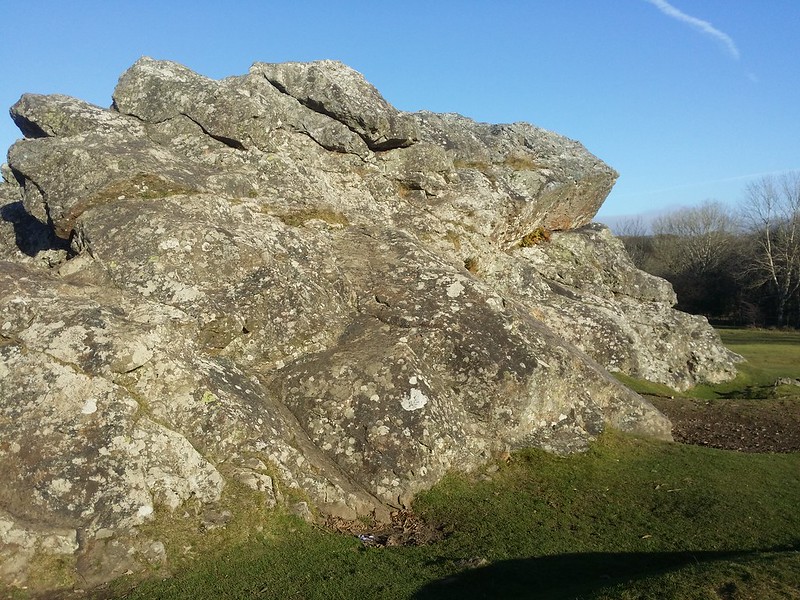 On the western periphery of the moorland range near the large village of Yelverton, lies a huge outcrop of rock to the south of the old airfield at RAF Harrowbeer. It is a strange non granite formation at the end of the down and its unusual shape is described by William Crossing: "On the slope between the eighth and ninth milestones is Roborough Rock. It is shown on an eighteenth-century map of Devon as Ullestor Rock, but early in the nineteenth was scarcely ever called by that name. It consists of two bosses, with a connecting portion of some length and much less elevation, the whole forming one mass. On the northern side of the eastern boss a rude resemblance to the human face in profile may be traced when seen from the road." It is important to note that neither of the milestones that Crossing refers to in his account are still extant, both probably having fallen victim to road widening of the mid to late 20th Century. 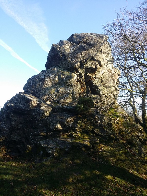 Writing many years later John Hayward (1991) speculates that the unusual shape of the Rock might be linked to the airfield that from 1941 was operative during the Second World War until its closure in 1950, but this is highly unlikely given Crossing's earlier description. However, he does add that the distinctive shape of the eastern crag is known to him as the 'Duke of Wellington's Nose'. Below the Nose, there is a most strange feature that is known as the Alan Williams Turret Base that, according to Wikipedia, "was designed for a machine gun to be fired either through the front loophole which was further protected by shutters, or through the circular opening in the roof in a light anti-aircraft role." Now though, only the foundations remain. 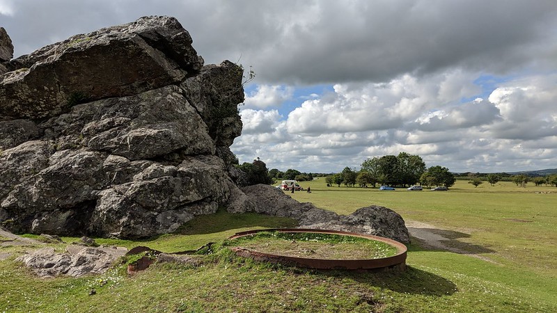 Nowadays more commonly known as Roborough Rock and marked as that on Ordnance Survey maps, the alternative name of Udal Tor was still being used by Worth in 1953 and in addition to 'Ullestor' Crossing also uses 'Ulster Rock'. The earliest reference is quite possibly Donn's Map (1765) that identifies the Rock as 'Hurlstone Rock', a name that is now totally redundant and was likely a local name at the time of the map's creation. Locally though it is known simply as 'The Rock' and presents as a low wall that stretches for some 50 metres or so from east to west, with the central portion reaching little more than 2 metres at its highest. However, at the ends, it rises to about 5 metres on the east side and a little more at the west thereby giving it its curious appearance. 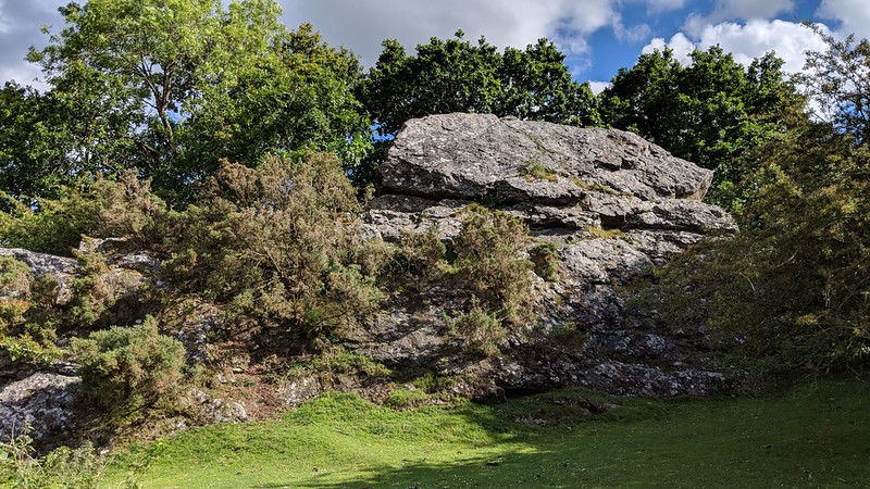 Writing in 1991 Terry Bound explains that a house to the north-west was once known as Udal Torre and in Kelly's Directory of Devonshire from 1910 this house is recorded as a sanatorium for the treatment of people with tuberculosis. To the south-east and close to the road there is a small monument bearing the inscription '1837 VR 1897' commemorating Queen Victoria's 60th year on the throne. Easily reached as it is just off the A386 with parking nearby a visit to the Rock is thoroughly recommended.
| ||||||||||||||||||||||||||||||