TORS OF DARTMOOR
a database of both lesser- & well-known rocks and outcrops
Rookery Brook Tor
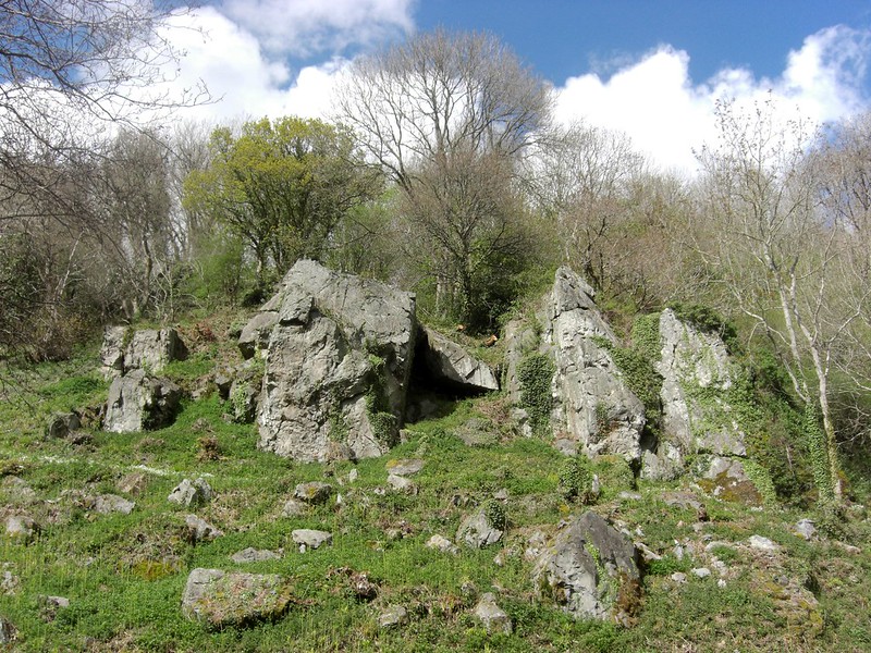 A splendid and craggy small tor juts from the hillside above Rookery Brook Cottage near to Bridford, giving the impression from the road of two main towers with two smaller outcrops beside that are, in parts, enshrouded in climbing plants. Even from a distance it is clear that the rock type here is not granite, the tor residing in the so-called Dartmoor aureole, a ring of metamorphic rock on the periphery of the granite pluton. Other nearby tors in the locality that are of the same composition include the little pile of Bag Tor near to Christow and, up on high, the ruinous Scatter Rock. 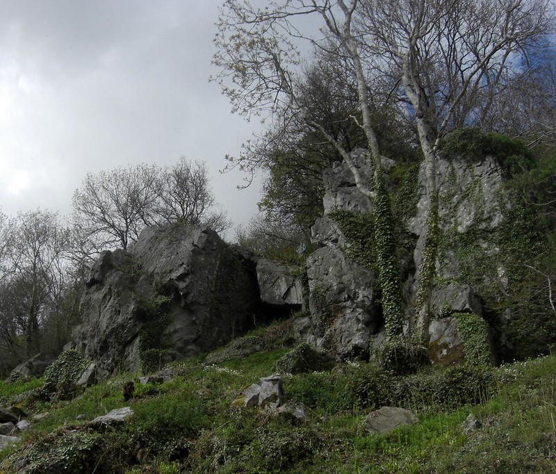 Steve Jenkins was the first to note and describe this tor in 2012 and it certainly deserves some recognition. It looms above the Rookery Brook, a forceful stream that makes a swift course down from the fields below Heltor Rock, and one of its most picturesque stretches is perhaps that which is just a short way above the tor to the west, where in a dark, somewhat ominous wood it passes under the road over mossy boulders. It seems most appropriate to designate the name of this brook (and cottage) to the tor which resides close by.  Rookery Brook Tor looks across the valley to the grand sweep of the now densely wooded Christow Common which rises abruptly in dramatic fashion southward, and were it not for the trees, a deep gash in the hillside much closer to us would be seen. It is part of the now disused Scatter Rock Quarry workings, and according to 'The Teign Catchment' website, "The Scatter Rock quarry at Christow Common, which opened in 1914, continued to flourish during the 1920s, and didn't finally close until 1950." It would have been an impressive scene where the scars of industry would have been in view from the tor, creating a distinct juxtaposition. 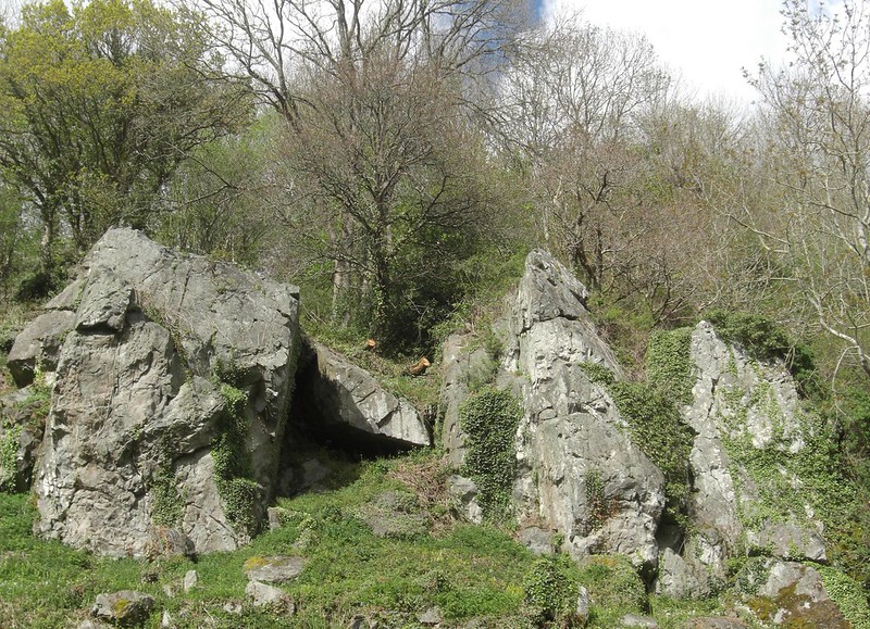 The best place to view the crumbling tor is from the road to the south, as it is situated on private land, but decent views can be obtained of it adjacent to the entrance to the aforementioned cottage. Old Ordnance Survey (OS) Maps indicate the presence of an outcrop at this site, albeit as a minor rockpile with no name, this being a rather common depiction of East Dartmoor by the OS at the time. It is worth viewing from the roadside and should you wish to get closer, always seek permission from the landowner.
| ||||||||||||||||||||||||||||||