TORS OF DARTMOOR
a database of both lesser- & well-known rocks and outcrops
Rooks Hole Tor
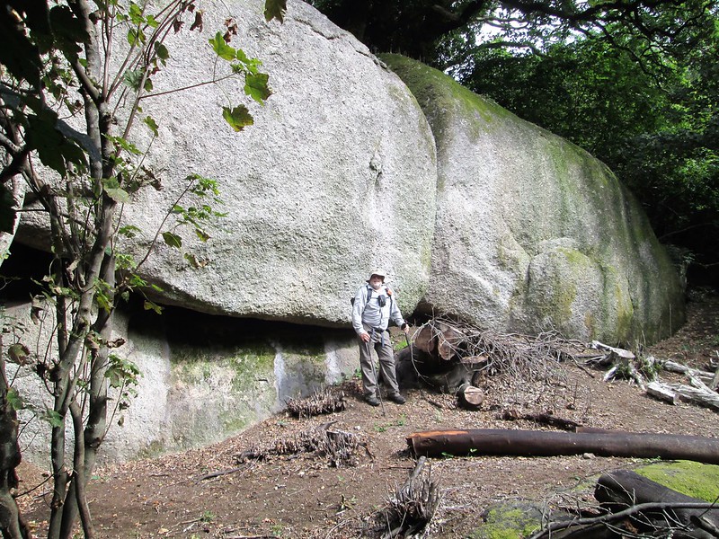 The grandest tor in the woods on the approach to Shap Tor can be found some 300 metres to the west of Rock Copse Tor and 250 metres east of Pixey Copse Tor. Now cleared of some of the surrounding trees the magnificent white-faced outcrops here tower above the visitor. Of the two main outcrops, the eastern contains within its toppled boulders a huge cave, accessed from the south side, that is big enough to house a group of people quite comfortably. It's spacious and allows for those who crawl in to stand up with ample head room. 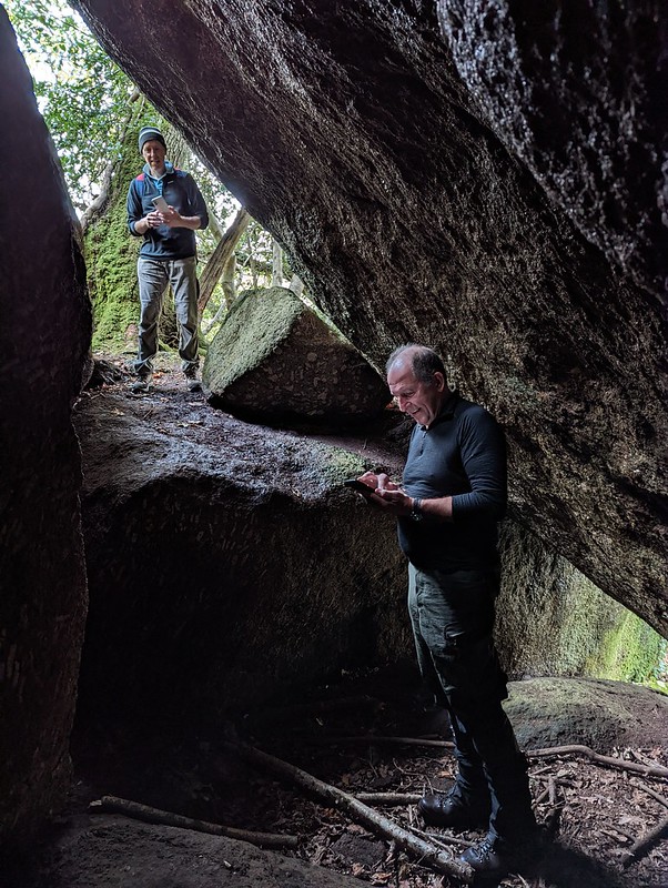 Huge bosses of granite that if seen elsewhere would immediately warrant attention stand in the heart of Shaptor Wood. The eastern mass is noted for its vertical jointings while the western is largely bereft of any. It is a fantastic array of granite and more outcrops extend into the trees above, these again each worthy of merit in their own right. In winter you might be lucky enough to catch a glimpse from above the wooded canopy towards Haytor Rocks. 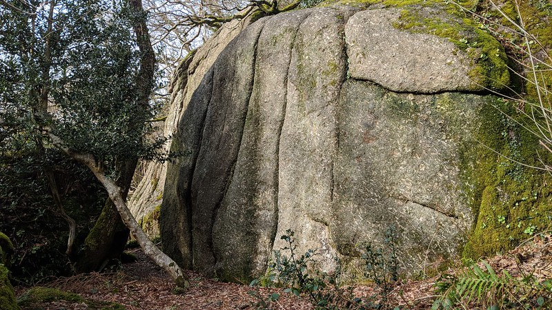 The name of 'Rooks Hole Tor' is taken from the plot of land we have calculated it to be within on the Tithe Map for the Parish of Bovey Tracey. Max Piper goes into great detail about the tor in Dartmoor News (2020), introducing this name for the grand spread of granite seen here for a modern generation to explore. Exactly two years later, in his ground-breaking publication 'East Dartmoor's Lesser-Known Tors and Rocks', he provides a thrilling explanation where he writes that "this wilderness of granite" is "one of the finest lesser-known tors in Dartmoor National Park, let alone East Dartmoor." It is, on reflection, quite remarkable how William Crossing, who visited Shap Tor at the turn of the 20th Century, didn't notice the rocks at Rooks Hole. Perhaps he approached by way of Slade Cross and didn't venture further south-east? 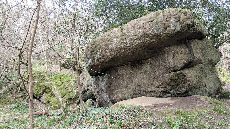 We learn from the Woodland Trust, custodians of this special place, that "Shaptor was of the first 20 woods brought into the care of the Woodland Trust in the 1970s by Trust founder Kenneth Watkins, thanks to a grant from the Countryside Commission. Today it remains a well-beloved piece of Dartmoor's most precious woodland." Access to Rooks Hole Tor is relatively easy as it lies on the slope about 50 metres above the main permissive path through the wood, which is dotted by Woodland Trust plaques. The great pale-faced rocks have lesser (but still well-defined) pathways leading to them.
| ||||||||||||||||||||||||||||||