TORS OF DARTMOOR
a database of both lesser- & well-known rocks and outcrops
Round Hill TorRoundhill Tor 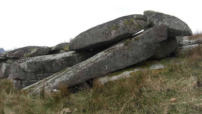 As with most lesser known tors of Dartmoor, it is once again the meticulous Eric Hemery (1983) who seems the only person to have commented on this considerable rock pile. From his account, Tim Jenkinson has been able to confirm that the tor is most probably located on the northern side of Blacka Brook at SX 606 739, approximately 400 yards south of Round Hill Farm. Here just off the summit point, three closely grouped and broken outcrops lie, with a large clitter that ranges over the southern slopes of the hill, almost to the water's edge. The largest pile, the lowermost, when viewed from the convenient wooden footbridge, spanning the brook to the south east at SX 60665 73844, is seen to form the most prominent and main part of the tor. 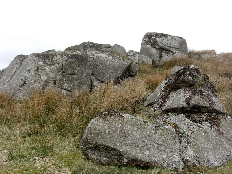 The central outcrop, forming a small yet distinctive rock face on the eastern side, consists essentially of two huge boulders, whereas the highest and smallest pile has within it a large propped rock, that also achieves its best effect when viewed from the bridge. Below the main tor, a disused leat channel runs from east to west, having conveyed water to the farm. The scene from the highest rocks is unique, particularly to the west where the prison at Princetown is clearly visible beneath the mast of North Hessary Tor. South eastward the Blacka Brook winds its way towards its confluence with the West Dart beneath Prince Hall Rocks. Presiding over this lower section of the brook, on its southern bank, are the shadowy, ominous outcrops of Blakey Tor, whilst to the south west, Bachelor's Hall nestles steepily in the valley sides. 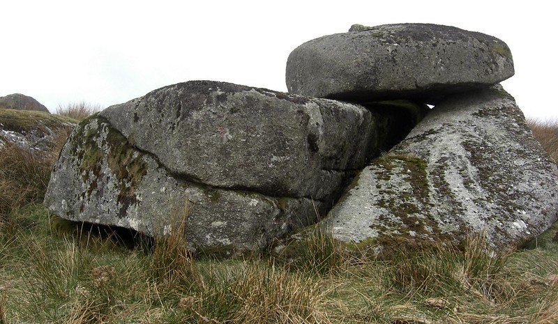 Although Crossing (1912) gives several brief references in his 'Guide', to not only Round Hill but also its Cottage, Farm and antiquities, he does not mention the rocks in the vicinity. This is a surprising and somewhat puzzling omission from the pioneering author, particularly as the tor's substance and clitter, forms an eye catching feature when viewed north and westward from the brook beneath Blakey Tor. It is this failure to acknowledge the tor, coupled with a rather vague description of Blakey Tor (Crossing uses the name 'Colden'), that causes Hemery (p391) to question whether or not Crossing actually ever visited this area. However, this criticism seems a little harsh given the distinct advantage that Hemery had over Crossing in terms of motor travel and being able to access and explore parts of the moor much more readily than him. 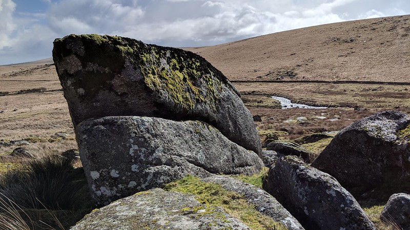
| ||||||||||||||||||||||||||||||