TORS OF DARTMOOR
a database of both lesser- & well-known rocks and outcrops
Rowdon Rock
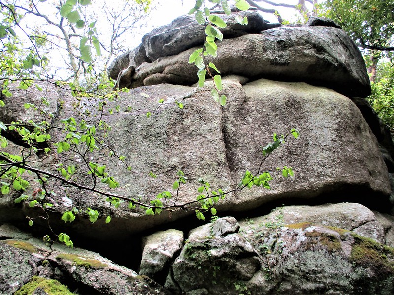 Although clearly marked on OS maps this magnificent tor, for it is so much more than a rock, is quite difficult to find and involves a clamber uphill from a public footpath to the south-west of Bridford. The landscape here is overgrown with scruffy vegetation and in the summer months the rocks are virtually impossible to reach so visits at other times of the year are recommended. Whilst it is set on private land Rowdon Rock is accessible and requires a walk uphill parallel to the fence on your right. After about 100 metres or so the giant lower portion of the Rock emerges, and it simply takes your breath away towering above. It has a distinctive rounded shape and is one of East Dartmoor's finest sights. 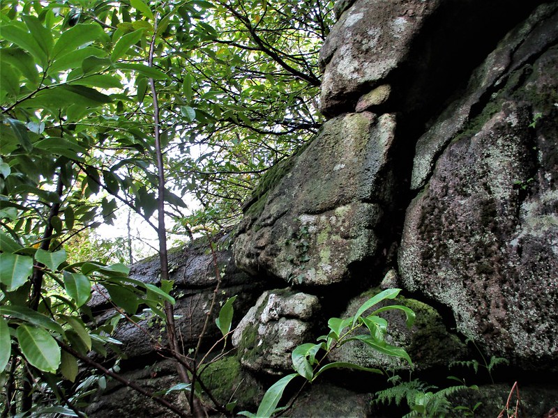 There is a steep muddy trail that threads between the outcrops that is difficult to negotiate after wet weather, but for the more adventurous it takes you higher up through the giant outcrops and reveals much more of the tor especially if go to the left staying close to the granite. Here large mossy boulders with caves can be found and this mid-section provides glimpses of an even higher pile to the right up through the trees that is very hard to get to and not for the faint hearted. Extra care must be taken on the descent retracing the steps you have taken. 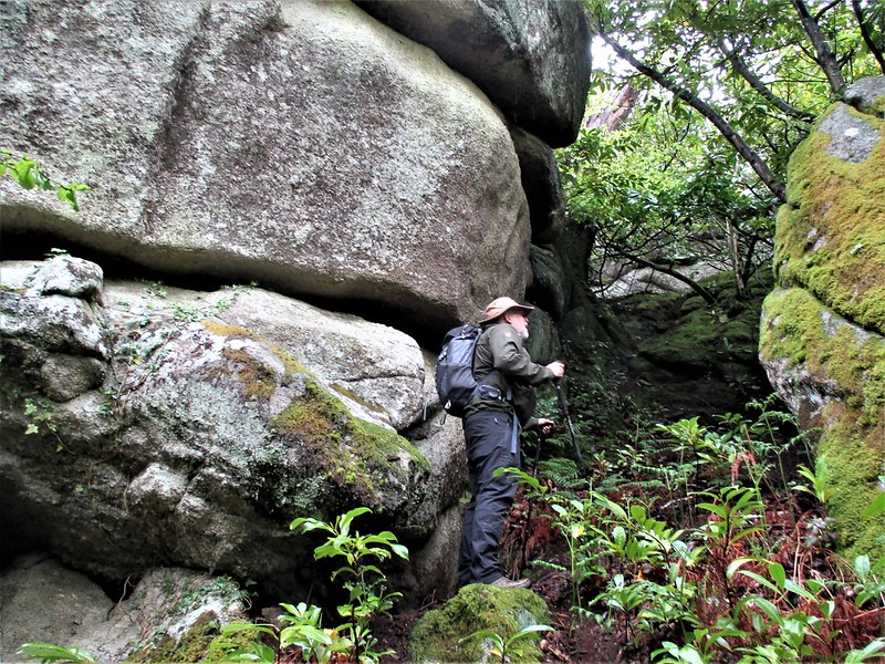 Thanks go once more to Steve Jenkins for helping with the location of this fine feature back in April 2012 when Tim Jenkinson was able to visit following his directions. It is surprising that such a prominent landmark as this receives such scant attention in the literature other than what are brief notes from Ringwood in 2013 who writes "On the side of a steep hill, there are rounded granite blocks with little clitter. Field boundaries on the tor, woodland to NW and E, overlooking Rookery Brook to the S. Hidden by grass, ferns, gorse, holly and laurel." 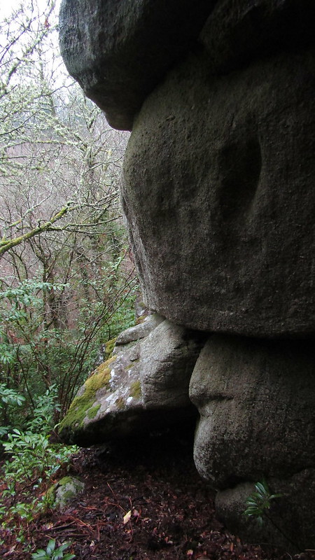 However, as this description implies the only downside to visiting is that the area around Rowdon Rock feels almost like a tropical rainforest with its swooping branches and the claustrophobic closeness of the trees and plants that give the feel of the Rock being set somewhere far away from civilisation, when in reality it is only a few hundred metres from the village of Bridford. That said it is still a magnificent cluster of outcrops and well worth the effort to get there as you will not be disappointed.
| ||||||||||||||||||||||||||||||