TORS OF DARTMOOR
a database of both lesser- & well-known rocks and outcrops
Sharp Tor (Lydford)Sharpator, Lydford Sharp 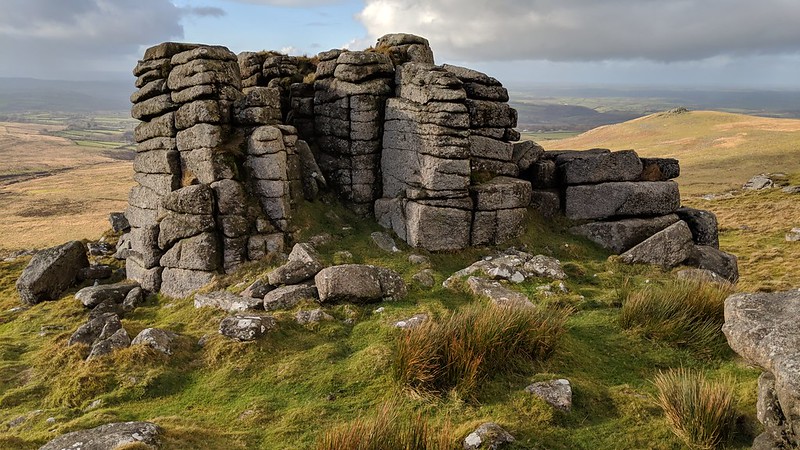 This is a very impressive tor with tonnes of clitter on its western side. From Sharp Tor, you are afforded some great vistas of North Devon and Cornwall, some of the finest among the western tors of the high North Moor. From afar, it is somewhat knocked out of prominence by the more conical mound of Hare Tor, but this tor arguably has more significant outcrops that are worthy of exploration, and upon reaching the top of this crown, you will realise that it is one of the finest tors on North Dartmoor. 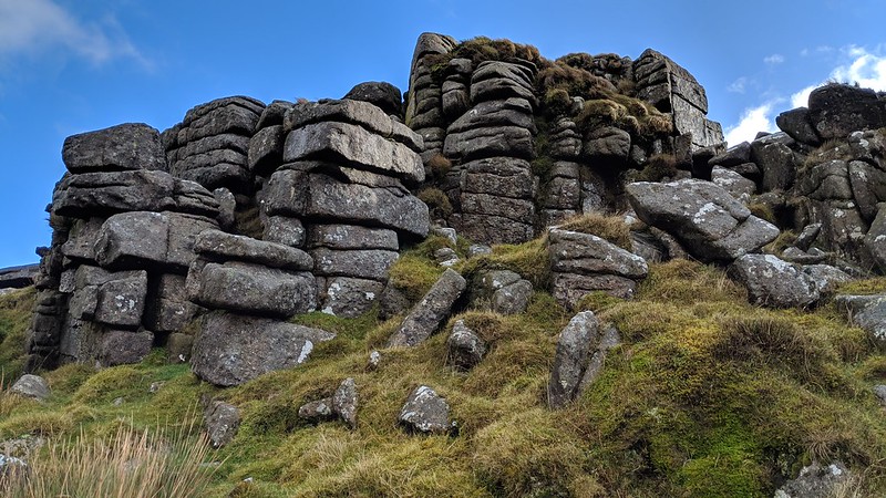 Whilst Sharp Tor is first shown by this name on William Mudge's Ordnance Survey map of the County of Devon in 1809, Crossing is the first to mention it as 'Lydford Sharp' "A little N. of Hare Tor and not far W. of the head of Dead Lake is a small tumulus known as Hay Tor Bound of Willsworthy Manor and N. of this is Sharp Tor, called sometimes by the moormen Lydford Sharp, to distinguish it from the chief pile of the Tavy Cleave group of tors, which also bears that name." Crossing's account is quite interesting he goes on "Some ninety odd years ago it was remarked by an antiquary that this tor well deserved its name, some of its points being as sharp as a spear, but he does not say that it was derived from this." 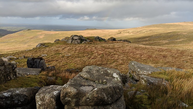 Eric Hemery (1983) says of the hill it sits on; "...its steep west scarp topped by the rock mass of Sharp Tor (1,719 feet), locally known as 'Sharpator' or 'Lydford Sharp'. The main pile is an avenue tor, and under its south wall a small shelter has been built against the rock. The further side of its north wall has a broken rock-face, and beyond it is a small remnant pile on the north brink of the hill." To add to this, the main outcrop is a huge block of granite that is seemingly divided into tall, vertical segments where the release of pressure in the horizontal joints has caused the rock to split in places making it very characteristic and resembling plasticine. The north side shows evidence of pink granite that has been intruded into the rock, the juxtaposition demonstrating the tor's proximity to the edge of the granite pluton. 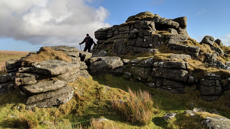
| ||||||||||||||||||||||||||||||