TORS OF DARTMOOR
a database of both lesser- & well-known rocks and outcrops
Sharp Tor (Tavy Cleave)Sharpy Tor, Tavy Cleave Sharp, Tavy Cleave Tors
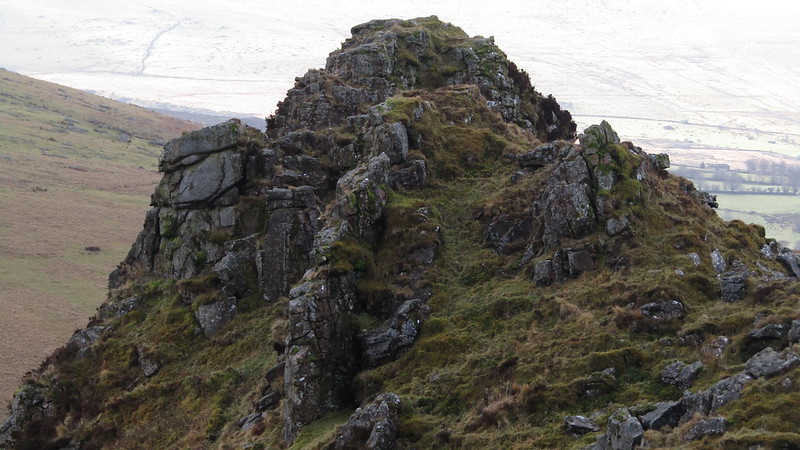 The Tavy Cleave Tors are among the most glaring of omissions from Ordnance Survey Maps, for they are so striking that it is shocking to see how underrepresented they are on the most popular map of Dartmoor National Park. The five most prominent outcrops are often collectively known as the 'Tavy Cleave Tors' and have been documented as such in the literature, but one pile is given the name of 'Sharp Tor' honouring its steep, vertical east face that dominates the River Tavy that passes below. It is a true sentinel overlooking arguably the most impressive valley on the moor, and it is easy to comprehend why William Crossing (WC, 1905) chose it as one of his 'Gems in a Granite Setting'. For the first time we get an idea on the number of tors here; "The group of tors to which allusion has been made stands above the north-eastern side of the great amphitheatre and consists of five distinct piles. They are usually known as the Tavy Cleave Tors, only one of them bearing a distinctive title." 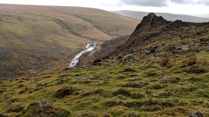 WC explains that; "This, the principal mass, the Moormen often call Sharp Tor, and distinguish it from another of the same name on the adjoining common by referring to the latter as Lydford Sharp." To stand at the south side of this conical mass, and to look up the valley, is part of one of the most dramatic scenes on the moor, and the Cleave is best viewed through the gap between the two main outcrops of the tor further up the hill. Partially grass-covered the tor is a massive bulk. 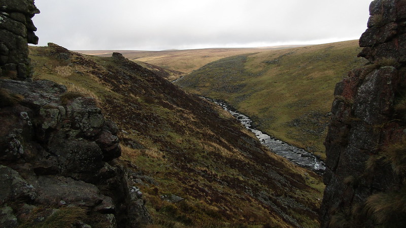 The author concludes nicely with; "From these tors, the situation of which is such as is occupied by no others on the Moor, the best view of the cleave is obtained, much of it not seen from Ger Tor being revealed. The beholder looks into the depths of the defile as from a precipice, and so far below is the Tavy that in appearance it can be likened only to a rivulet." It should also be noted that there is an error in his book with a photo of this outcrop being captioned 'Ger Tor', on page 185. The author, who was clearly taken by the staggering depth and expanse of the Cleave, describes it as a "defile" that "for wild grandeur is unsurpassed throughout the Moorland region". 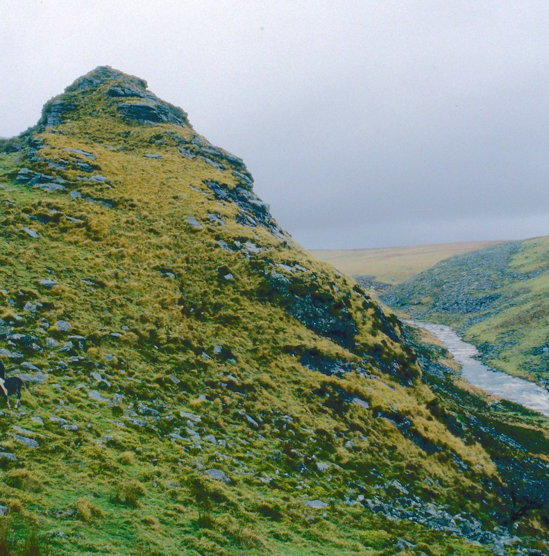
| ||||||||||||||||||||||||||||