TORS OF DARTMOOR
a database of both lesser- & well-known rocks and outcrops
Sharp Tor (Yartor Down)
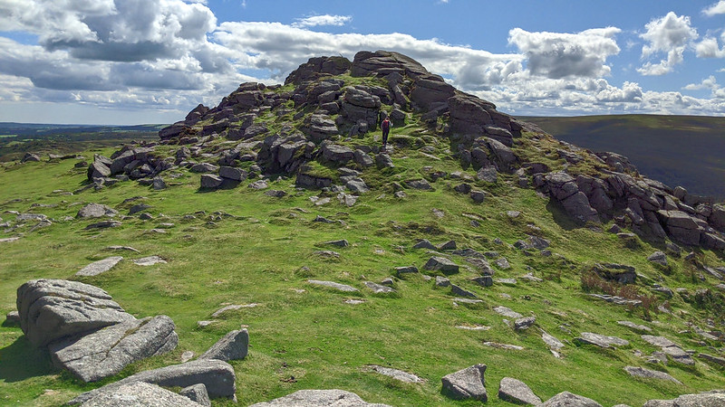 One of the Dart Valley's most magnificent rockpiles is Sharp Tor, a giant cone of granite that is situated roughly halfway between the hamlets of Dartmeet and Ponsworthy. The tor's easy accessibility from the main road plus its striking position above the River Dart make an excursion memorable. When visiting, the most popular places to start from are the car parks at either Bel Tor Corner to the east or Rowbrook Hill in the west; both routes, while on well-defined tracks, involve a steep but short ascent and will reward you with wonderful outcrops and vistas. 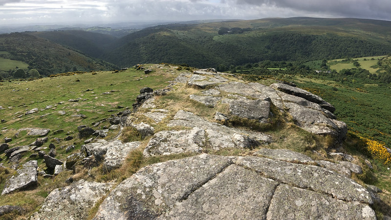 Approaching the tor from any direction except the north will entail a steep climb that is particularly rocky on the southern slope that is plagued with patches of furze. As you crest the hill you will notice that the tor is a summit avenue with two main stacks, both quite unlike one another: the northern is blocky with widely-spaced joints whilst the southern is higher and more conical. It is the latter that attracts attention as from its top there is a thrilling vista of the wooded valley sides of Dart Gorge as it passes beneath the Bench Tors; elsewhere the views embrace a mixture of pasture and moorland with distant views of the English Channel beyond Torbay. On some still days the fierce roar of the Dart can be heard in the valley below. 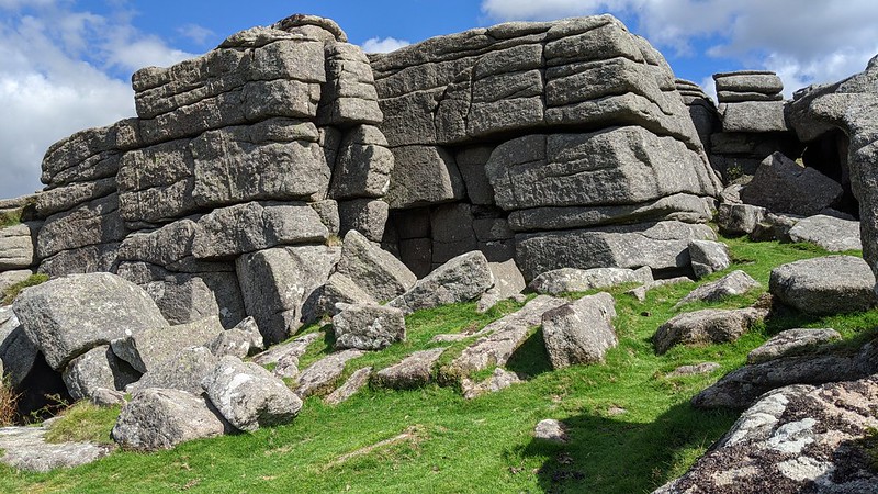 Eric Hemery (1983) writes about the tor: "Sharp Tor (1,254 feet) provides striking views in all directions, and particularly of the winding gorge with its wooded, interlocking spurs six hundred feet below, and is contrasted with others so named. On the south side of the tor is much decayed granite, the edge of a rock-basin being in process of crumbling while others are forming. A massive, weathered rock-face rises on its west side..." A lone, crooked hawthorn tree clings onto the southern side of the rock ridge and features in many photographs as it provides a focal point for composition. 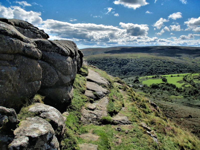 The name 'Sharp Tor' is the most common title given to outcrops on Dartmoor, and most tors going by this appellation are noticeably steep-sided and sheer, and this tor is no exception to that, presenting its best aspect from the north-west as a double peak and the south, by Venford Reservoir, as a rugged pyramid. On account of its projection into the sky and stunning location, the rambler must pay a visit not only to the summit but also the slopes to marvel at the tor's character and dominant position here.
| ||||||||||||||||||||||||||||||