TORS OF DARTMOOR
a database of both lesser- & well-known rocks and outcrops
Sharpitor (Lustleigh)Sharpiter, Sharp Tor, The Nutcrackers, Nut Crackers, The Christening Stone 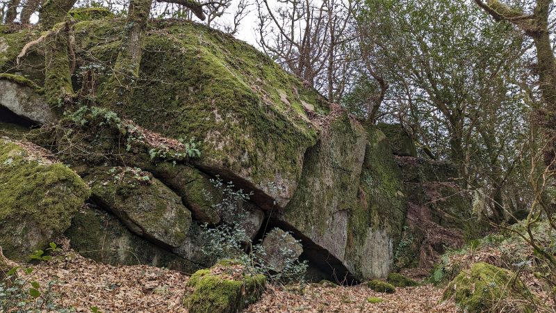 Perhaps nowhere on the East Dartmoor periphery can a tor compare with the magnitude of Sharpitor. One of the grandest woodland tors, the towers of rock seen at the south-eastern edge of Lustleigh Cleave stand testament to the grandeur of granite outcrops, especially as today the tor is totally enshrouded in trees giving little clue to its magnificence from afar. The main part of the tor is famed for not only once being a popular picnic spot but also for having a logan rock known as the 'Nutcracker' in its midst that was allegedly toppled by vandals on 6th May 1950 (Stanbrook, 2000). According to the author, the Parish Clerk of the time Mr F. Amery thought the rock was "dislodged by young men with crowbars out for mischief." In the Western Times on 19th May Miss W.M. Cook of Nutcracker Cottage confirms this: "I saw two men with crowbars on Saturday night and they told me they were going to push a boulder over. I was on my way back to my cottage when I heard a crash. Had I known they intended to push over the Nutcracker I would have done my best to stop them." Although the incident was widely reported in the press at the time, some local residents, including Mrs Mary Smale, believed the Nutcracker to be still intact and that the rock that was overthrown was one known as the Christening Stone just a few feet away, this being a far more distinctive one with rock basins atop that had been occasionally used for the christening of local children either with rainwater or bringing holy water up from the village church to the site. 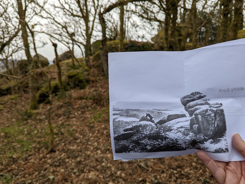 A Tors of Dartmoor Team visit to the location on 5th March 2023 compared historic photographs with the present scene and unanimously deduced that it was the Christening Stone that was toppled, with the Nutcracker indeed still in situ, albeit no longer rockable, as one photo showed a gentlemen rocking the triangular stone. The top rock of the Christening Stone seems to have toppled a short way to the south-east and is now resting on an angle. Throughout her article, Stanbrook explores the possibility that the toppling of the Nutcracker was a case of mistaken identity with the vandals targeting the more prominent Christening Stone instead. She uses black and white photographs to show the position of the different stones and cites the testimony of the aforementioned Mrs Smale (Western Morning News) who was able to demonstrate the cracking of hazelnuts to not only a number of soldiers but also a Daily Mirror reporter thereby proving that the Nutcracker stone was still intact. Indeed, accounts of post 1950 visits to the logan long after the furore had died down and its ability to crack open nutshells lends more support to its ongoing existence at the site. Indeed, the name of Nut Crackers (Logan Stone) still appears on OS maps. The viewpoint at SX 77220 81443 provides one of Lustleigh Cleave's most spectacular views, a deep ravine decorated by trees on all sides with Trendlebere Down and Black Hill standing aloof guarding the Bovey's exit from the granite. 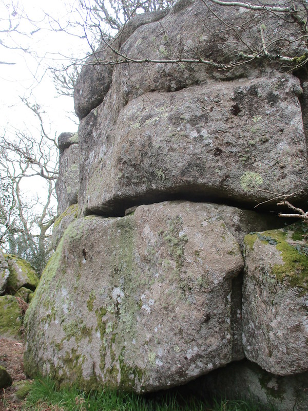 We also learn from William Crossing (1912) that Sharpitor had multiple logan stones, and one such contender recorded by Tim Jenkinson lies at SX 77153 81476... but there is much more to Sharpitor because as mentioned there are a plethora of striking granite stacks and boulders to explore. If you leave the bridleway at the top of the Cleave you enter the Cleave proper where the best of the tor resides. The summit rock is huge and cracked and a long spine of broken outcrops with one or two rock basins gives rise to a tremendous series of crags on the south-eastern slope that rear up above the Hammerslake prehistoric settlement. 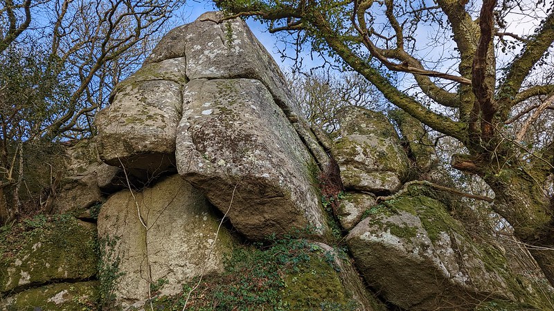 Sharpitor is a maze of granite, so much so that actually trying to perambulate the tor is quite difficult, especially on the southern side where there are also brambles and steep drops to be aware of. It is a tor best visited in winter and early spring to get the full picture of what we have here, one of Dartmoor's finest gems, with terrific views above the canopy and an unspoilt woodland which, just over 100 years ago, was moorland grazed by sheep. It is no wonder then that Sharpitor was frequently seen on old postcards and recommended in guidebooks as a place to visit from Lustleigh Station on the once prosperous Moretonhampstead Branch of the Great Western Railway that closed in 1964. Whilst it necessitates a steep climb up from the village it is well worth it.
| ||||||||||||||||||||||||||||||