TORS OF DARTMOOR
a database of both lesser- & well-known rocks and outcrops
Shelstone TorShellstone Tor, Shilstone Tor, Shilston Tor
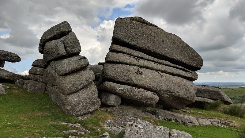 The West Okement River begins its swift course from its source near to Cranmere Pool at a little over 550m above sea level which, once it has reached Vellake Corner, about 5 and a half miles downstream, has dropped to a mere 300m. Overlooked by numerous tors and hilltops on the North Moor, Shelstone Tor boasts one of the finest vantage points from which to view this river's path to the south east through the valley that is bounded by Black Tor on the left and the Slipper Stones on the right. The tor stands like a granite sentinel above this river and its many outcrops offer shelter from any wind direction. 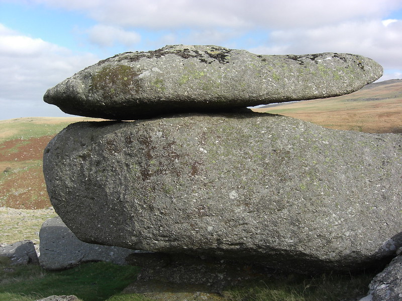 Seen from Sourton Tors as simply a distant and somewhat lowly tor on the spur of the hill, yet on closer inspection Shelstone Tor's multiple outcrops are the remains of what must have once been a truly massive tor here judging by the extensive clitter spreading northward to the Valley of Rocks, a picturesque stretch of the aforementioned river, but what is left today is still remarkable, consisting of several distinct rockpiles, one of which is capped by a logan stone noted for its pitted rock basins. Other outcrops are seemingly split in two such as on the north-east side which is most probably a direct result of rock-parting where erosion causes joints in the rock to weaken and eventually succumb to its demise. Inspite of the tor's apparent lack of height the views are nonetheless spectacular, where the visitor can observe two of Dartmoor's most fascinating glacial-created features - Corn Hole and the Slipper Stones - both of which are believed to have been carved by the relentless ice that forced its way through the underlying bedrock of the North Moor. 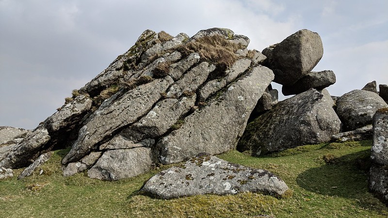 In Gems, Crossing writes of the likely origin of the tor's name; "The name, it is not unlikely, is a corruption of "shelf stone" - the first word appearing in the Devon vernacular as "shil" - and would describe the dolmen, or cromlech, in which the quoit, usually a flattish stone, may be likened to a shelf. But there are no vestiges of any megalithic monument to be seen in the immediate vicinity of the pile, and it is quite probable that the "shelf stone" was nothing more than one of the rocks of the tor itself, which, overhanging on those on which it rested, presented an appearance to the object in question." Visiting the tor is straightforward and easiest from Prewley Moor following the wall in a south easterly direction crossing Vellake Stream where a grassy path leads to the rocks. 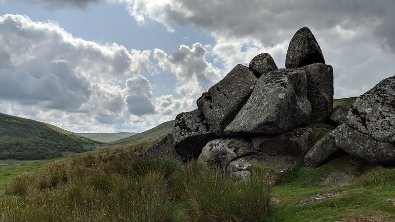
| ||||||||||||||||||||||||||||