TORS OF DARTMOOR
a database of both lesser- & well-known rocks and outcrops
South Bench TorSouth Tor, Bench Tor, Benchy Tor, South Benchator, Benjy Tor, Benjay Tor, Benjie Tor
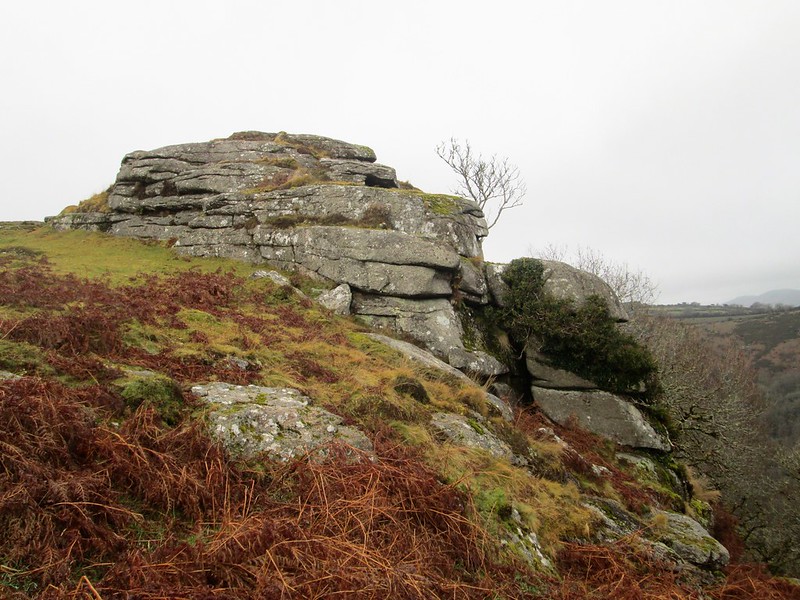 We learn from William Crossing (1912) that Bench Tor "consists of several piles, two of them being named in an old deed North Bench Tor and South Bench Tor respectively, which overlook the Gorge of the Dart. Another is known as the Eagle Rock." The South Tor, despite being less impressive than the giant crag at the North Tor, still presents as a large rockpile with several interesting outcrops at the southernmost end of the Bench Tor ridge. 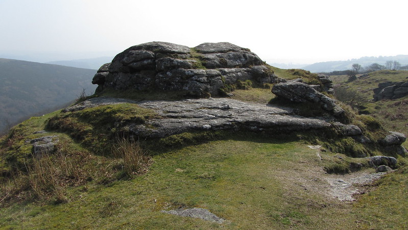 When approaching from the parking area at Venford Reservoir, to the south-west, it is the rocks of the South Tor that you are likely to arrive at first. Appearing quite lowly and disappointing, on closer inspection you will notice that the tor rapidly gives way to the steep valley side in White Wood and is quite dramatic at close quarters. The tor is best admired from the east where oaks and bracken are encountered but it is from here where the outcrops are most striking, rising as they do from the bouncy turf like crannied towers. Some of the lower rocks are engulfed in moss and this tangled landscape only increases the further you head into White Wood. 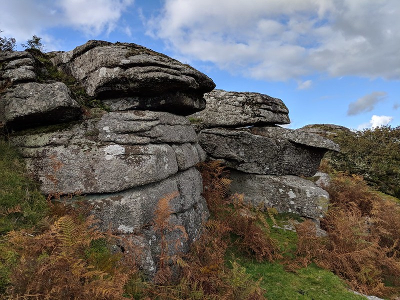 Near a grassy track, a short distance to the south-east of the southernmost rockpile, a fine slotted gatepost can be noticed at SX 69403 71420 nestled within a field boundary. 'Bench Tor' is not the only name that has been afforded to this area; in fact, Hemery (1983) is pretty insistent on the name 'Benjy Tor' and explains that it was "Rendered as 'Benjay Tor' on the first edition of the OS one-inch map of 1809..." Rowe (1896) also gives 'Bengie Tor' and historic 19th Century Tithe Maps give the North and South Tors separate identities - that of North Benchator and South Benchator respectively. It is an interesting example of how pronunciations and spellings have evolved over time. 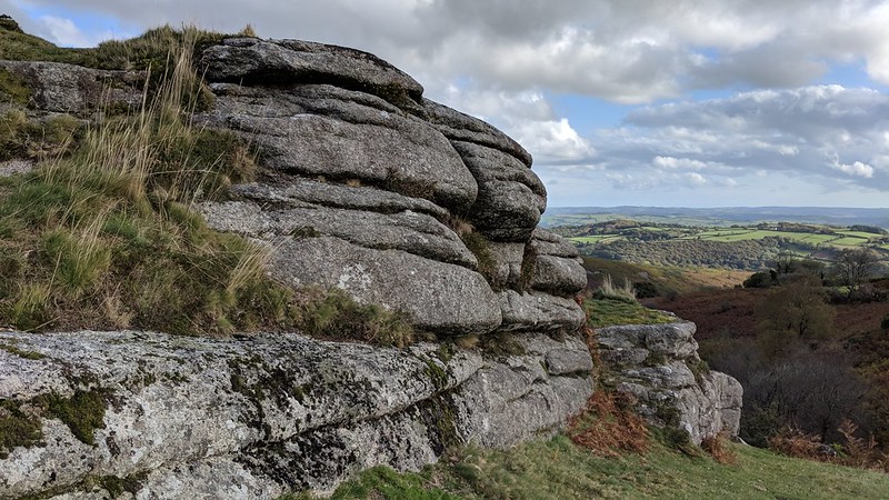 It is an exhilarating walk along the ridge between the South and North Tors where you ascend and descend over and around smaller outcrops enroute; peering to the east above the canopy you will see the beautiful River Dart racing through the gorge embellished on all sides by a dense covering of trees. For the sake of the magnificent vistas commanded and ease of accessibility, the entire spine of the Bench Tor ridge is well worth a visit and is especially recommended in the autumn when the leaves and bracken are turning to a golden brown. You will have a memorable experience.
| ||||||||||||||||||||||||||||