TORS OF DARTMOOR
a database of both lesser- & well-known rocks and outcrops
South Devil's TorMudge's Devil's Tor 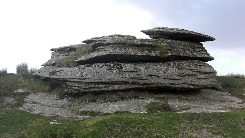 This prominent ledge of granite some 400 metres to the south of the present day Devil's Tor and the Beardown Man menhir immediately warrants attention. The feature, really that of an emergent tor, is also marked on OS maps as a large elongated outcrop but, oddly in the history of the moor, it has never possessed an official name. 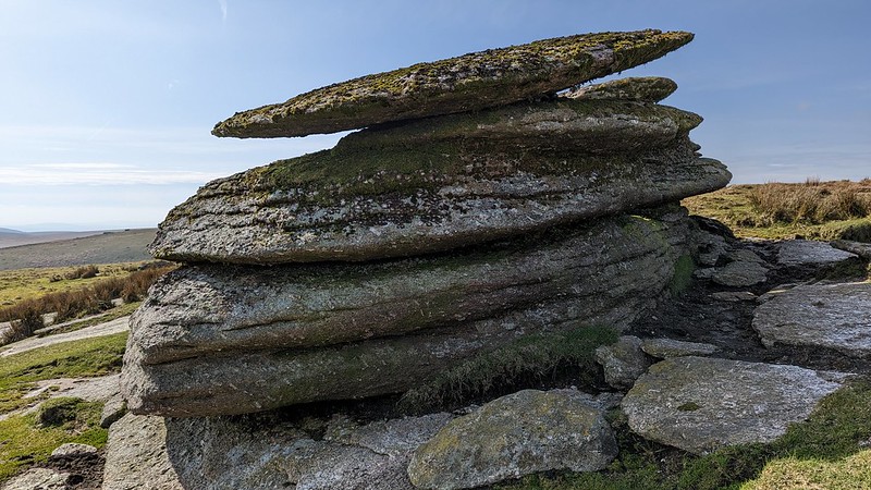 It was described by Hemery in 1983 where he writes: "A little to the south of Devil's Tor the fen ceases, and a rock, unnamed, far more shapely and significant than Devil's Tor proper - poised as it is on the very brow of the ridge - affords a fine prospect of the Central Basin and the tors cresting the Beardown ridge." In the 1990s at the height of the Dartmoor Letterboxing hobby the names of 'Devil's Tor Outcrop' and 'Little Devil's Tor' were being used to identify the rockpile in the various clues being circulated. However, both of these now unauthentic names are no longer recognised. 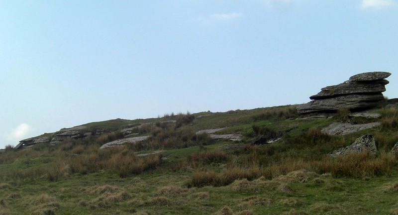 Indeed at the turn of the New Millennium, in his article on the Nameless Rockpiles of Dartmoor Tim Jenkinson (TJ 2000) writes: "However, names for the southern pile such as Lower or Little Devil's Tor seem inappropriate for an outcrop that is clearly much larger and prominent. To complicate matters further, Colonel Mudge (1809) appears to mark the south pile as Devil's Tor leaving the rock beside the menhir unlabelled." TJ's remarks regarding Mudge's depiction are quite contentious as they imply that since he produced his map, subsequent surveyors (and writers for that matter) have somehow misplaced the true Devil's Tor on the ridge. When standing at the Holming Beam car park and range hut, one can look north up the Cowsic Valley and it is without doubt the South Tor that is the most pronounced, with only the tip of Beardown Man being visible in comparison. Could it be that Mudge simply couldn't see what we know of today as Devil's Tor if he was standing at the same spot? It is not inconceivable as knowledge of the deep moorland interior was restricted at that time by ease of access. 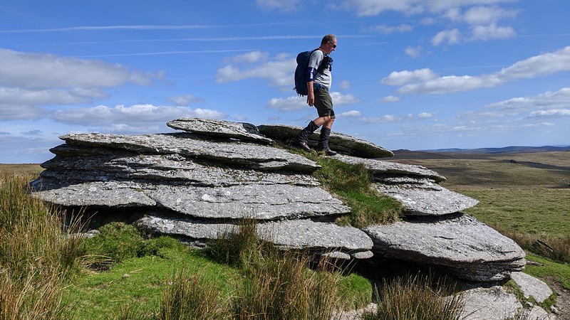 In more recent times, the name of 'South Devil's Tor' has been suggested to give this tor some credibility, as it is a far more interesting outcrop to look at and affords more dramatic southerly views over the valley of the Methern Brook, flanked by Crow Tor, as it drops down into the West Dart. The parallel ridges of Longaford and Beardown, each marked by great granite embattlements, sink into infinity whilst the South Moor, ahead, rises tremendously like an impenetrable wall of high open moorland.
| ||||||||||||||||||||||||||||||