TORS OF DARTMOOR
a database of both lesser- & well-known rocks and outcrops
Stacombe RocksStacombe Tor, Mardon Down East Tor  At about one and a half miles above and to the north-east of Moretonhampstead is an expanse of open moorland known as Mardon Down that is well used by locals for walking and exercising their dogs. Best reached by taking the lane to the north of Cossick Cross, the Down is peppered by Bronze Age cairns and Dartmoor's widest stone circle. Writing in 1956 Arthur Wilde makes the following observation: "I have rambled once again over the spacious slope of Mardon Down. I often think that Moretonhampstead folk are fortunate in having such a pleasant region for rambling, with that champagne-like air to breathe." 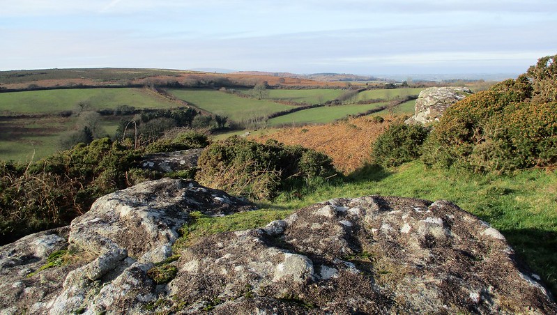 On the eastern side of the Down there is a small ruined rock pile scattered across the gentle slopes above Stacombe Farm that is indicative of an emergent but quite lowly tor. Several large boulders are found here that are readily visible from the minor road between the aforementioned crossroads and the so-called Headless Cross, otherwise known as the Maximajor Stone. Tim Sandles includes the following account of the Cross on his Legendary Dartmoor website: "As far as the 'Headless Cross' is concerned, Gerrard, 1997, p.63 considers that this is a menhir or standing stone and that it may have been re-used or re-named for Christian purposes. There are no visible signs of this stone ever having had a cruciform shape so it can be dismissed that any head or arms have been lost. Strangely enough there are no incised crosses on the stone either so the stone is a 'cross' in name only." 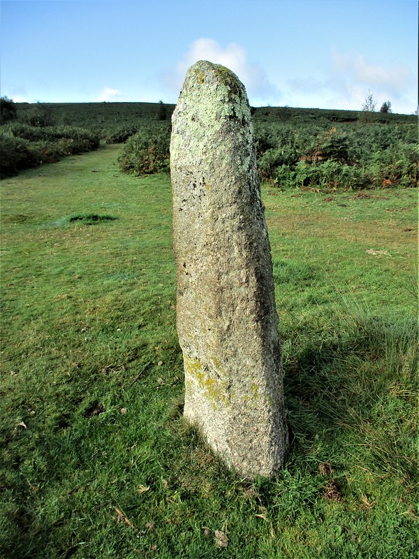 In 2010 more information is provided by Alan Rosevear on the origins of the Maximajor name, along with an interesting observation on the shape of the stone although he is merely commenting on the replica, as it seems that it was the original that had the Ordnance Survey benchmark: "This tall, slim stone stands at the crossing of the track across the saddle and the ridgeway track. It has a similar twist to Bennett's Cross and imagination might conjure up the stump of an arm on the south side - but it is generally regarded as a free-standing stone pillar, not a despoiled cross. There is a benchmark carved on it. Maximajor was the Giant who was buried on top of Mardon Down but pushed open the barrow and escaped, only to be petrified here." 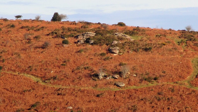 Returning to the small tor remnant at Stacombe there are several good sized rocks on the slope above the Farm, one being a compact fissured outcrop of at least 7 feet in height on its south side. The scene from the slope is especially good as Max Piper (2022) remarks: "In keeping with the rest of Mardon Down, the views are mesmerising, especially to the south where the bold masses of Haytor Rocks rear up from the turf and are encircled by several other stunning tors in what Hemery (1983) calls the 'eastern highlands'. With an element of exclusivity, Stacombe Rocks are well worth a visit and are very easy to reach from the car park at the Headless Cross (Maximajor Stone)." However, be warned that the hillside here is choked with bracken in the summer months so a visit in winter is recommended. Stacombe Farm itself that is set in the dip below dates to the mid 16th Century with 17th Century alterations and it received Grade II Listed status in February 1987.
| ||||||||||||||||||||||||||||||