TORS OF DARTMOOR
a database of both lesser- & well-known rocks and outcrops
Steng-a-TorStinka Tor, Stenga Tor, Steynchatorr, The Camel, La West Solle, Le West Solle, Westolle, Steincator, Steinegtorr, Steinga Tor, Stinkatorr, Sourton Tor 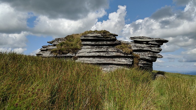 Surrounded by a bog, high above the beautiful West Okement Valley, the weathered pile of Steng-a-Tor has a remote lonely feel attached to it. Certainly, it is not a popular destination with those caught out by its mire moat but its reputation is exaggerated, undeserved and in truth it is fairly straightforward to approach if you pay attention. 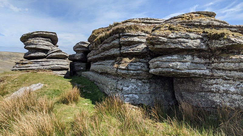 Its shape, when viewed from the north-eastern side, has afforded it the nickname of "The Camel"; the seated dromedary's body being the 'humped' outcrop in the foreground with its neck and head consisting of a tall stack positioned slightly behind. On the tor's south-west side the illusion is lost but here you find a ledge with a lawn manicured by sheep that, whilst a pleasant place to linger on a warm summers day, regularly suffers in the prevailing wind when shelter would be most welcome. 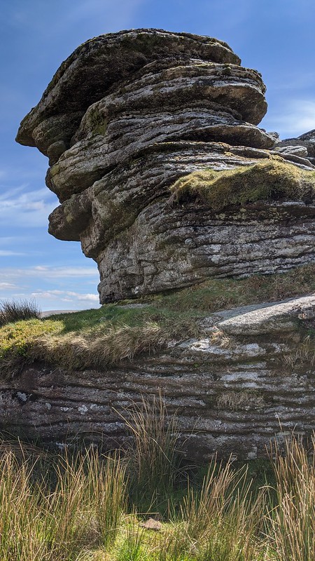 When interpreting the route of the Dartmoor Forest Perambulation of 1240, historians and scholars widely accepted that this lone outcrop was a boundary point. However, Roland Ebdon in his book 'The Perambulation - Dartmoor's Original Long Distance Walk' says that it was the 1609 perambulation when 'Steynchatorr' (tor in a bog) appeared by name and he expands further to question whether the jurors of 1240 even visited; "...the route eastwards from the tor is steeply down over rocks and would be an impossible ride. It is, in fact, a very uncomfortable walk, steep and rocky. Travelling to the tor and then back along the ridgeline toward Kitty Tor is a diversion from the most direct route down into the West Okement Valley. Therefore I do not consider that the perambulators would have gone near it." 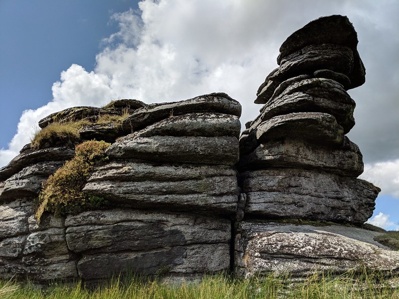
| ||||||||||||||||||||||||||||||