TORS OF DARTMOOR
a database of both lesser- & well-known rocks and outcrops
Stowford Cleave Tor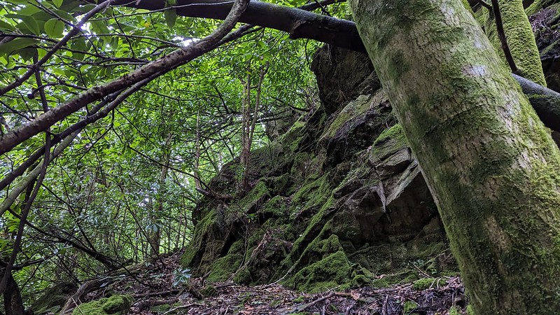 Remembered from a visit to the area in the 1990s by Dartmoor Guide Paul Rendell, this magnificent tor extends along the steep hillside just to the east of the River Erme near Ivybridge and is little more than 100 metres to the north of the impressive Grade II Listed railway viaduct that to this day carries rail travellers back and forth from Plymouth to Totnes and beyond. 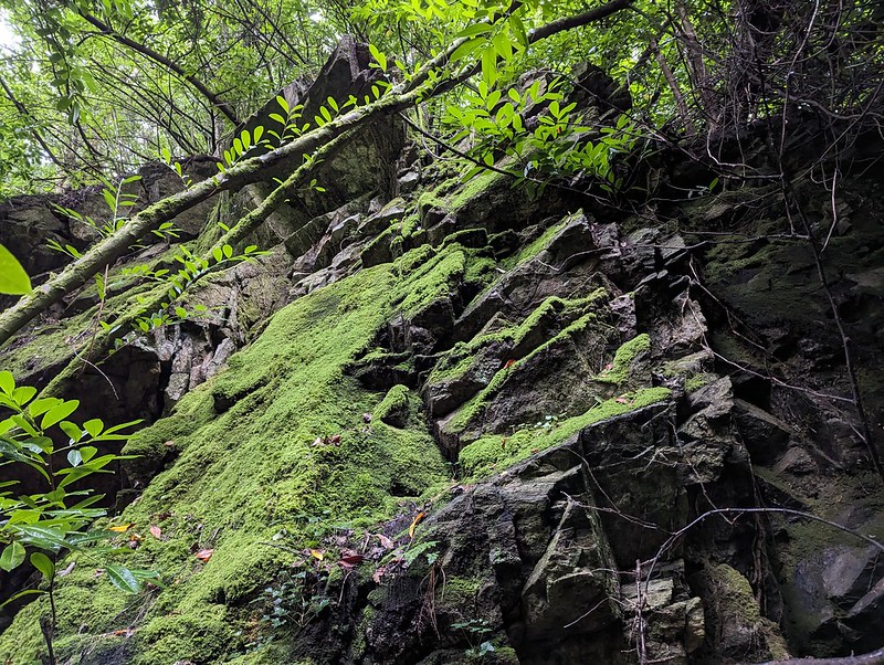 With its dark and brooding metamorphic crags reminiscent of a huge cliff face, the immense rocks here are forever condemned to twilight on account of the dense canopy of unchecked trees and bushes that have grown up around them since the viaduct's construction. 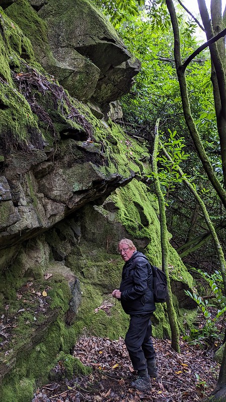 The site is claustrophobic and quite difficult to access but the rocks can be reached with perseverance from nearby footpaths and gaps in the fence with narrow tracks that lead down to the old weir and leat channel that if followed north soon reach the underside of the tor that extends uphill on the slope. However, assessing the true sprawl of the rocks here is complicated by the terrain but there looks to be some huge outcrops jutting from the slope. It is an altogether hidden gem but be warned care must be taken on the ascent, even to the lowest part as it is slippery and steep with unstable ground. With this on the ground assessment by Max Piper and Tim Jenkinson in August 2023, Stowford Cleave is confirmed as the most southerly, albeit non granite, tor on Dartmoor. 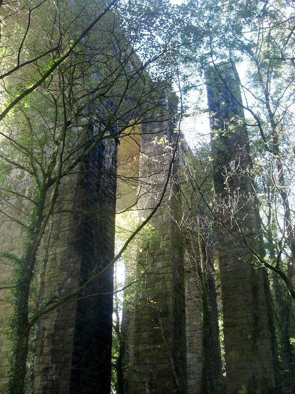 We learn from the Ivybridge Heritage Group that the original viaduct a magnificent feat of engineering was built in 1848 under the instruction of Isambard Kingdom Brunel. It was at the time reported to be 104 feet in height and covering a distance of 252 yards. The current structure that we pass beneath to get to the tor was designed in 1893 by Sir James Inglis the General Manager and Consulting Engineer of Great Western Railway (GWR) when the line was doubled in order to accommodate the greater use of the trains in late Victorian England. One side of the original piers were abandoned in the rebuild but are incredibly still extant at the site in the 21st Century and were grouped in with the Grade II Heritage listing of 1984. For those interested in railway artefacts there is an interesting cast iron GWR boundary marker dated 1911 surviving beside the viaduct at SX 63678 56931.
| ||||||||||||||||||||||||||||