TORS OF DARTMOOR
a database of both lesser- & well-known rocks and outcrops
Swell TorSwelltor Quarry, Swelltor Quarries, Swill Tor
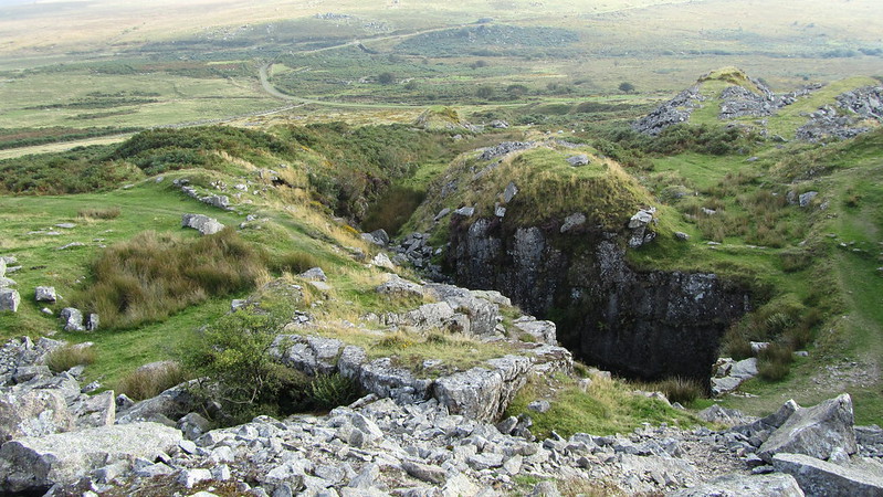 There is today very little left of Swell Tor as like neighbouring Foggin Tor to the east its substance has been plundered by a succession of quarrying operations digging out the hillsides for granite building blocks. Foggin Tor was first excavated as Royal Oak from 1820 onwards and then throughout the 19th Century until the resources dried up c1900 when attentions turned to the nearby Swell Tor and yet more work began. Hemery sums it up nicely "Swell Tor has been decapitated and disembowelled by the quarrymen. On the brink of the quarry face a few lumps of granite remain of the original tor." There is a better example of a tor remnant set well below and to the south-east of the main quarry, it could be argued that these rocks are of a sufficient distance from the summit to be regarded as something separate and a candidate for the location of Crip Tor, as shown on the Tithe Map for the Parish of Walkhampton. This is a pile that is also named as 'Inclined Plane Tor' by Bray and cited as such by Crossing in his 'Dartmoor Worker' account. 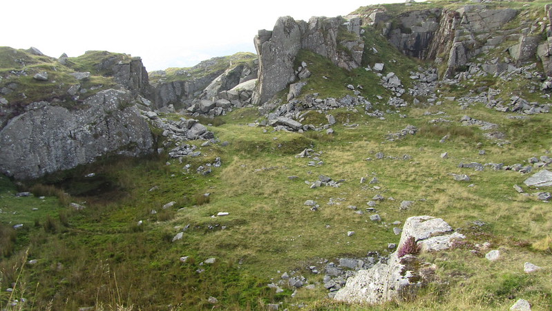 Swell Tor is nowadays much better known for the line of abandoned granite corbels or structural pieces of stone that were cut in 1903 and intended for London Bridge but left at a siding to the north-west of the quarry at SX 5561 7340. Hemery gives dimensions for each of them measuring 9 feet 6 1/2 inches long, 1 foot 3 1/2 inches wide and 3 feet 7 inches high from the base, with three of them noted as having toppled on their sides. Wherever you look at Swell Tor there is a huge granite ruin and no longer any evidence of a tor here: rocks are tossed up in all directions and spilled into huge spoil heaps, with a few remains of the tracks and huts that the quarrymen used to frequent. We learn from Helen Harris (1968) "Production continued throughout the 19th century at a high rate, aided by the introduction of the drill, up until around 1900, when work ceased at Foggintor, moving to Swell Tor, which appeared to have better prospects. Work continued there until the First World War in 1914 and at that time, 90 men were employed, living at Princetown and Rendlestone, as well as in cottages close to the quarries. Production declined in the early 20th century and the workings closed, although they were briefly reopened in 1937 when waste granite was taken for use by the Devon County Council as road metal." 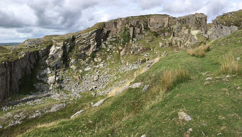 The industrial wasteland of all this activity, is still very much evident today at the start of the 21st Century standing testament to a time when the granite rock of Dartmoor was so very much sought after as a building material for bridges and houses in London and other cities beyond. 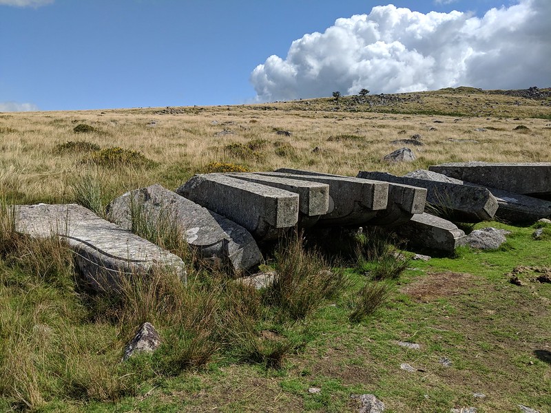
| ||||||||||||||||||||||||||||