TORS OF DARTMOOR
a database of both lesser- & well-known rocks and outcrops
Tavy Cleave North-East Tor (higher)Tavy Cleave Tors
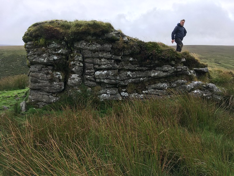 The Tavy Cleave Tors are among the most glaring of omissions from Ordnance Survey Maps, for they are so striking that it is shocking to see how underrepresented they are on the most popular map of Dartmoor National Park. The five most prominent outcrops are often collectively known as the 'Tavy Cleave Tors' and have been documented as such in the literature, but only one pile, Sharp Tor, bears its own identity. This is a bit of a mistake because although that tor is perhaps the grandest of the group, it does the other outcrops a disservice. 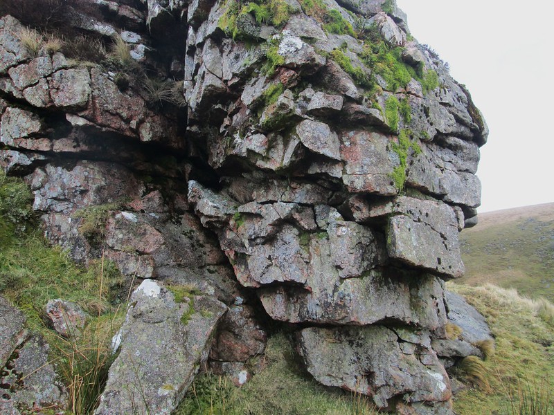 Crossing (1905) in 'Gems' is the first time we get an idea on the number of tors here; "The group of tors to which allusion has been made stands above the north-eastern side of the great amphitheatre and consists of five distinct piles. They are usually known as the Tavy Cleave Tors, only one of them bearing a distinctive title." This, the higher North-East Tor, is a jagged pile with stunning views down the river back towards Sharp Tor. Most of the outcrops here are topped by vegetation. 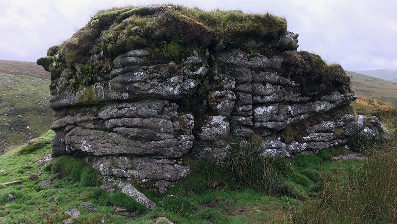 It is the higher of the two outcrops to the north-east of Sharp Tor, and once more the views of Tavy Cleave are awe-inspiring and quite spectacular. In Gems Crossing describes Tavy Cleave as a "defile" that "for wild grandeur is unsurpassed throughout the Moorland region" and indeed what we have here is a special scene of unparalleled beauty. Dr. Peter Sanders and Alan Watson were the first to describe the remaining four rockpiles individually and attempted to name them in 1996, but it was Tim Jenkinson who gave them slightly adjusted names in his Spring 2019 Dartmoor Magazine article that were agreed after an assessment and consultation with the Tors of Dartmoor team. 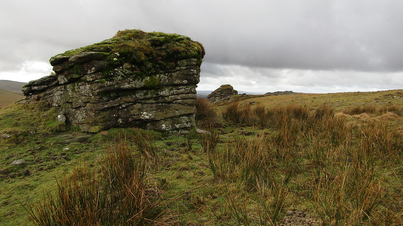
| ||||||||||||||||||||||||||||