TORS OF DARTMOOR
a database of both lesser- & well-known rocks and outcrops
Cob Loaf, The
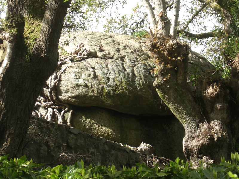 Lustleigh is a haven for small, though largely characteristic, rockpiles that can be found beside roads and in private gardens. The steep slopes above the main village are strewn with intriguing granite shapes but the masses here that are dotted throughout the valleys are seldom remarked upon in the extensive literature of Dartmoor. One of the earliest commentators on the far east of Dartmoor is William Crossing and when talking of Lustleigh he remarks "The wildness inseparable from the scenery of a granite district is charmingly mingled with the efforts of the cultivator." Tim Jenkinson (2015) also writes "In the past Lustleigh has been described as 'all hill, valley and rock' (Polwhele 1806) and as being surrounded by 'much disintegrated granite with curious weathered granite blocks like huge loaves' (Book of Lustleigh 2001). The visitor today, if taking one of the many public footpaths that criss-cross through the woods in the village, will certainly concur with the latter account." 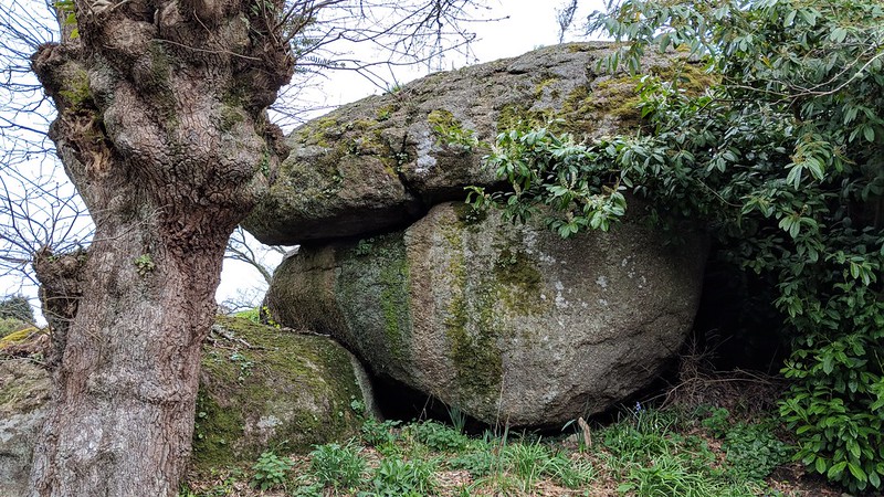 One of these outcrops is the curious Cob Loaf, a fantastic giant crouching and rounded boulder that is set in private land above the village on the hillside in the hamlet of Pethybridge. The squat outcrop is partly hidden in trees but can be seen to the left of the road descending towards the village centre at the entrance of a driveway which gets you close but a tree blocks the entire view from this side. More boulders are part involved in the garden and beside the cottage above here at the start of the descent, a short distance away at SX 78042 81029, a massive boulder is seemingly wedged between a wall and a house. 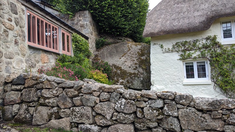 The main outcrop is actually in the garden belonging to Cob Cottage, and when speaking to the owner at the house named 'The Crags' in September 2018, Max Piper found out that the small tor is known locally as the 'Cob Loaf' due to its distinctive shape which, presumably, is how the adjacent cottage earnt this name. It is an appropriate appellation that fits well with the tor's appearance as well as honouring the unique landscape of this beautiful village and the descriptive names used throughout. 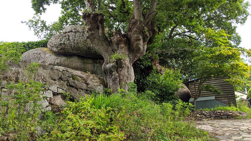
| ||||||||||||||||||||||||||||||