TORS OF DARTMOOR
a database of both lesser- & well-known rocks and outcrops
Thirlstone, TheThe Thurlestone, Thurlestone Tor, The Thurlstone, Thurlesdon, Watern Tor, Watern Borough, Walter Tor, Waterdon Tor, Waterdontor, Waterdontorr, Walterydonne
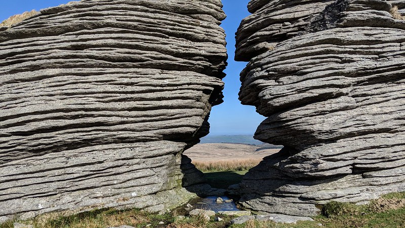 The most well-known feature at Watern Tor is the gap in the lowest outcrop that is known as the 'Thirlstone'. As with the rest of the tor, the Thirlstone possesses some of the best horizontal jointing to be found on the moor and could be associated with the Thurlestone Rock in the South Hams. The arch of the tor possesses a boundary mark inscribed low down spelling 'GP' for Gidleigh Parish. Crossing writes about it; "This pile bore the name of Thurlestone in the thirteenth century, for there can hardly be a doubt that it is the bound named as such by the perambulators of 1240." 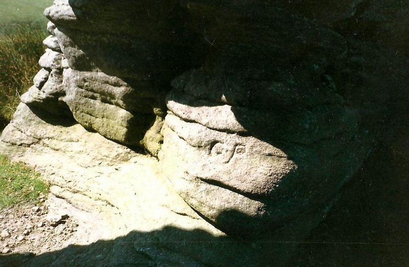 The author continues; "This name is supposed to be derived from the appearance presented by the two northern piles, which, when viewed from certain points, give the idea of being one in which is a large aperture, the thurl, or thirl, stone being thus the perforated stone.'' It is an optical illusion as from some vantage points there is one hole, from others two, and from others none! It is a fabulous arch to walk through where you get a sense of grandeur and the time that it took to create the layers. 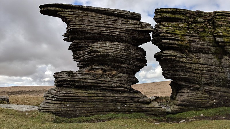 Collingwood (2017) explains the extraordinary appearance of the granite; "When the massive weight of the overlying rock was removed over time by erosion, the release of pressure created an uplift in the granite, allowing horizontal lines to form" that have been enhanced by "fine-grained granite." A stunning vista is commanded from the top of the Thirlstone, easily scaled from the north side with a gentle incline, where all of the streams by Gidleigh Common can be seen meandering through the boggy landscape that resembles a huge pan, with above it the isolated lump of Kestor. Northward the huge, rounded dome of Cosdon is visible with the Belstone range to the left of it beyond Wild and Hound Tors. 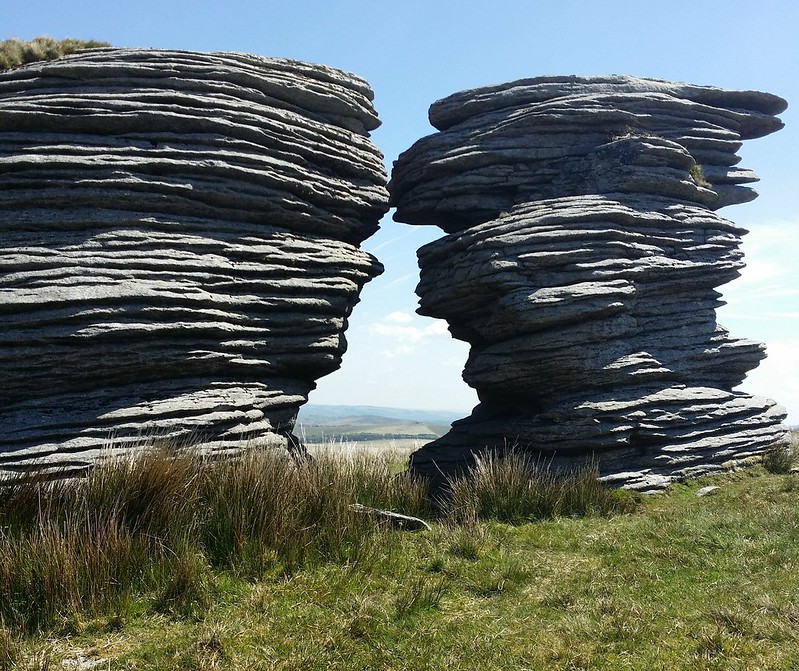
| ||||||||||||||||||||||||||||