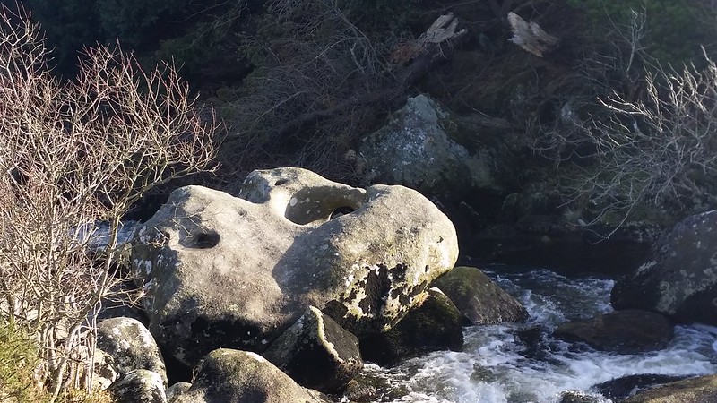
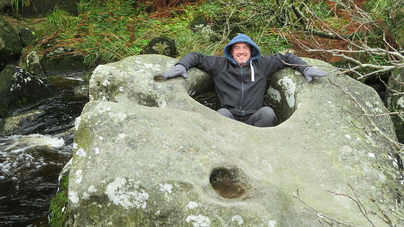
The Tolmen Stone is a large boulder perched on rocks on the river bed, with a huge hole through it, the result of river erosion. It is a significant stone, with fanciful tales like a cure for rheumatism if you crawl through the hole.
Hemery also says: "The confluence is a wild and beautiful place. Below it, the ancient wall of the Batworthy enclosures reaches the right bank, and in the river near the opposite bank is a remarkable, water-worn boulder known as 'the Tolmen (i.e. holed) Stone'. On the boulder are four rock basins; the largest has a diameter of 3 feet and 4 inches and, due to the action of the rapid water below, is bottomless."
Tolmen Stone, The
The map above is not a navigation tool and we recommend that the grid reference shown below is used in conjunction with an Ordnance Survey map and that training in its use with a compass is advised.
Grid Ref:
SX 6549 8707
Height:
360m
Parish:
Gidleigh
Tor Classification:
Boulder
Access:
Public
Rock Type:
Granite
Credit:
Ordnance Survey Eric Hemery
Reference / Further Reading:
Ordnance Survey Maps Eric Hemery: High Dartmoor
Please Support Us
We are proud to see the names of lesser-known tors are now being used more commonly on other websites and whilst this is to be encouraged we do request that, should you wish to use the information on this page, you provide a backlink to the website as reference, by copying the relevant address:
Please also consider a small donation to the upkeep of the site; any contribution goes toward the fees to keep the database online and any costs incurred when undertaking research such as subscriptions to online archives.