TORS OF DARTMOOR
a database of both lesser- & well-known rocks and outcrops
Thornworthy Tor
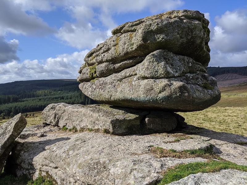 The earlier oracles of Dartmoor seem to have overlooked Thornworthy Tor mentioning it in passing. For example, William Crossing, writing in the early 20th Century, on p.259 only states; "On Thornworthy Down is Thornworthy Tor, less than 1/2 m. W.N.W. of the farm, and to this the rambler will now make his way." Eric Hemery (1983) offers further details; "The east side of the valley is dominated by Thornworthy Tor (1,393 feet), conspicuous background to the view from the Three Boys. The summit consists of a large area of granite bedding; other piles, most of them broken, include one of considerable interest as a very fine, unrecorded logan-stone." 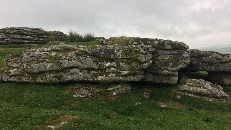 The tor sits atop a prominent hill surrounded on its west, north and east sides by a newtake wall that separates the Down from Longstone Brook and Claypit Mires. The outcrops are pleasing and numerous, especially on the west side where the low-lying rocks display close horizontal jointings. These fissured outcrops are sited on the very brink of the hilltop and below them the hillside steepens. A rock shelter can be seen in the south side of the summit outcrop that is situated perfectly to protect one from a northerly wind. 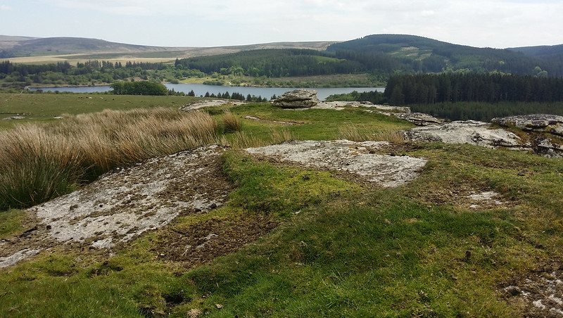 Views from Thornworthy Tor are memorable, and it perhaps provides the best platform from which the visitor can view Fernworthy Reservoir glistening in the sunlight. North-eastward, the trio of tors called Frenchbeer, Middle and Kes are noticed, and to the left of these and distant is the huge dome of Cosdon Hill and further left the distinctive masses of Watern Tor crowning the declining Watern Down. A visit to Thornworthy Tor on a clear day will reward the visitor with a thrilling vista and a modest tor with a lot of interest surrounding it. 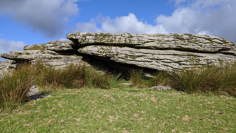
| ||||||||||||||||||||||||||||||