TORS OF DARTMOOR
a database of both lesser- & well-known rocks and outcrops
Tor RocksTorr Rocks, Harford Rocks, The Parrot Rock 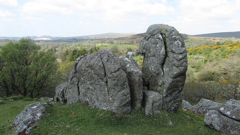 This secluded and part shattered tor lies a mere 350 metres or so to the south-west of the once car park at Harford Moor Gate that was unfortunately closed to visitors by the landowner in 2021. Apart from a few scattered large boulders, unusually the main rocks are not visible from any part of the moor to the north or east, but upon descending Butter Brook the fascinating tor remnant is revealed. Crossing was equally impressed, first describing the Rocks "as a very interesting pile" and later as one that "the rambler should visit". Hemery uses even more superlatives, calling it "an extraordinary pile". 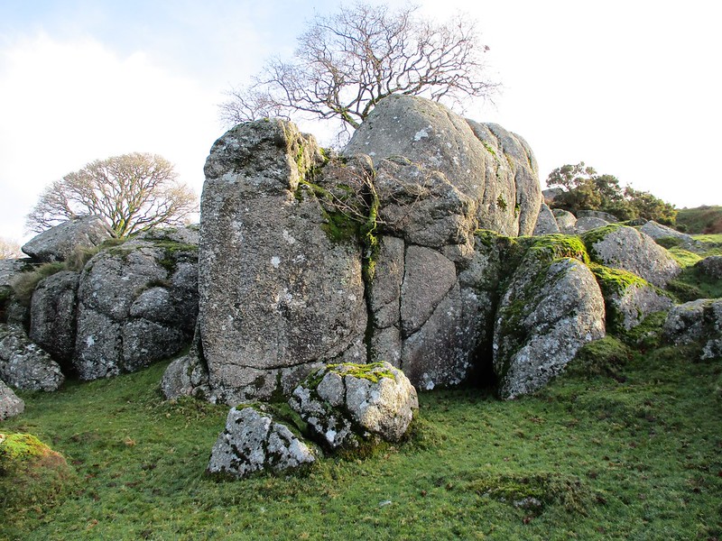 Set above the south bank of the Brook the granite here has been plundered with a huge excavation in the side of the hill. This was reported upon in the Western Morning News of July 1861 with a somewhat scathing account about the Duchy of Cornwall's role in moorland management upon the proposed closure of the nearby Harford Moor Rifle Range: "Beyond once a year coming down on Harford Moor to search for bullocks, the Duchy have never exercised any rights or committed any acts of ownership until about five years since, when, alleging that the moor was theirs, they granted permission to a company to open a granite quarry, by which Torr Rocks, a valuable and interesting monument of antiquity, was destroyed." 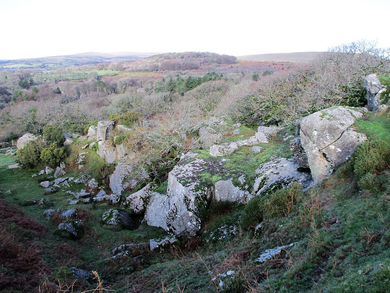 This therefore dates the quarry, which is still marked by that name but now disused on modern OS maps, to about 1856. Whilst the rockpile is not entirely 'destroyed' it has certainly suffered, but still retains some interesting features. For example, near the summit there is a curious rock formation that from certain angles resembles a parrot's head. Some of the outcrops on the north side are considerable and it is a most sheltered and picturesque spot beside the Brook that flows beneath. Higher up the slope though, the true extent of the quarrying is revealed and indeed there has been considerable disturbance to the tor's substance. The main quarry is very large, gouged as it is into the very heart of the Rocks, and the ruin here is a sobering reminder of how the desire to cut granite out of the hillside to be used as a building stone completely overtook parts of the Dartmoor landscape in the mid 19th Century. That said views from the top of the quarry are especially good. 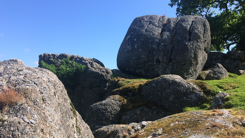 The name of 'Harford Rocks' appears in numerous newspaper accounts of the 1870s whilst recounting the excursions of the Hunting fraternity in this area, and it would be fair to assume that this was once a local name for the pile, although peculiar to these extracts and generally not used elsewhere. One example occurs in 1872 when charting the fox's escape from the village. It reads: "...leaving the church to the left [it] broke over the wall near Harford Rocks up the valley to Hangershell Rock to Gleascombe [Glasscombe]."
| ||||||||||||||||||||||||||||||