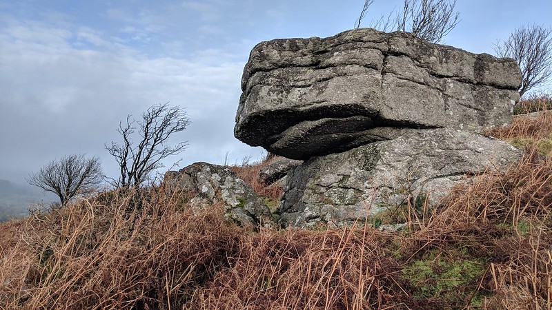
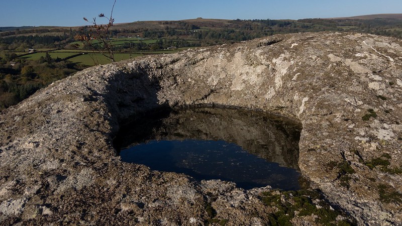
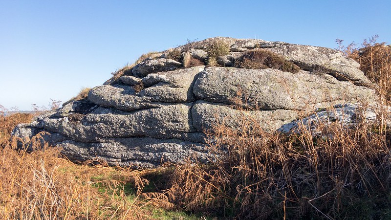
There is a series of large and scattered rocks on the hillside above and just to the east of Tunnaford Cross on the lower south-west slopes of Meldon Hill, one of which possesses a splendid oval rock basin on its upper surface that was first noted in 2000 by Tim Jenkinson.
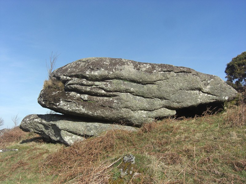
There is also a huge overhanging boulder amid the other rocks here, so they are well worth a visit. The ruined tor is best seen in winter when the vegetation is low and allows for an easier access.
Despite the obvious rocky terrain of the slopes a Chagford nine-hole golf course was operational close by between the years of 1908 and 1930, with holes ranging in length from 88 to 426 yards all set with natural hazards to avoid such as boulders and difficult lies.
Tunnaford Rocks
The map above is not a navigation tool and we recommend that the grid reference shown below is used in conjunction with an Ordnance Survey map and that training in its use with a compass is advised.
Grid Ref:
SX 691 859
Height:
330m
Parish:
Chagford
Tor Classification:
Ruined
Access:
Public
Rock Type:
Granite
Credit:
Tim Jenkinson
Reference / Further Reading:
Tim Jenkinson: Dartmoor Magazine No.58 Spring 2000: 'Nameless Rockpiles of Dartmoor Field Notes and Photographs'
Please Support Us
We are proud to see the names of lesser-known tors are now being used more commonly on other websites and whilst this is to be encouraged we do request that, should you wish to use the information on this page, you provide a backlink to the website as reference, by copying the relevant address:
Please also consider a small donation to the upkeep of the site; any contribution goes toward the fees to keep the database online and any costs incurred when undertaking research such as subscriptions to online archives.