TORS OF DARTMOOR
a database of both lesser- & well-known rocks and outcrops
Valley of RocksIsland of Rocks, Isle of Dogs, Highland Rocks, Vellake Rock
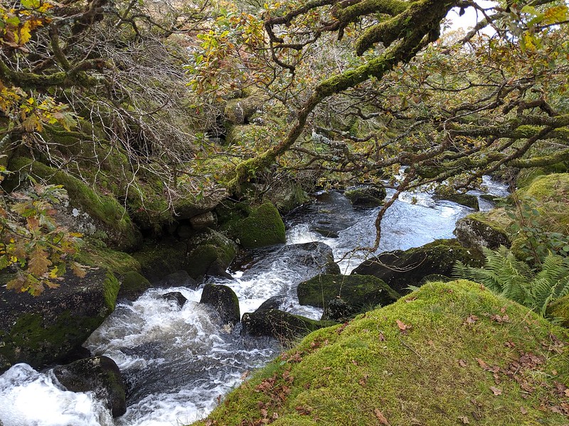 Having passed through the walled intake of the South-West Water Authority, the waters of the West Okement now enter a beautiful and quite charming cataract that is steep and difficult to access. Above the right bank there runs a service track for the intake, from which you can venture down into the trees to catch teasing glimpses of the enormous boulders and cascades that reside below. From the left bank, which Hemery says; "...is precipitously jammed by the great clitter of Shelstone Tor" you are afforded the better views of the valley, looking across to Homerton Hill Rocks (which arguably could be considered a part of Valley of Rocks) and Black Tor beyond. 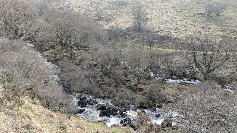 Crossing, in his Gems in a Granite Setting, described the valley as he ascended from Vellake; "At every step the scene becomes more impressive, and the beautiful and the romantic unite in a manner that cannot fail to cause the most supreme delight. It is a mingling of oak tree and fern; of mountain-ash and bushes of the wild raspberry; of sturdy thorns and withies that bend to the breeze; of briar, and ivy, and heather, and whortleberry, half-shrouding grey masses of granite; of rushing river and gleaming foam, and deep pools; of rugged tor and hills that shut out the world." 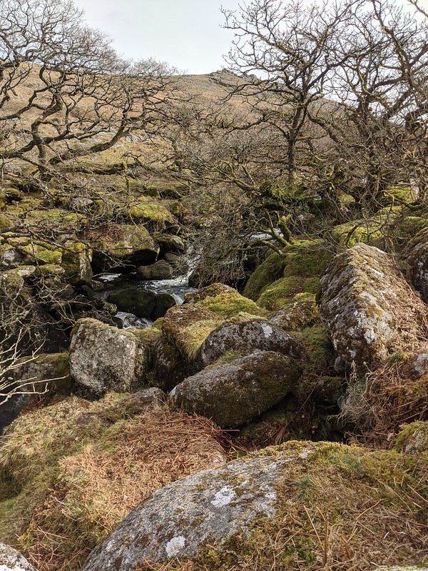 At grid reference SX 5582 9023, just as the river exits the gorge, its course is split by a narrow islet of moss-clad granite boulders that is some 90 metres in length and known as 'the Island of Rocks'. Crossing's account differs little to what you find here today; "The island is entirely covered with trees and undergrowth, as also is the eastern bank of the stream." Interestingly, Crossing also gives us alternative names for both the island and the valley; the 'Isle of Dogs' and 'Highland Rocks' respectively. 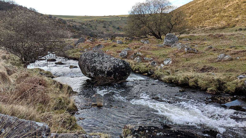 Dave Brewer (DB 2002) notes a curious boulder (one that he calls 'Vellake Rock') a short way above Vellake Corner in his book on Dartmoor Boundary Markers and explains that it is one of two natural, uninscribed rocks in the West Okement River that denote the edge of the parish bounds of Okehampton Hamlets, the other being further upstream on the west edge of Black-a-Tor Copse. DB supplies the NGR of SX 5550 9050, but this is incorrect that places Vellake Rock much closer to Meldon Reservoir and below the aforementioned Corner. Steve Grigg (2021) remedies this mistake by providing a more accurate SX 55714 90303. The boulder is poised in such a manner as to loosely resemble that of a logan stone and is the first point of contact that the visitor, who approaches from below, has with this enchanting stretch of boulder-clad river.
| ||||||||||||||||||||||||||||