TORS OF DARTMOOR
a database of both lesser- & well-known rocks and outcrops
Virtuous Lady Crags
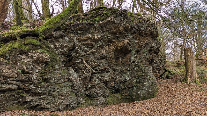 There are at least four large non-granite crags lining the hillside to the south of Double Waters, the place where the Walkham and Tavy Rivers meet and then to continue their journey together towards the sea at Plymouth Sound. Dealing with the crags from east to west, the first, at SX 47577 69868, presents as a huge bulk rising about 8 metres in height. Almost devoid of vegetation, the rugged wall of rock is easily found as it sits adjacent to the track running between Buck Tor and Tavy Cottage. Opposite here, a path leads across the Walkham to the beautifully perched Goat Rock and in 2023 a wooden footbridge was replaced with a sturdier version. This is a serene location where the lapping waters of West Dartmoor's two mightiest rivers converge in a oak woodland of sylvan beauty, where time never seems to pass. A visit to the meeting of the waters is thoroughly recommended. 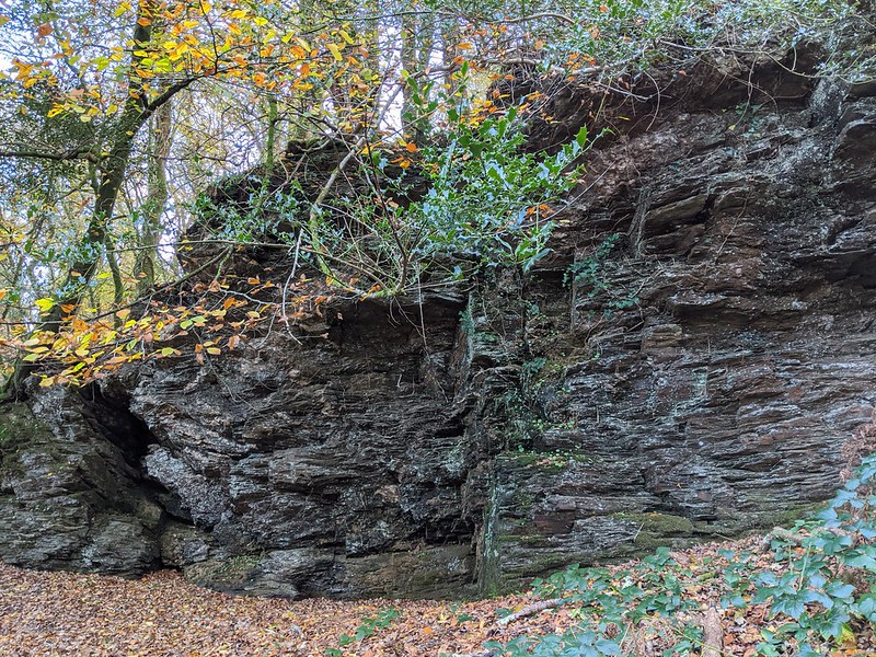 The next crag along is covered in vegetation but is still impressive, presenting as a long ridge of rock stretching part of the way up the hillside at SX 47504 69878. One of the features noticed here is an almost cuboid rock atop of the east side (shown below) which is clearly visible from the track. Next at SX 47327 69804 is a huge bulk, sitting high above the river immediately to the east of Tavy Cottage, which can be viewed from the point where the track makes a great curve. The top of the rock is embellished by a vibrant carpet of moss and, in autumn, spectacular golden leaves. 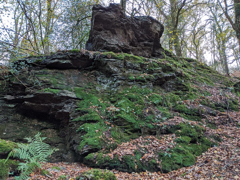 Down below the track lies the westernmost crag at SX 47264 69721. This is a magnificent tower of rock, onto which a wall has been built, close to the aforementioned Cottage. It presents as a huge pinnacle reaching skyward with crumbled layers that is quite unlike the other crags in the area. 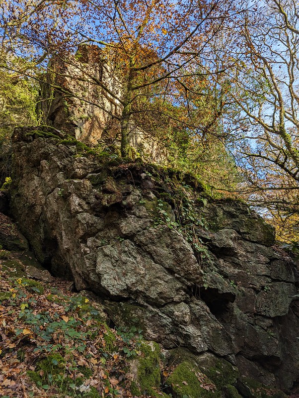 Collectively the rockpiles here are named after the nearby Virtuous Lady Mine that operated from 1558 to 1807, and again from 1830 to the 1870s when it reached its demise (information gleaned from Helen Harris's 'The Industrial Archaeology of Dartmoor' book). This area of Dartmoor, the far south-western tip, is a well-known mining area where copious amounts of copper and tin were once discovered and exploited but it is predominantly the former ore that was so readily extracted here. Together with the Lady Bertha Mine which is just a short way downstream but nowadays set on private land, the Virtuous Lady was the primary copper producing mine in the vicinity. The name of 'Virtuous Lady Crags' has been suggested by Peter Freeman, whereas the alternative of Double Waters Crags is also a possibility, particularly for those rocks that are closest to the confluence.
| ||||||||||||||||||||||||||||||