TORS OF DARTMOOR
a database of both lesser- & well-known rocks and outcrops
Watern OkeWatern Oak 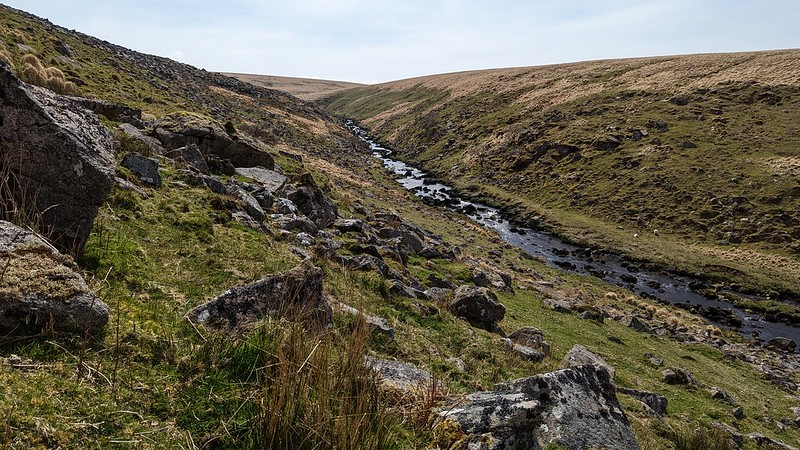 The River Tavy has an exciting course on Dartmoor, passing beneath magnificent tors and through narrow gorges. Between Sandy Ford, where it meets the Amicombe Brook - and Rattlebrook Foot, at the entrance to Tavy Cleave - the river arcs to the north-west under dense clitter. This clitter field, one of Dartmoor's most spectacular, sits on the southernmost slope of Amicombe Hill and the name of 'Watern Oke' predominates on all Ordnance Survey (OS) Maps. 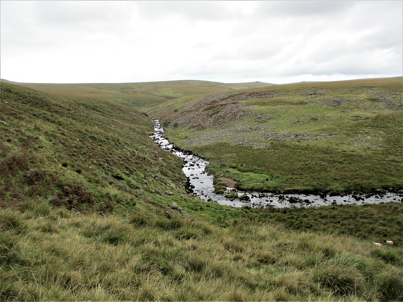 One of the earliest references to the Oke is on Mudge's Map of 1809, although it is incorrectly shown to the south of the Amicombe/Tavy confluence at Sandy Ford, and not to the north. As a result, it is a bit confusing trying to determine what the Oke actually is and where precisely it is sited. Page (1892) seems to place it somewhere near the Tavy Cleave Tors: "Westward we have that beautiful ravine called Tavy Cleave, through which the river beneath leaves its mountain home, overhung on the one hand by a succession of rocky pinnacles, of which Great Tor - locally Gert Tor - is the boldest, and on the other by the steep bluff of Stannon Hill. Midway is the solitary wind-twisted tree called Watern Oak, which has been so often hailed with delight by the moor-man lost in a fog. Away to the north from this defile runs a long line of rocky crests commencing in the graceful cone of Hare Tor, and terminating in the beetling crags of Great Links." In the same year, the name of the Oak was included on Chudleigh's fold out map in the back of his book 'An Exploration of Dartmoor's Antiquities', but this time it was sited in the current location as marked by the OS. Crossing (1994) attributes the name of 'Watern Oke' to the hill here instead, and not a lone tree. The author suggests that 'Oke' or 'Ock' "is traceable to a Celtic root, 'osc', signifying 'water', and is found in several objects..." The presence of a particular outstanding tree to bear this name in the present day and in the accepted location is unlikely, as there are a few stunted oaks finding refuge in the clitter. Indeed, Shrubsole (2022) tells us that "Alas, no such tree exists today." 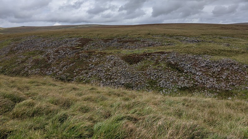 Nowadays, the name is commonly used for the clitter on the hillside and the proliferation of hut circles nestled within; it being an obvious choice for a settlement with plentiful building stones and a superb position above the river. We learn from Hayward (1991) that there are over 70 huts in this Bronze Age village, making it the largest found anywhere on the moor with the most notable hut found close to the top of the clitter line. The clitter here in parts does resemble a totally disintegrated tor, spread far and wide, with another separate section to the east at SX 5682 8353. Below this at SX 56980 83424, is a tinners' hut with a distinctive table-like slab in its centre.  This locality is of sylvan beauty that cannot be compared: it forms the gateway into the northern wilderness, where the onlooker can feel fully immersed in the surroundings looking east towards the majestic Fur Tor, or westward to Tavy Cleave where the river enters a valley of rocks; with granite hanging above the banks, and then making its rapid descent. A compelling account summing up the scenery and repeating the reference to the tree was written in the Exeter and Plymouth Gazette in 1867: "Amicombe is surrounded by a fine group of tors, which disclosed themselves one by one, a grand sign as the envious mists again rolled off; to the north, Links Tor and Dunnagoat (Dun-a-coet' Saxon for "underwood"); to the west, Sharpton Clatter, and Hare Tor; southwards, on our left, the infant Tavy winding through Tavy Wane [sic] , and bound for ancient Tavistock; beyond it, Watern Oak, a solitary tree, backed by the abrupt crags and lofty peak of Fur Tor..."
| ||||||||||||||||||||||||||||||