TORS OF DARTMOOR
a database of both lesser- & well-known rocks and outcrops
Whiddon Wood Tor
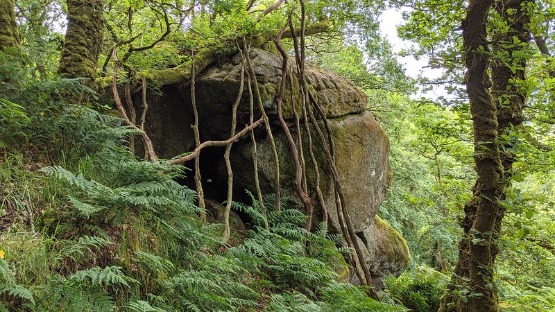 In 2011, whilst undertaking his soil survey of East Dartmoor, Dr. Tim Harrod drew Tim Jenkinson's attention to what he described as a 'magnificent tor' shrouded in a dense canopy of trees near to the top of the conical Whiddon Wood high above and to the south of the River Teign. Much of the tor resides behind the high, seemingly impenetrable wall that surrounds Whiddon Deer Park, but it can be accessed by using the gate at SX 7254 8961 and handrailing the wall to your right on a narrow path to the summit. 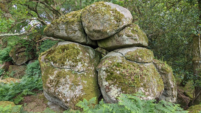 On approach you meet a lower pile at SX 7271 8941, the first of several huge boulders and four principle outcrops that culminate in summit rocks within Whiddon Wood. A natural route can be taken around the lower section to the right, passing a fine moss-clad face, to the middle pile at SX 7274 8939 consisting of a large outcrop with a rock basin on its side and an aesthetically pleasing stack of half a dozen boulders. The higher pile, at SX 7275 8935, includes another stack, this a striking tower beside another substantial outcrop. Further to the east at SX 7282 8939, is the fourth, an emergent pile that juts out above the valley with a narrow cave and a line of straight dead branches resting on the west side suggesting it has been used for shelter. 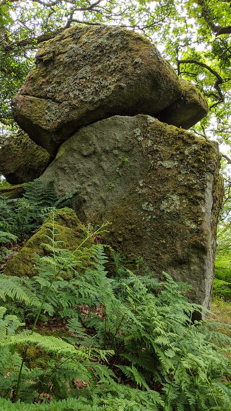 There is also a fifth pile at SX 7268 8945 on the north-west slopes in Whiddon Deer Park, the other side of the great wall. Here the elongated outcrop has a good appearance and actually looks like part of a tor extending downhill to a square fronted block a few paces above the wall. Summing up, this excellent tor consists of several huge moss-covered boulders and outcrops that culminate in summit rocks. Large caves occur throughout and, were it not for the trees, it would rival its neighbours Hunter's Tor and Sharp Tor across the Teign Gorge. 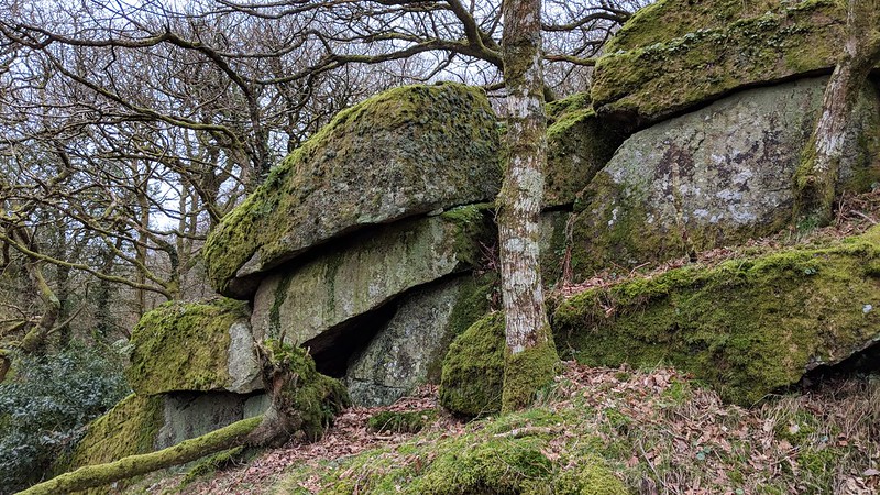
| ||||||||||||||||||||||||||||||