TORS OF DARTMOOR
a database of both lesser- & well-known rocks and outcrops
White TorPeter Tor, Peter Stone Rocks, Whit Tor, Whittor, Whiter-tor, Peterstone Rock 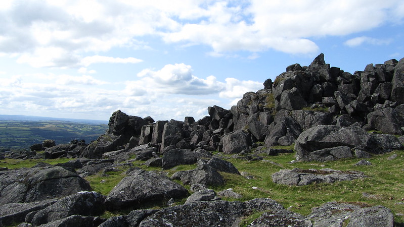 At a little less than 3 kilometres to the east of Peter Tavy lies White Tor, a magnificent ruin of rock, its debris emanating from the crest of the hill. Whilst it is an untidy tor it is important to remember that the rocks here were utilised by ancient Bronze Age settlers that have influenced a great deal of what we see today. Dwellers from that era constructed a number of cairns to honour the dead and built a massive Neolithic settlement, the latter of which is nowadays known as a 'tor enclosure'. Phil Newman (2013) explains that "Closely spaced parallel rubble walls define the edge of the plateau, forming a circuit, and take advantage of several prominent rock outcrops, which have been incorporated." Eric Hemery (EH, 1983) records it incorrectly as "an Iron Age fort" which given that it was excavated in 1898 and 1899, when the evidence of it dating back to the Neolithic period was first confirmed, is a strange mistake from the author. This earlier research makes it one of the oldest settlements on Dartmoor. 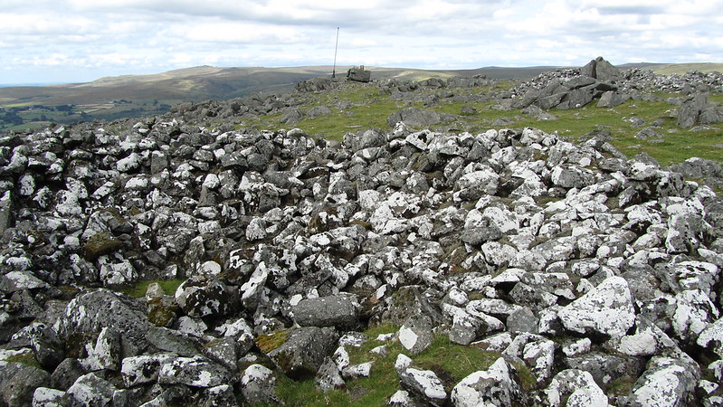 The extent of the ruined rock field here is quite bewildering and it can be tricky to explore the tor due to a considerable heaped clitter beneath the summit which can twist ankles - so please take extra care. Mrs. Bray recounts her visit to White Tor in the 19th Century, but calls the tor by a different name: "Soon after we took leave of our good old guide, and went to Peterstone rock, the highest stone of which, about forty years ago, he said had been split in pieces by lightning." And in the same work: "Peter Tor was evidently a fortified stronghold, as it is surrounded by a mound of stones, and, in the midst, three or four rocks are encompassed with the same." Bray incorrectly asserts that the rock type here is black granite, but it is actually dolerite, residing within what is known as the metamorphic or Dartmoor aureole. Collingwood (2017) explains that dolerite is "a volcanic intrusion from c 350 million years ago, when the area was a huge warm sea." As such the rocks are dark, angular and rough resulting in crag-like formations that arise from the summit plateau, with the most spectacular perhaps being on the east side, a tall upstanding pile at SX 5428 7866. Other outcrops here are equally as imposing at close-quarters, especially on the north-west side, but none present with as much character or with as much distinction. Another rockpile which lies well over 300 metres away from the main pile of White Tor to the west, has been previously called Little White or Whit Tor, a name first introduced by EH. 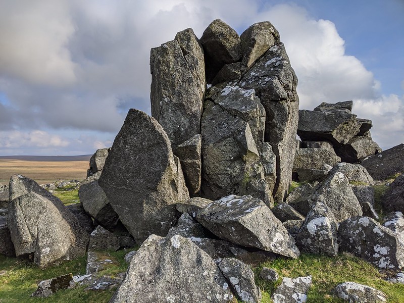 The military have also made their mark on the tor, with both a flagpole on the summit and two range huts on the east side, above which is another flagpole. White Tor does not reside within a live firing range, but it is close to Merrivale Range and visitors should heed caution and check the live firing times if they wish to proceed eastward towards Langstone Moor. 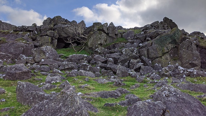 White Tor affords a truly thrilling vista that encompasses the entirety of western Dartmoor - including the mesmerising heights of Great Links Tor and Great Mis Tor - as well as the narrow cleft of Tavy Cleave and the unbroken field systems of West Devon beyond. The views cannot fail to leave the visitor spellbound and on a clear day the ascent is well worth the effort. A good car park from which to approach the tor is the old quarry at Smeardon Down, near Peter Tavy, and then by following the track up to Stephen's Grave before the final push up to the tor carefully picking your way through the myriad of scree.
| ||||||||||||||||||||||||||||||