TORS OF DARTMOOR
a database of both lesser- & well-known rocks and outcrops
Willowray Cleave Tor
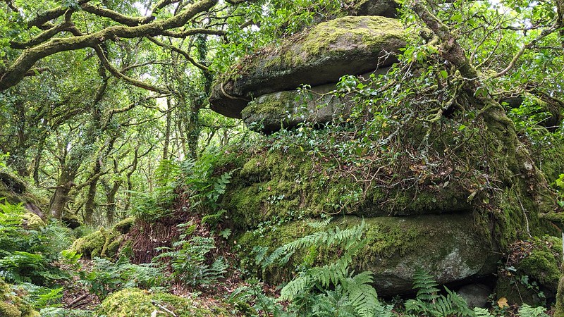 A splendid tor can be found within Willowray Cleave, the name given to the plot that the majority of this rockpile resides in; plot 1817. Covering a large area, the tor extends from a low, flat pile at SX 78369 83226 at the very top of the woodland which features several shallow rock basins on its surface, on the edge of an enclosed moorland that is bracken-infested in summer months. The rocks stretch south-westward, culminating in a beautifully rugged outcrop at the boundary of three walls at SX 78314 83198, pictured above. 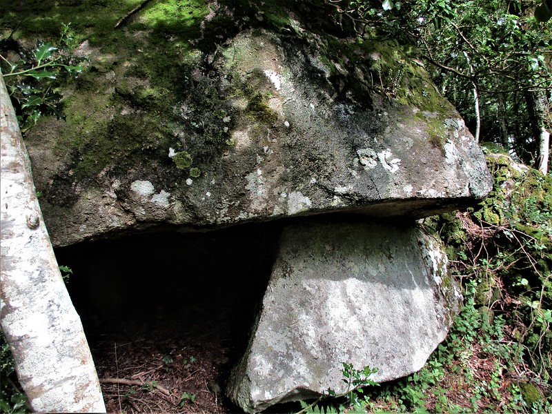 Hugging the boundary wall, the tor continues downhill becoming a little less distinct amid large, tumbled boulders all enshrouded in luxuriant moss. The broken rocks eventually come to a halt at SX 78262 83142 just above a quarry that is called East Wray (sometimes 'Wrey') Quarry, presenting as a small rock face with an overhang beneath a mass of granite, shown above. It is certain that the lower part of Willowray Cleave Tor was plundered for granite, the quarry being described in a book entitled 'In the footsteps of the Victorians' (2018, p.133) in a piece by Nick Walter; "The opening of the quarry may have coincided with the railway construction (1864-1866), implying it originated to supply granite for the railway engineering works, such as bridges, culverts and viaducts." It seems that the quarry closed sometime in the early 1950s leaving a deep scar on the wooded hillside, with an oddly placed spoil heap at SX 78205 83089. There is a very steep drop down to the quarry below the tor which is a bit unexpected so extra care must be taken. 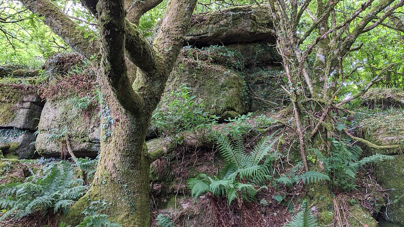 The tor also boasts two outliers to the north, at SX 78278 83257 and SX 78325 83295 respectively. The outcrop at the former location is rather shabby straddling a barbed-wire fence while the latter at the top of the woodland, and pictured above, has much more to offer. This somewhat isolated rockpile presents as a tangled mass, but climb on its top to discover a wonderful rock basin measuring 58 cms in length, 38 cms in width and 12 cms in depth. It is a fine example albeit a rather muddy one and was noted by Paul Buck. Willowray Cleave Tor does reside on private land, although its southern extremities do come close to the northern boundary of East Wray Cleave which is public access. 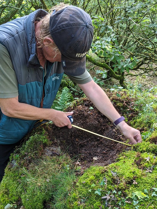
| ||||||||||||||||||||||||||||||