TORS OF DARTMOOR
a database of both lesser- & well-known rocks and outcrops
Wind TorWind Torr, Dunstone Down 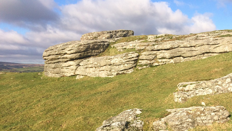 This tor receives relatively little attention in the Dartmoor literature despite it being easily reached by walking south from the road at the top of Southcombe Hill at Two Crosses. William Crossing (1902) describes it simply as a "small tor on Dunstone Down south west of Widecombe village" but Eric Hemery (1983) gives it much better press: "Open to the four winds the tor certainly is with noticeably wind smoothed rocks and the ever presence of the element could well be the reason for its name". He continues to describe the substance of the rocks "The summit is of very coarse-grained tor granite with huge feldspars" and comments on "the old time moormen were not beyond cutting into a tor summit for their building stone". 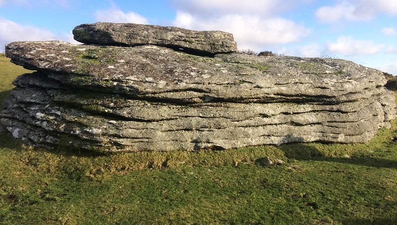 One of its best features are the grand views from atop of the low-lying outcrops. Whilst of no great height there is nonetheless from the highest point a superb vista, in most directions. Hemery sums up the location perfectly "Wind Tor peninsulated by roads, is comparatively unremote yet there comes a feeling of its belonging not to the vales and border country so near but to the aloof giant, Hameldon, which can fling down upon the little tor with that dramatic suddenness peculiar to Dartmoor, a mantle of mist or thrashing rain and so transform it into a shadowy lost place". 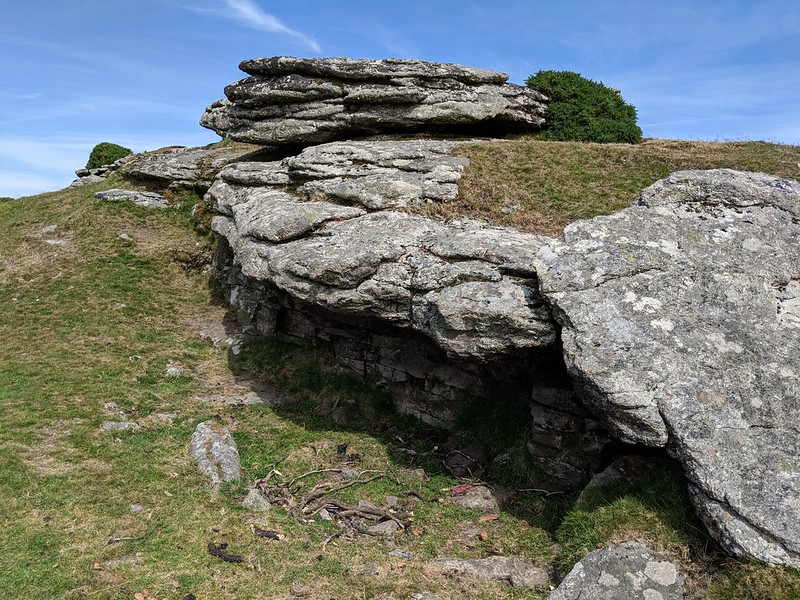 The tor sits amid an extensive system of reaves and there is even a hut circle very close by to the east at SX 70883 75795. Its outer edge is largely grass-covered with a few rocks indicative of its former size. To the north of Wind Tor, a broken millstone can be located at SX 70835 76012. This fine relic likely broke during transportation hence its abandonment here on the path. Easily accessed from a small car park to the north watch out for the Two Crosses inscription that is set by the roadside at SX 70769 76342 as you walk towards the tor over the gentle rising ridge of Dunstone Down. The stone here dates from 2008 and is attributed to members of the Widecombe Local History Group. 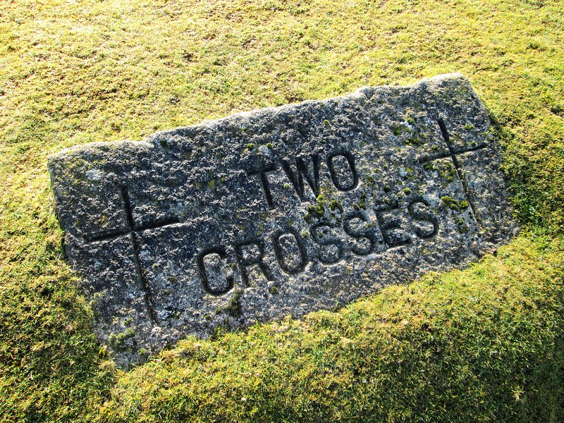
| ||||||||||||||||||||||||||||||