TORS OF DARTMOOR
a database of both lesser- & well-known rocks and outcrops
Winney's Down Logan Stone
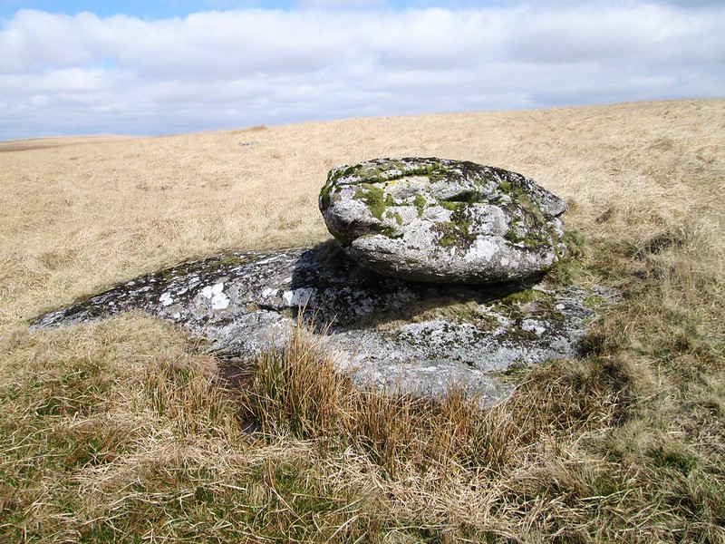 In his accounts Hemery (1983) makes reference to a logan stone in the vicinity of the East Dart Waterfall and supplies a photo in 'High Dartmoor'. The author is the first it seems to mention the feature where standing on the south slope of Stats House Hill he writes: "A short distance south-westward from the crest, and on firm ground declining to the river near Waterfalls, is a logan-stone which I first noticed in 1952; resembling a giant fish with its head towards the valley, it has an appreciable logging movement." 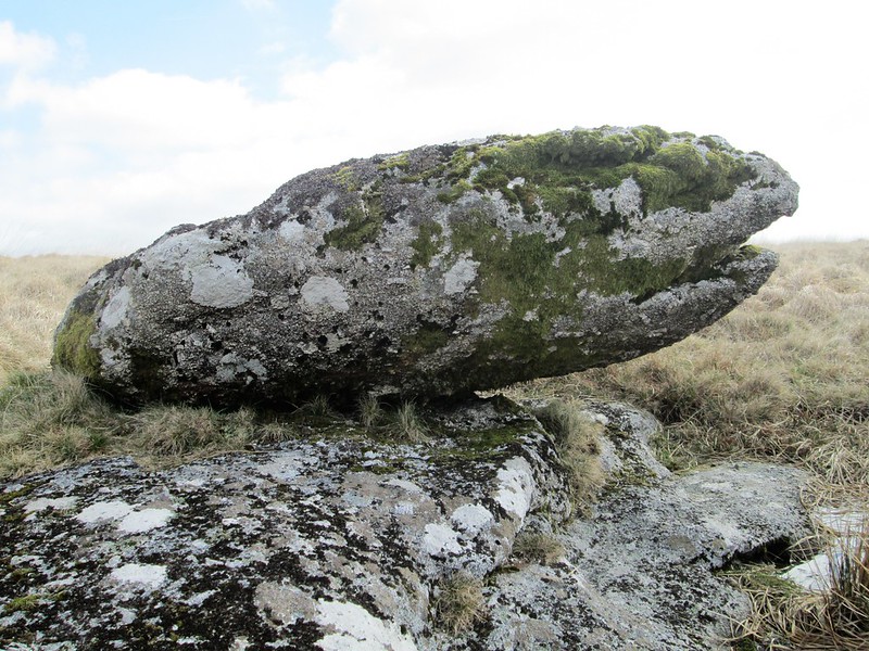 Tim Jenkinson (2017) provides further information in his article entitled 'The East Dart north of Postbridge Part 2', and explains a naming error related to the locality that remains still to this day: "In his account of the area Hemery takes the opportunity to remind us of another Ordnance Survey (OS) error, this time the apparent misnaming of the hill to the north as Winney's Down. He corrects the error by explaining that the east side is known as 'Maish or Marsh Hill', and the summit and west slope always as 'Stats House Hill'. Given that this debate first surfaced as long ago as 1965, it is perhaps surprising to see this error still replicated on modern OS maps." 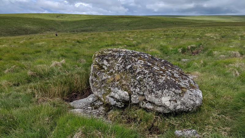 Tim also likens the logan stone as taking on "a rather reptilian form" which is best admired from the east. The rock forms a most splendid natural bench from which to enjoy the rolling vista of Broadun (Broad Down) and the East Dart River passing beneath in its sheltered valley close to Sandy Hole. The sense of remoteness that is felt here is an especially attractive aspect of this part of Dartmoor, giving the visitor an immense feeling of isolation that is archetypal of the hinterlands with only a zephyr blowing across the tussocks breaking the silence. 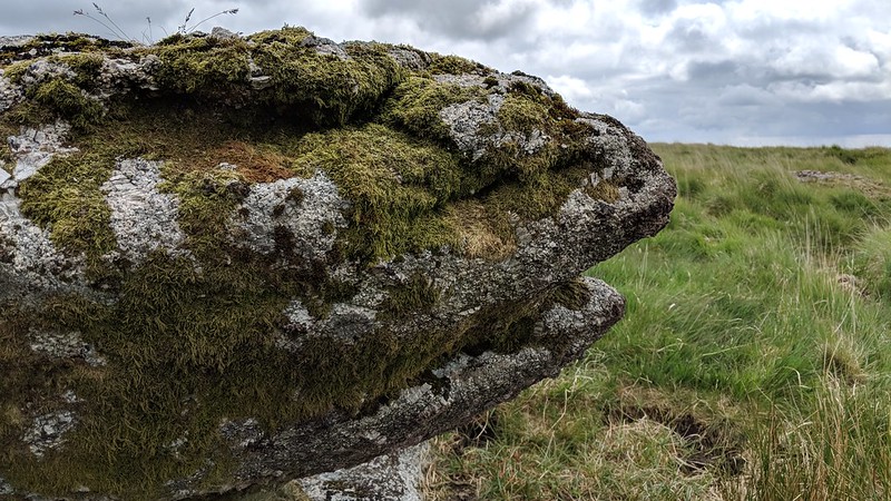 Since the logan stone is situated in a remote part of the North Moor, there are many ways to approach it, but the best option might be that from the south-west from Postbridge, either by passing over Broadun and crossing the aforementioned waterfall, or by following the east bank of the river up from Hartland Tor and crossing Lade Hill and Winney's Down Brooks. It should be noted that both of these routes require you to cross water, and after a prolonged period of heavy rain these can be very difficult to cross. The walker should remain vigilant at all times when in the vicinity of these watercourses, especially the East Dart River.
| ||||||||||||||||||||||||||||||