TORS OF DARTMOOR
a database of both lesser- & well-known rocks and outcrops
WittaburrowWhittaburrow, Whitaburrow, White Barrow, Westburrow 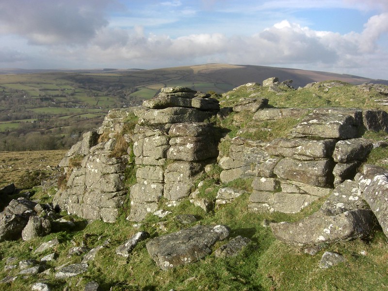 The Ordnance Survey (OS) have always shown the detached hilltop to the south of Pil Tor by the name of 'Wittaburrow', its summit crowned by a massive cairn that is prominent from neighbouring viewpoints and was therefore piled up for a person or persons of great importance. On the north shoulder of the hill, a short distance from the cairn, lie two broken rockpiles that stand above an immense clitter of angular blocks that are interspersed with reaves (prehistoric field divides) above the track from Blackslade Ford to Tunhill. That said, it is a rather scruffy landscape. 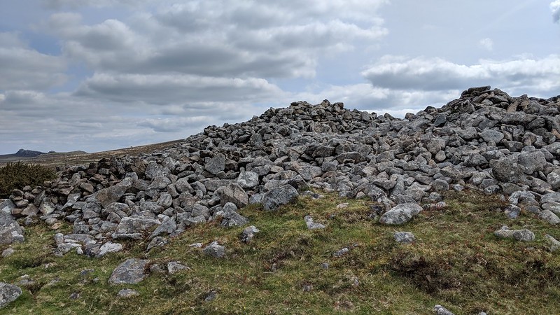 Crossing (1912) is one of the first writers to comment on Wittaburrow, but he only writes of "a cairn which we see on the hill a short distance off." This scant account overlooks the presence of what is a ruined tor here. Historic OS Maps show two outcrops, with the name of 'Wittaburrow' seemingly linked to the rocks. The spelling of the site is often interchanged with that of 'Whittaburrow' or 'Whitaburrow', both almost certainly deriving from 'White Barrow' of which there are multiple examples on the moor elsewhere. 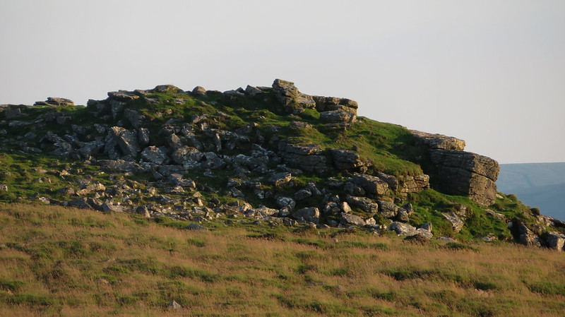 The first real description we see of the ruined tor comes from Hemery (1983) where he writes: "A reave runs from the cairn to the tor remnant, clitter from which lies on the north-west slope of the hill as a series of rock streams - and it is noticeable that the Blackslade kistvaen is aligned with Whitaburrow and Pil Tor." The tor remnant is quite striking, and on closer inspection you will notice that grass seams embellish the twin piles and that the concentration of ruined granite here was most probably utilised by prehistoric dwellers to construct nearby reaves and boundaries. 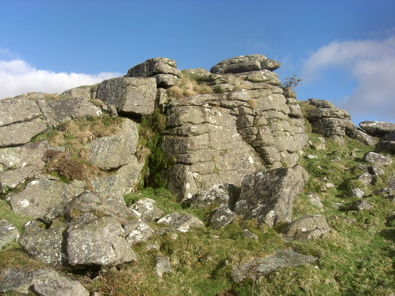 Views from the cairn and small tor are tremendous; they include some of Dartmoor's finest and best-known tors. To the east are the celebrated Haytor and Saddle Tor and nearby the prominent peak of Rippon Tor with, on its right-hand slope, Nutcracker a small but distinctive pile that is described elsewhere; southward rises the lower peak of Buckland Beacon which drops dramatically to the valley of the Dart that separates the bold range of the southern eminences; westward is Dartmoor's central basin, an area of comparative low altitude that is enclosed by a succession of hills and tors that soar high into the sky dwarfing the valleys below them, most notably North Hessary and Higher White; and northward the imposing whaleback of Hameldown which opposes Bonehill Down, and together they completely overshadow the village of Widecombe in the Moor, although its church being plainly visible in the valley below from this superb vantage point.
| ||||||||||||||||||||||||||||||