TORS OF DARTMOOR
a database of both lesser- & well-known rocks and outcrops
Yes Tor (Okehampton)Yestor, Highest Tor, Eastor, Eagles Hill, Grenestor, Ernestorre
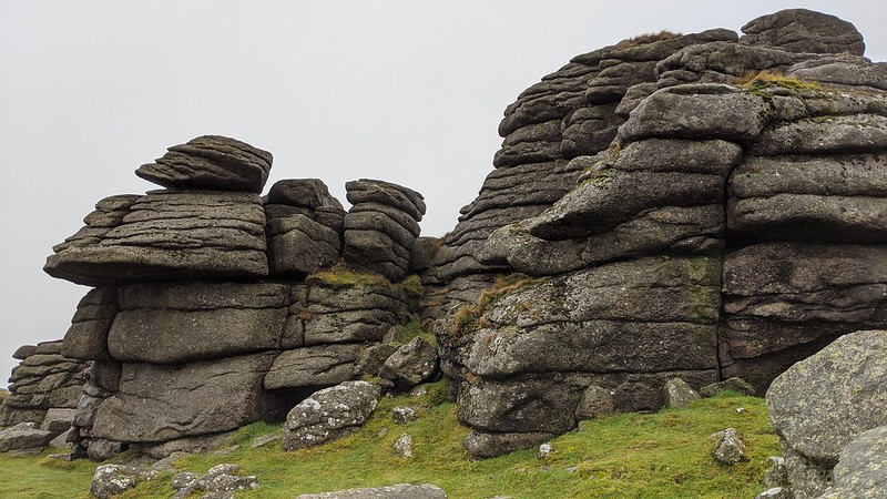 This is a superb example of a large granite tor that, despite being knocked out of prominence by its (2m) higher neighbour High Willhays to the south, is much more impressive, and capped with an OS trig point and bronze-age cairn to the west. The tor is essentially split into two major piles, the easternmost presenting as the highest with a flagpole and military range hut. This outcrop reveals a steep, vertical east face that overlooks a magnificent landscape, that of the deep interior of the North Moor and the ridges above the East Okement and Taw valleys. A tethering ring can also be found just below the trig, a rather strange place to position one given the sheer drop beside it that would be an unsuitable spot to tether an animal; perhaps its existence is for military purposes. 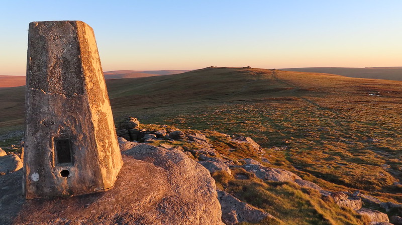 William Crossing in Guide to Dartmoor tells us of Yes Tor; "The fine pile of rocks of which Yes Tor consists may be easily ascended; indeed, on the W. side a path has been made by which it is possible to ride almost to the top of the tor." He continues; "It might be considered rather strange that such a prominent object as Yes Tor, although on the line of the original boundary of the forest, is not mentioned in the Perambulation of 1240, or in subsequent surveys." Although Crossing was indeed right about the tor not featuring in the Perambulation, this may be because it is not the highest point in the area and when viewed from most southerly viewpoints it is hidden behind the mound of High Willhays that might have led to this omission. The tor boasts one of the loftiest positions in Devon, its clitter spreading some way down the north, east and western slopes of the hill from the avenue at the top. A possible error by Mudge, he seems to call it 'Tes Tor' which may have been a simple misprint. 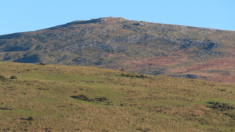 Standing atop Yes Tor gives the visitor a sense of grandeur, much more than that experienced at High Willhays, for whilst the southerly view is somewhat obscured it is the giant slabs of rock on this crown that elevate its position as one of Devon's finest viewpoints. The origin of the tor's name is an interesting one. There are two main theories, one suggesting that 'Yes' is a corruption of 'East' meaning 'East Tor', but what Yes Tor is east of is unclear. Another more plausible theory is that it is derived from 'Highest' as in 'Highest Tor' which from many angles Yes Tor appears and, to some, is the true highest tor on Dartmoor that boasts the much better northerly view, a striking one in fact embracing much of West and Mid Devon and over to North Cornwall, Bideford Bay and the dark ridges of Exmoor and beyond to the Bristol Channel. 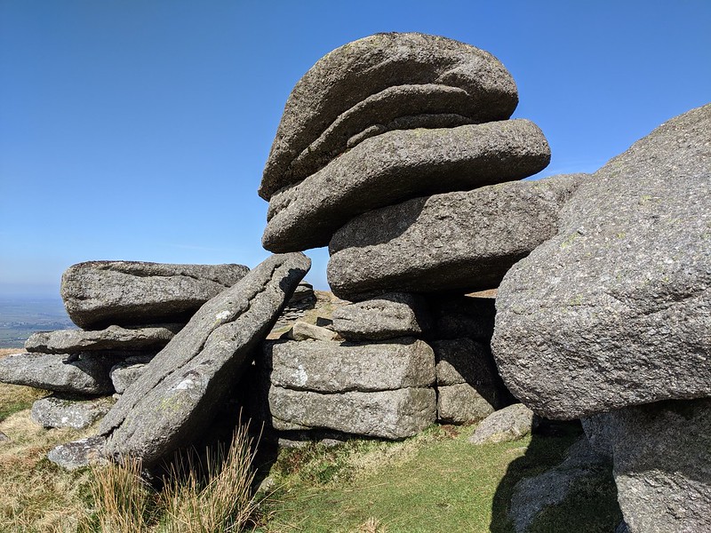
| ||||||||||||||||||||||||||||