
If you look at a map of the area between Canonteign Falls and Hennock, on the eastern edges of Dartmoor, you will see a few places with the name “Hyner”; There’s Hyner Bottom, Hyner Farm, Hyner Hill Plantation, Hyner Bridge and Little Hyner, but curiously, there doesn’t appear to be reference to a Hyner Rocks or Hyner Tor.
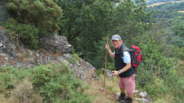
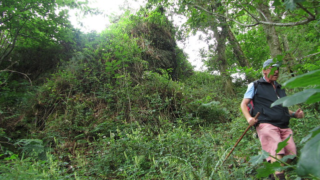
This is surprising, as the photographs I have seen of the outcrop show that it is a pretty substantial one. Most have been from a distance, the narrow contours on the map testament to the steep terrain within the woodland above Beadon Brook, making it difficult to explore properly. With the summer in full swing and foliage being prolific this probably wasn’t the best time to seek out Hyner Rocks, but myself and Tim Jenkinson decided to try anyway.
Look closely at the Ordnance Survey 1:25000 map and you can see a mass of rocks drawn on the slopes above Hyner Bottom. When viewing a 1905 Ordnance Survey 25 inch map, the detail is better and clearly shows not one, but four large sections of rock in close proximity. For that reason, the name Hyner Rocks is a better description than Tor.
Plenty to find, but those closely packed contour lines on the up to date map were a real concern and it would be unlikely that the tracks on the older version would still be there 112 years later!
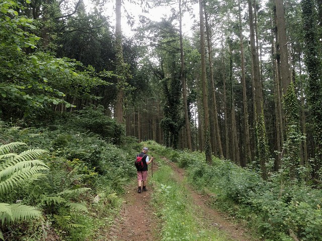
We began at Trenchford Reservoir, walking along the road to Tottiford Farm, where we could enter Netton Cleave Wood by a forestry track. It looked to contour the hill well, all the way around to Canonteign Down where we would expect another track to fork right, taking us close to the summit of Hyner Rocks. All fairly straightforward.
We missed the fork, but on retracing our way, it was hardly surprising, lost to nature. We followed as best we could to its conclusion then stepped into the trees. Soon we were beginning to see small pieces of exposed rock as we approached the prize.
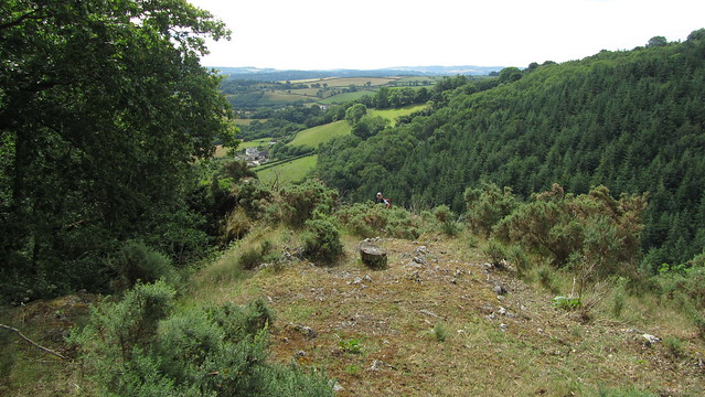
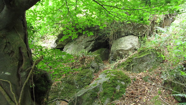
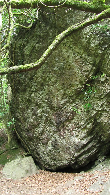
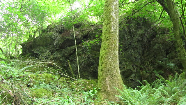
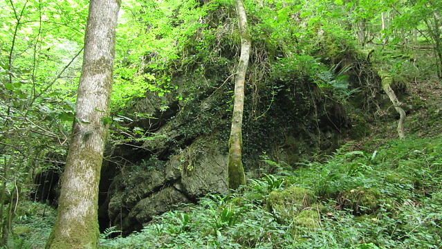
Then, the trees cleared, the soil too shallow to support any large vegetation, and a great vista opened up before us.
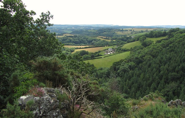
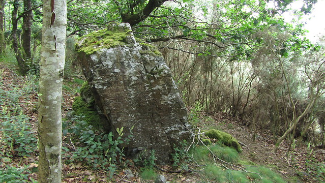
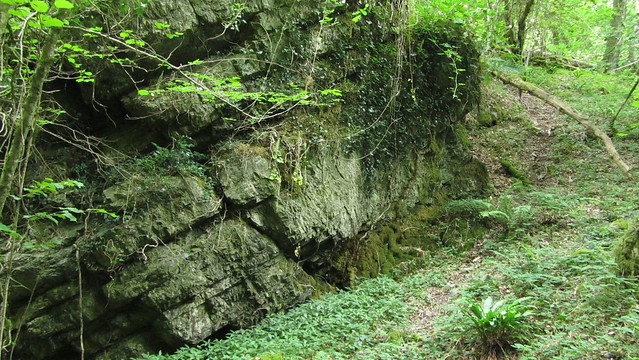
The immediate thing you notice is that the rock is not granite. It is a shale called Hyner Shale Formation, and named after the area it is found. That, in itself, would make you think it would have been mentioned on maps.
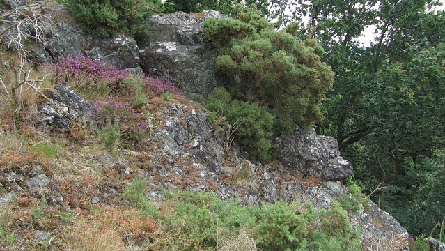
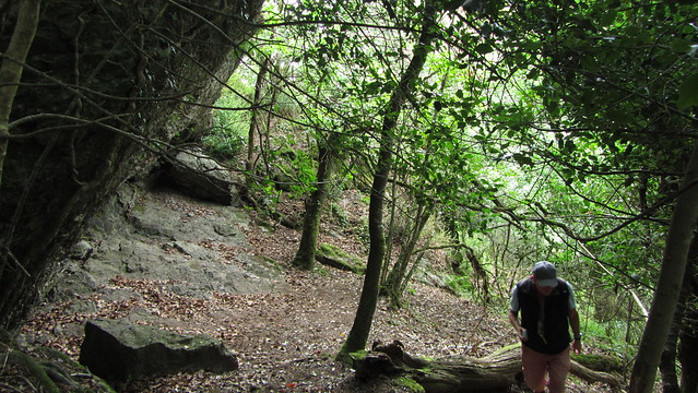
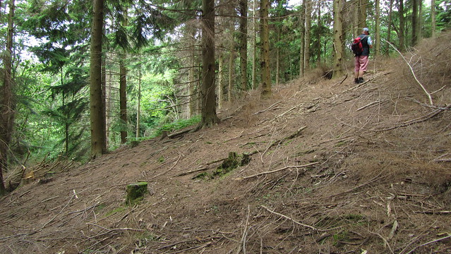
The shale makes the ground unstable and, as suspected, it makes for a tricky descent. We passed over the bulk of the upper outcrop, picking our way down the east side in search of the other rocks. I found a narrow track that, given the steepness, and the proliferation of ants on the ground, I think may have been cleared by their industry. Sure enough, a huge nest was located at the bottom of it.
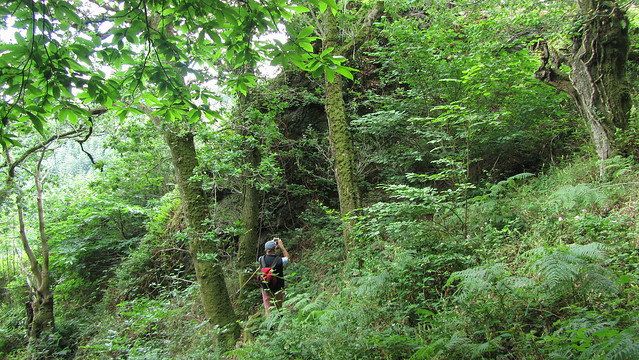
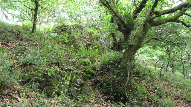
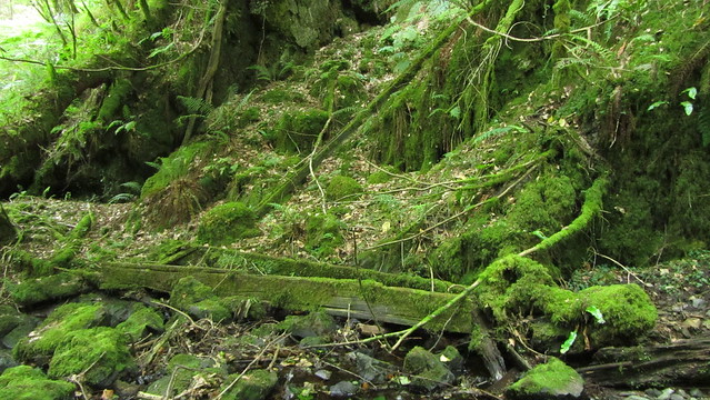
We were finding that little could be relied on when descending. Much of the branches were decaying and came away as you tried to steady yourself, and the valleys slope is littered with fallen trees, their roots unable to secure them in the shallow earth.
With the ants swarming, it wasn’t the place to stand about too long. It was clear we weren’t going to get much further by this route, so we climbed back up, an easier feat than descending.
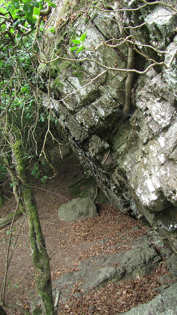
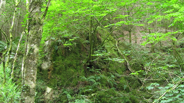
We contoured a short distance west, following a thin band of the exposed shale to its conclusion before taking some tracks where the ground wasn’t as sheer. I assumed these were man made, possibly remains of those on the old maps, occasionally trod to maintain the wildlife nesting boxes we could see in the area. Talking of wildlife, they certainly weren’t animal tracks; this woodland is quite oppressive and Tim pointed out the lack of birdsong, which was odd given the smorgasbord of ants on offer!
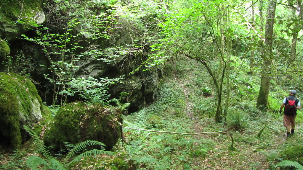
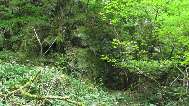
As the trickling water of Beadon Brook came within earshot, I spied a dark mass through the trees to our left. I diverted, finding a huge overhang, and a vegetation free area below it. This was a great outcrop, much more impressive than its higher neighbour.
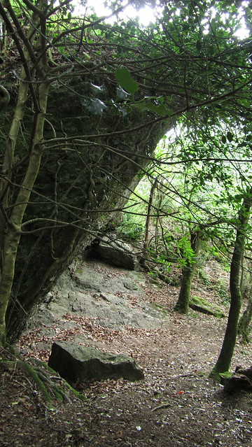
The scene put me in mind of some places I have visited in Australia; I could imagine our aboriginal ancestors sheltering here and being warmed by a hearty fire. Sadly, though, there were no dream time paintings to be had on the rocks!
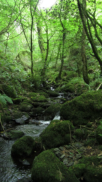
From the overhang, we got back to easier ground and descended to the brook as it ran through Hyner Bottom. It was akin to Jurassic Park down here, the humidity adding to the sense of being in a rainforest. Magical!
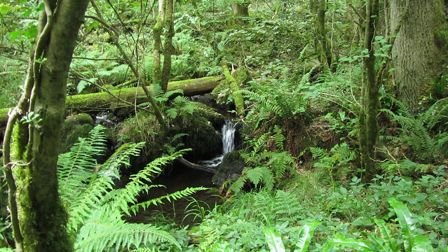
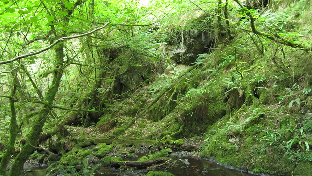
We strolled along the bank, where Hyner Rocks lower outcrops began to appear. This was a long section of high craggy facades, the work of a once mightier watercourse with the power to carve the little gorge before us.
On the opposite banks, we could see other outcrops, these less impressive given the bend in the brook.
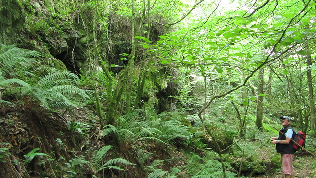
Tim spotted what looked like an adit about ten metres up on the other bank and then noticed a rickety wooden chute descending from it to the brook, used to remove water from the mine. There was also the remains of a wooden launder on the valley floor. Later investigation on the mine has proved unfruitful as the ruins within Hyner Bottom are something of a mystery. Wikimapia mentions that, looking at older maps, we can see drying sheds and ponds and that they appeared sometime between 1886 and 1905. A fascinating find that unfortunately raises more questions than answers.
Time was getting on, and we began our journey along the brook. The map lists two footbridges; one downstream, the other further up, giving us hope of a path out, but we saw neither and were resigned to having to ascend to the forestry track we had entered by.
It was tough in the heat, and by the time we had made it to the track, neither of us had enough energy to visit some other tors that Tim had found previously. There may have been mention of the pub in Hennock for lunch and that was by far the better option on a day like today!