
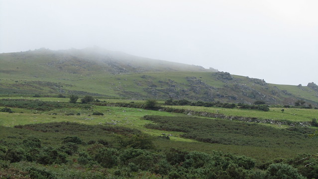
Every time I get wind of a tor I haven’t heard of before, the urge to get out there and find it takes hold. Less than 24 hours had passed, from my attention being captured, and I was venturing out in a brief window between the rain, in search of “Granate” Tor.
I had been tagged, by Phil Sorrell, into a conversation on the Facebook page of Legendary Dartmoor, where he had mentioned a Granite Tor lying north of Branscombe’s Loaf. When I asked for reference, I received the following; “Other Ordnance Surveyor’s drawings dated to 1802-3 give the name …Granate Tor just north of Branscombe’s Loaf on the north-west side of the moor.” Tom Greeves, Dartmoor Magazine, Summer 1994, p.6.”
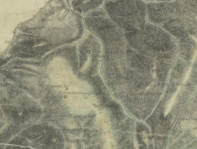
I found the Ordnance Survey map of 1803 online here. I had my suspicions this could be another one of those misnomers; the same map also lists “Litorally Tor”, to the west of Scorhill Down, which all those seeking have failed to find.
I had previously looked at a Google Map Satellite view for some inkling of granite to the north of Branscombe’s Loaf, finding plenty of it scattered across the hillside, but this looked very much like clitter. I feared that if there were a tor here, it would be a ruined one. I did spot one candidate, though, although it looked too far north and too far into the bowl of Corn Hole.
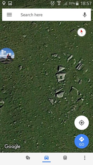
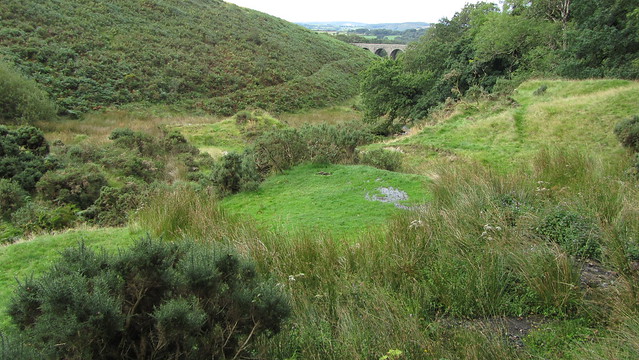
Despite my reservations, I never need an excuse to visit Corn Hole, one of my favourite spots on the moor. I parked at Prewley Moor and made my way over to this natural amphitheatre. I soon found the outcrop found on the satellite view, obvious by the green rectangle of grass on top of the largest slab.
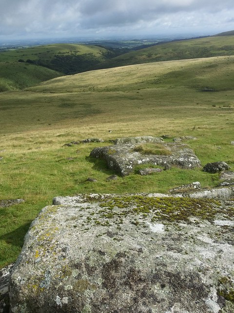
I immediately this as a candidate for Granate Tor but as it possesses a lovely vista to Shelstone Tor and beyond to the high moor I dubbed them “Corn Hole Rocks”, a collection of low granite, at SX 55366 89599, protruding from the grass slopes.
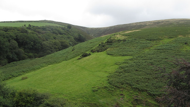
I now looked south, and up Corn Ridge. A bit of a slog, but the ground was good. I reached an intriguing feature cut across the side of the hill; was this ditch natural, a disused leat or merely an old track worn by footfall? Whatever its origins, it was a point to catch my breath and enjoy the scene.
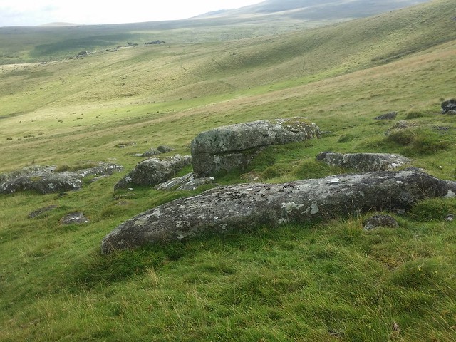
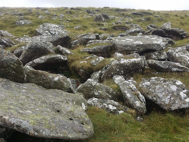
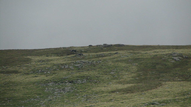
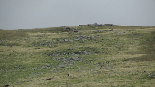
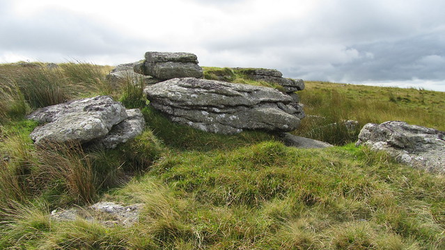
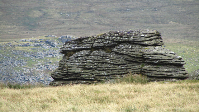
I soon started to encounter the clitter I had seen on Google the day before. It is quite extensive and pinpointing a significant outcrop proved tricky. I swept back and forth across the hillside, searching extensively, and whilst I found some large boulders, this, if it were Granate Tor, looked very much to be ruined.
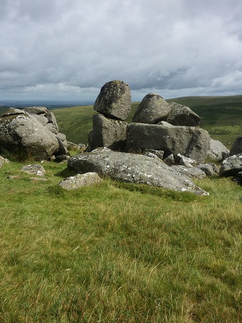
I found myself up on the top of the ridge and the familiar Branscombe’s Loaf loomed into view. I made my way over to the “loaf”, then to the smaller outcrop William Crossing cites as the “cheese”, where I sat and surveyed the area north for clues.
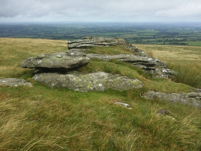
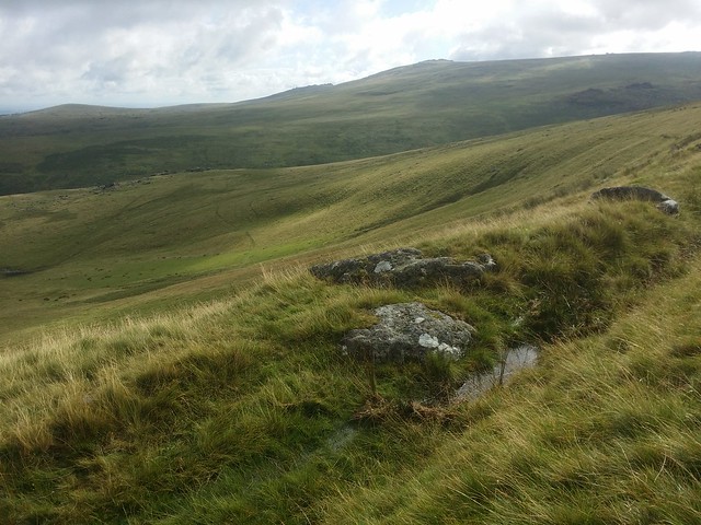
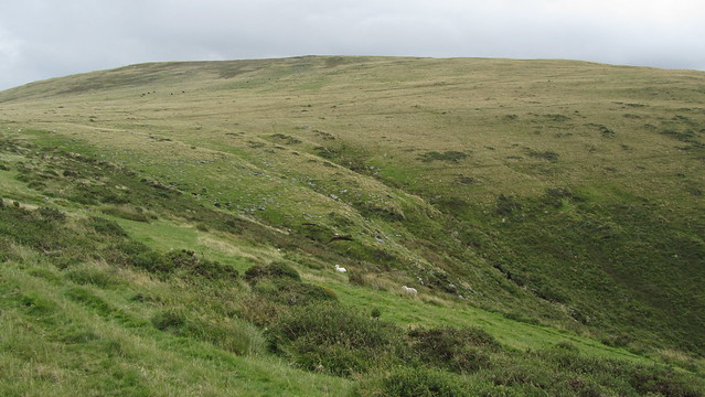
I figured I would visit Shelstone Tor before I headed back to the car, and so I trod northwards, back into the clitter field. On this occasion, I found a tiny outcrop, at SX 55251 89363, significant because of a logan stone atop, that still rocked when I “surfed” upon it. It was a nice feature and, if this were the lost outcrop, as good a spot as any to mark as the position of Granate Tor.
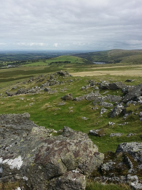
I dropped around the ridge of Corn Hole, making my way down to Shelstone Tor. This is one of the best set of outcrops on the moor, in my humble opinion, possessing some great balancing boulders and a cracking view up the West Okement valley to Lints Tor.
When making my way back across the hole to the car, I looked back up at Corn Ridge. It made me consider if there was anything on the north-west slope and I remembered some outcrops on the direct route from Branscombe’s Loaf to Sourton Tors. I climbed the ridge again, I guess I was enjoying myself so much I didn’t want the hunt to end! Back up to the loaf, I turned onto the trodden route to Sourton Tors.
The small outcrop is just off the brow, to the left of the path. I took some time to consider it and my hunch is this was not the tor I was searching for, but I could well be wrong.

I could see the rain sweeping across West Devon from here, and so decided to miss a visit to Sourton Tors, instead heading straight down to Prewley Moor, reaching the car just in time.
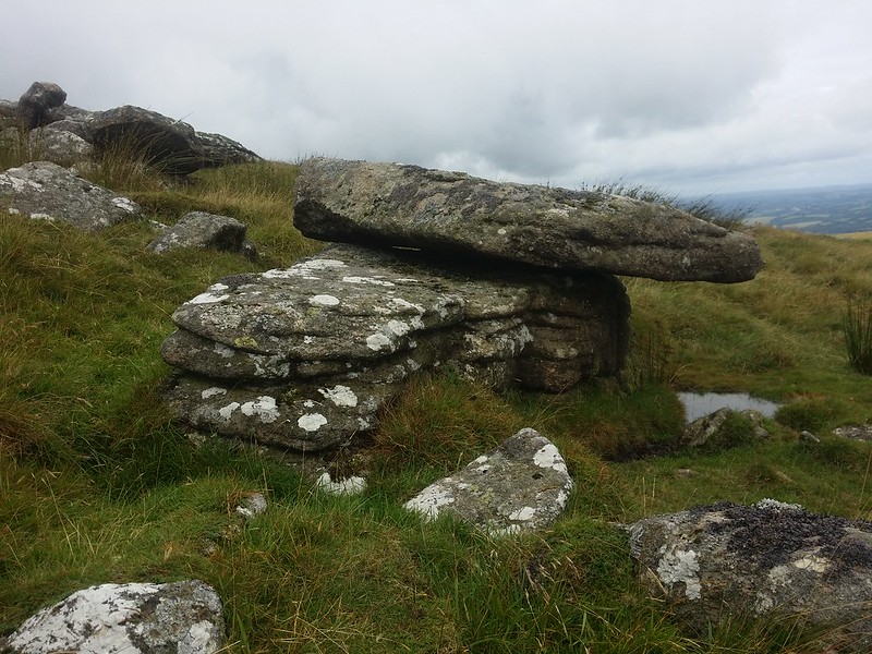
An enjoyable hunt, if not entirely successful. I came to the conclusion that there was a high likelihood that Granate Tor was indeed ruined but I wasn’t convinced it was the clitter field I had encountered. That said, whilst it might be disappointing , the little logan on Corn Ridge is worth seeking out and I encourage the reader to visit.
Soon after my initial visit, I soon received more information, via Tim Jenkinson, and uncovered a later map that placed the forgotten tor in a different location. Problem was, both pieces of information contradicted each other. I was going to have to get out there and investigate both.
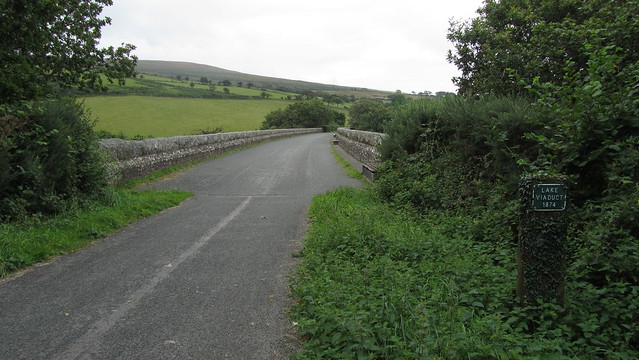
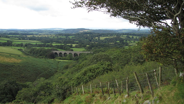
I parked at Prewley again, this time taking the Granite Way, bound for Lake Viaduct, and Deep Valley, where there are the remains of an old copper mine.
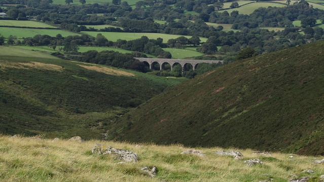
Walking the Granite Way seemed appropriate, given my goal today! It certainly made the walk to Deep Valley simpler than the open moor, but when reaching the viaduct it was time to put in a bit of effort.
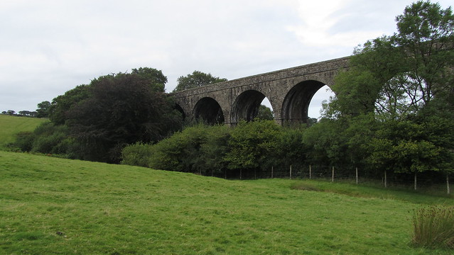
The viaduct offers a panorama of Deep Valley and Lake Down. From here, it also looks like a lot of ascent and it was going to test my fitness!
I took a left path, which switched back down under the viaduct. At a junction, where the Bearslake Inn is left, I turned right, out onto the open moor where I picked up the old track through the bracken.
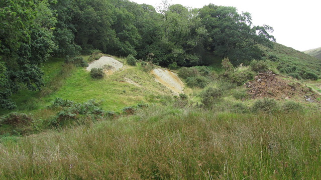
I reached the disused mine, hoping to see some remains of buildings but all I could see was a once flat area dotted with spoil heaps that were being reclaimed by nature. There was some evidence of quarrying hidden away behind the foliage on the edge of Tor Wood.
Researching the mine, I found it originally worked together with Wheal Fanny further south, Tor Wood Mines was little more than a prospective trial for copper and lead. Little is known of the history, although it was being worked in the 1820’s but abandoned in 1828 when it was advertised for sale.
So what was I doing here, and what did it have to do with Granate Tor? Well, the first bit of information I received was that Granate Tor might have been a misnomer, and was actually Sourton Tor.
An 1851 publication named “A Hand-book for Travellers in Devon and Cornwall” by Thomas Clifton Paris had the following to say about the location of Granate Tor; “In 6 m the traveller reaches a few cottages, collectively known by the name of Lake, where, l. of the road, in a deep gully, is a small copper mine called Tor Wood, deserving notice for its gigantic water-wheel and picturesque locality; and on the neighbouring heights Granate Tor, very beautifully covered with snow-white lichens, which show that the rock is not granite, although the name would seem to imply it.“
This little known book, after many editions, was later incorporated into the more popular Ward Lock’s Dartmoor Guidebooks where the paragraph was amended; “..we reach Lake (its cottages are so few that it scarcely deserves the name ‘hamlet’) near which is Tor Wood a small copper mine, noted for its large water wheel at the foot of Granate Tor, the snow white lichens on whose surface clearly show that it is not composed of granite, the popularly received derivation of its name not withstanding.“
The texts are significant because, as Tim Jenkinson pointed out to me, Tor Wood mine was, in fact, at the foot of the Sourton Range, which are, indeed, non-granite.
I had intentions to continue along the length of Deep Valley, but it was a humid day and so I climbed out along the walled edge of Tor Wood, out to where the southern outcrop of the Sourton Tors appeared.
I could see why the theory in the book was plausible, as this outcrop is a few hundred metres from the rest of the others and could have originally been considered a separate tor. But a couple of things niggled;
Firstly, I reconsidered the text. Tim pointed out that it kept being amended in different editions of the Ward Lock publication, in 1896, it was “Granate” (incidentally, Sourton Tors was individually mentioned in a different part of the guide), then, in 1919, the spelling was changed to “Granite”. By 1930, the name had disappeared and it had been changed to “Sourton”. This suggests to me that the original description had been wrong in the first place.
Then there were the maps; Sourton and Granate Tor are labelled, with a big distance between them. The 1803 map points to the north-west slope of Corn Ridge, although that is open to interpretation. Tom Greeves, in his article in Dartmoor Magazine ambiguously says it is “north of Branscombe’s Loaf” and just looking at the map I can see an argument for both locations. However, having visited them the previous week, neither were a strong candidate.
But now I had a later Ordnance Survey map, dated to 1840, placing Granate Tor on the western slopes of Corn Ridge. I’ll admit, this map, like the 1803 edition, is far from perfect. Both appear to place Branscombe’s Loaf too far south on Corn Ridge, suggesting that the ridge had not been surveyed correctly. What is important, in my opinion, is that the later map places Granate Tor on the western slope.
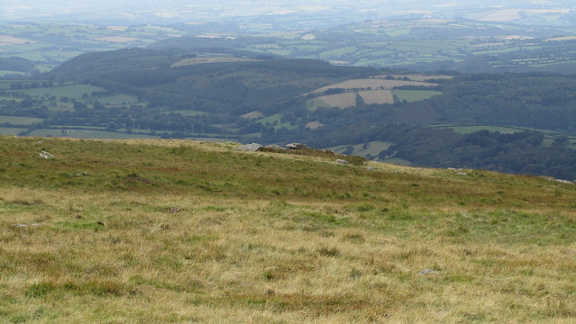
When I stood at the southern Sourton outcrop, I looked east, to Corn Ridge, hoping to spot the forgotten tor on the west slope. My heart rate, now recovered from the climb up from Deep Valley, quickened again when I could clearly see shapes on the brow; obvious bumps of exposed granite.
With renewed optimism, I went for the ridge, making my way around the head of Deep Valley, with its fine views down to the viaduct.
Another look up to the ridge, and the outcrops were more pronounced. I crossed the Kings Way and began my ascent to the clitter beneath.
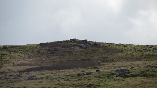
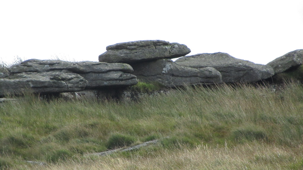
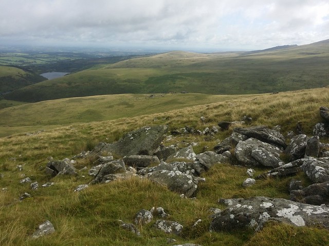
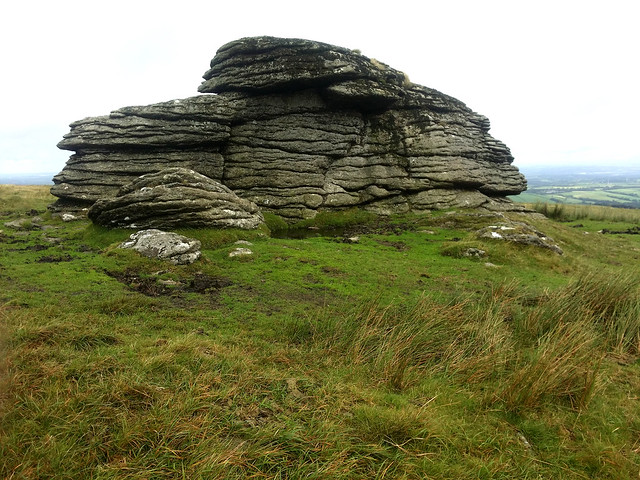
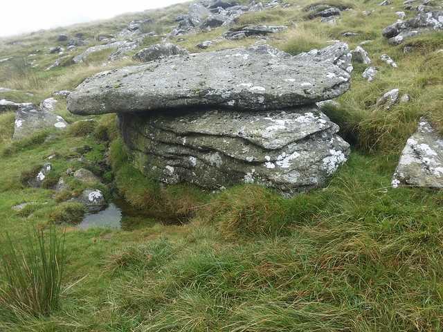
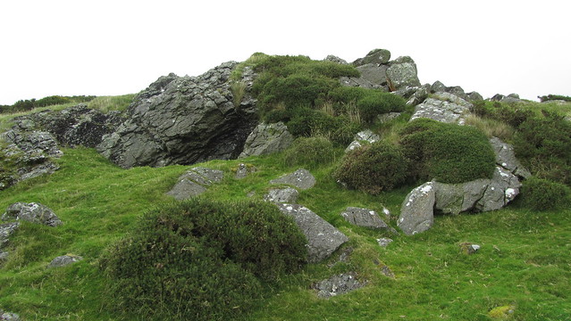
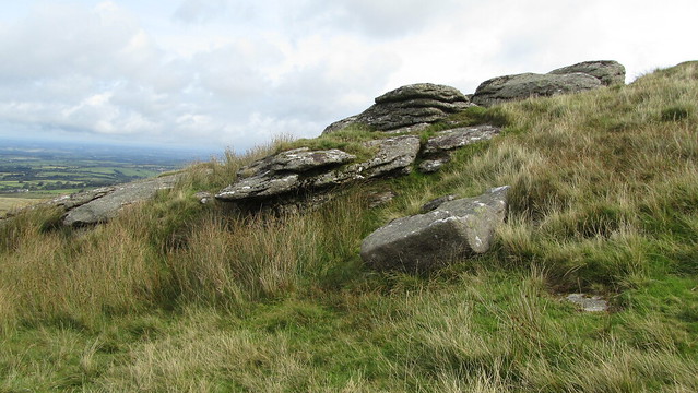
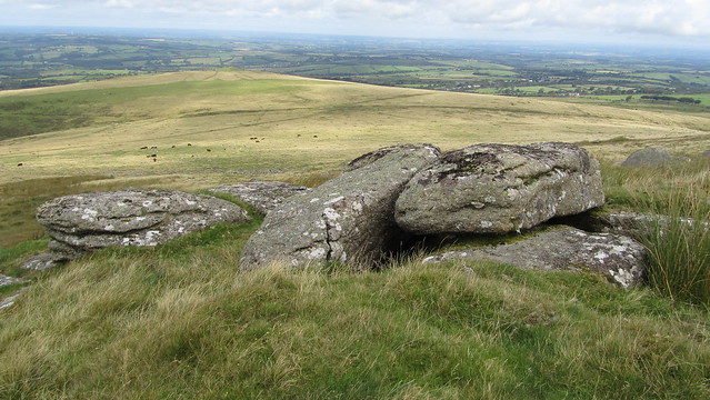
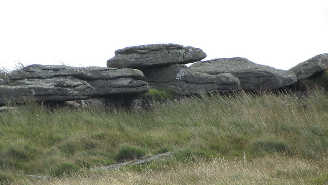
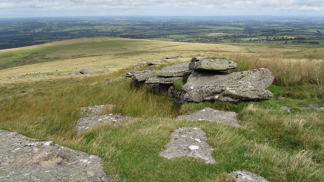
The closer I came, the greater I felt I was encountering my best candidate for Granate Tor. I reached the first pile, where I could then see a higher, larger outcrop. The lower consisted of some hefty, impressive, rocks and were evidence enough for a tor in this location.
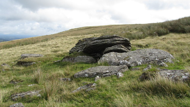
I visited some of the outlying rocks between the two main outcrops, some interesting shapes and formations, including a small boulder wedged between two slabs.
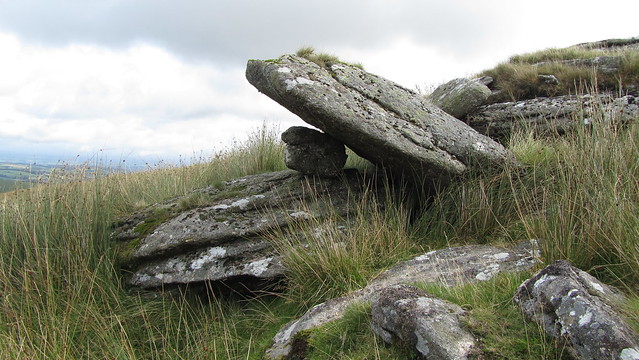
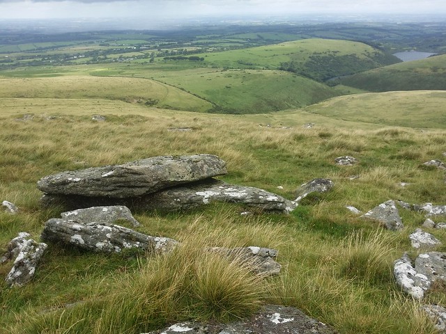
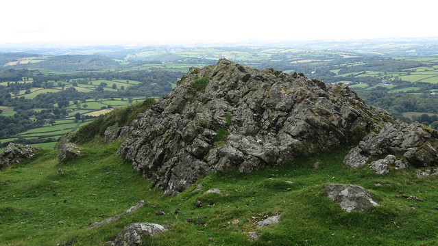
At the higher pile, I found a substantial tor. Importantly, from this outcrop I could see higher to the cairn on the top of Corn Ridge, placing Granate to the south-west of Branscombe’s Loaf.
The main part of the outcrop had granite slabs piled in an “L” shape, the natural enclosure beneath a damp patch evident by the tall grass. I sat down at the drier back of the tor, out of the wind, for lunch.
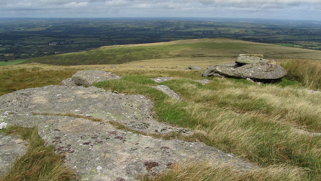
Being so close to the top, a visit to the loaf had to be done. I headed for the cairn. Once there, I looked back to Granate, still visible and, with the benefit of hindsight, obvious.
Branscombe’s Loaf was looking majestic in the light, with high Dartmoor as a back drop. A satisfying moment.
Time to head home. Dropping down the ridge, admiring the view to the north of Meldon Reservoir, diverting via Sourton Tors.
Back at home, I considered the day, wrote up the proceedings and then tried a couple of times more to explain my theory. I am certain I have located Granate Tor now. Of course, others may disagree and if that is the case, I’d welcome evidence to prove me wrong. After all is said and done, what is important is getting the right location in the end.
UPDATE:
We later found that the outcrop I consider to be Granate Tor has a couple of different names such as ‘Flagpole’ and ‘Corn Tor’ but neither pre-date the Ordnance Survey maps. For more on these, please visit the Tors of Dartmoor Page.
2 replies on “The search for “Granate” Tor”
Hi Paul,Firstly thanks for your brilliant site with its detailed map and blogs. It has enriched my walks on Dartmoor over the last couple of years.Secondly, re Granate Tor. Yesterday I did a circular walk from Prewly Moor to Great Links, Dunna Goat, Green, Kitty to Shelstone and back via Branscombe's Loaf. Just west of the Loaf is a very obvious, flattish but reasonably substantial outcrop that I felt deserved a name more than some named ones such as Little Hound Tor. Could this be Granate Tor?
Hi Peter, thanks for your kind comments, I’m glad you are enjoying the blog. I hope you’ve also seen the new project Tors of Dartmoor which has rather taken up my time. In response to your query regarding Granate; It is entirely possible that the outcrop I think you are talking about could be the lost tor, although some consider the outcrop to be the cheese to the loaf. Have you seen this on the Tors of Dartmoor website: https://www.torsofdartmoor.co.uk/main.php?tor_name=Corn%20Tor? The truth is it’s purely speculation and an intriguing puzzle.