TORS OF DARTMOOR
a database of both lesser- & well-known rocks and outcrops
Crip Tor (Tithe Map)Inclined Plane Tor, Swell Tor Stack
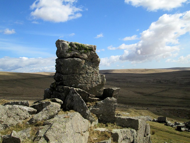 Despite Ken Ringwood (KR, 2013) placing Crip Tor on private land next to Criptor Farm, the actual location of this tor is disputed, with other evidence putting it elsewhere. For example, the Tithe Map of 1840 shows the name of Crip Tor in the vicinity of present day Swell Tor, an area ravaged by mid 19th Century quarrying. In William Crossing's (WC, 1992) 'Dartmoor Worker' (page 73), we read the following extract concerning an excursion to the area by Reverend E.A. Bray; "He discovered that the workmen did not hesitate to vary or change the names of the tors as suited them, for the Swill Tor of a few days before had now become Swell Tor and rockpile above the quarry he was informed was Inclined Plane Tor! He does not seem to have pushed inquiries in this direction any farther, but contents himself with remarking that in his researches on the moor he could seldom meet with two persons who gave the same names to the tors." 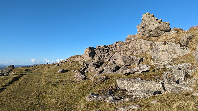 In his Guide, WC affords no description of Crip Tor whatsoever, and Eric Hemery only refers to the farm. Mike Brown, in his 1985 Gazetteer, places it south-east of Swell Tor, and this supports the position of the Tithe Map interpretation for the Parish of Walkhampton. Whilst much of this tor has been plundered by the extensive quarrying of the hillside there remains a tor remnant, often considered part of Swell Tor and known to some as Swell Tor Stack, this being perhaps the likelier candidate for Crip Tor. It is very prominent, especially when seen from the Foggin Tor direction. It is a miracle that a natural outcrop still survives here after the surrounding tors of Swell and Foggin were decimated by the industry. 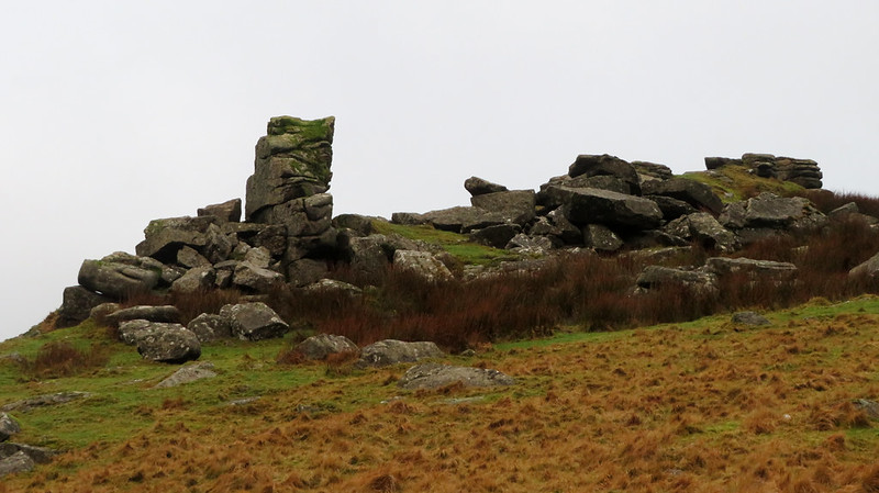 Beneath Crip Tor (Tithe Map) is an unfenced and deep quarry, known locally as Sailors Home Quarry. Large spoil tips that have spilled under the surviving rockpile are conspicuous from Ingra Tor and the old Princetown Railway, suggesting that Crip Tor was once much grander in stature. Adjacent to the outcrop is an explosives store, a square-shaped building that was built into the dilapidated rocks and used during the quarrying operations. 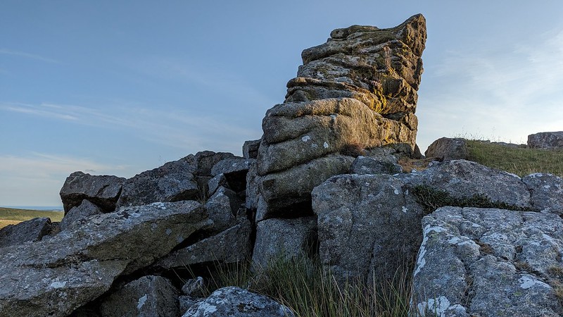 Alternatively KR's location (see here) is on private land with part straddling open access land, on a short rise at the back of the farm with the same name. It too is a worthy contender and consists of a number of large, smooth-rounded outcrops, with lower bedrock spilling beyond the fence; but please note that the surrounding terrain to the immediate south - where the tor should be reached via crossing the Yes Tor Brook - is largely overgrown by bracken and tall grass in the summer months, and that elsewhere it is very boggy. This restricts when visits are possible without getting entangled in vegetation. If you do visit, please keep well away from the farm and respect the privacy of the current owners.
| ||||||||||||||||||||||||||||