TORS OF DARTMOOR
a database of both lesser- & well-known rocks and outcrops
Watern TorWatern Borough, Walter Tor, Waterdon Tor, Waterdontor, Waterdontorr, Walterydonne
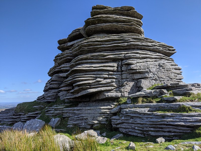 The name of 'Watern Tor' refers to all the outcrops on the northern spur of Watern Down. However, the best-known feature is the 'Thirlstone' in the most northern section which affords a lovely view through its gap. We have created a separate page for that, linked here. Watern is one of the most spectacular rock formations on Dartmoor and, in the past, has been called Walter Tor and even Watern Borough, most notably by Crossing. It is believed that 'Watern' is a corruption of 'Water' meaning 'Watery Down' which seems quite appropriate when you take into account that the hillside is damp in places draining into the Walla Brook as it passes through Watern Combe. 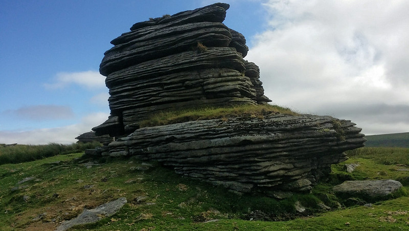 Due to its unique formations that are quite unlike those seen at most other tors on Dartmoor, authors have taken to the rocks admirably, including Hemery who goes on to explain; "Seen from far and wide, the four cohesive but remarkably weathered piles of the tor, each a huge block with close-packed horizontal jointings, render it unmistakable." Rowe also remarks that; "Watern Tor is one of the many remarkable natural formations of the granite rock which will repay a more particular examination. It consists of a series of piles, rising from the ridge of the hill, the stratification of which presents the appearance of laminar masses, in a horizontal position." Whilst the Thirlstone at the north end may command the most attention, the various outcrops on the south side are stunning, too, presenting as tall granite blocks with close jointings that sets this tor apart from others on the moor and in the vicinity. Other than being a popular checkpoint for the annual Ten Tors Challenge, the tor is a boundary point on the 1240 Perambulation. 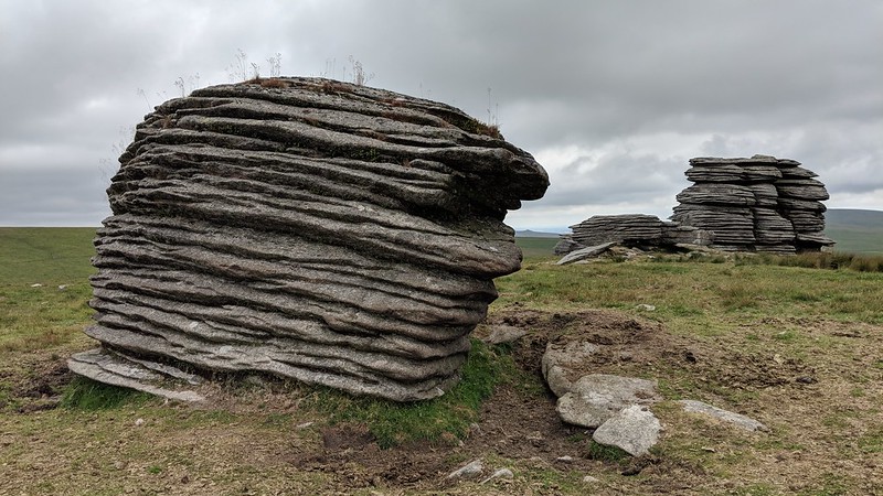 Accessing Watern Tor is not as straightforward as it might seem at first when consulting a map, as it is almost entirely surrounded by water; to the west and north by the Walla Brook, to the north-east by the bogs of Gallaven, to the east by the North Teign and to the south-east by Hugh (Hew, Wood) Lake. This means that after heavy rainfall the most sensible route to take is from the clapper bridge at Teignhead Farm, following a ruined newtake wall along the top of Manga Hill to a stile just below the cairn by the summit spot height of the Down. From there it is a short stroll northward to the tor. Alternatively, the Manga Rails that span the North Teign to the east-south-east of Watern Tor are part of a popular route by following the newtake wall that ascends the steep east slope. Whatever route you choose, approaching Watern Tor you will see that it is a tor of unparalleled beauty that really cannot compare to any other. 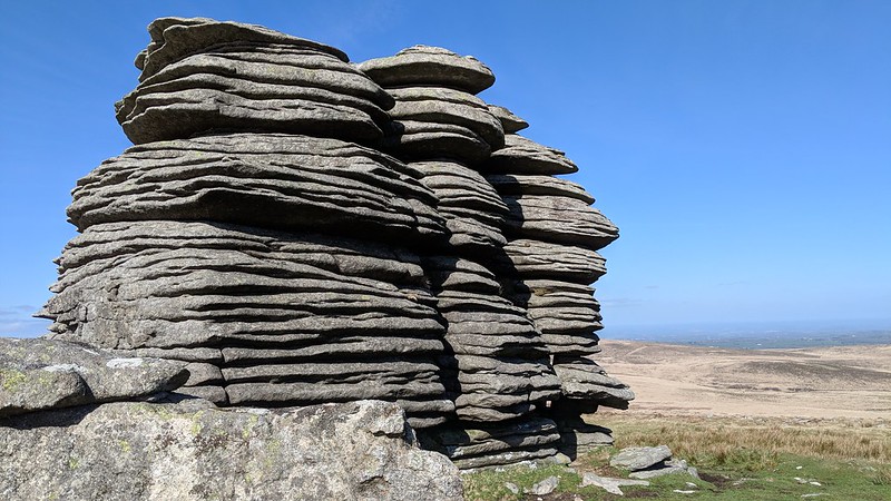
| ||||||||||||||||||||||||||||